Onion River (Minnesota) facts for kids
Quick facts for kids Onion River |
|
|---|---|
 |
|
|
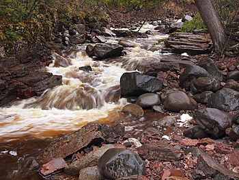
Mouth of the Onion River
|
|
| Country | United States |
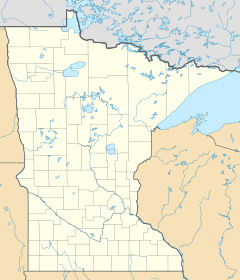
| State | Minnesota |
| County | Cook County |
| Physical characteristics | |
| Main source | Honeymoon Mountain 47°39′48″N 90°47′00″W / 47.6632308°N 90.7831956°W |
| River mouth | Tofte 47°36′29″N 90°46′16″W / 47.60806°N 90.77111°W |
| Length | 6.1 miles (9.8 km) |
The Onion River is a cool, short stream located in the northeastern part of Minnesota, in the United States. It's about 6.1 miles (9.8 kilometers) long and flows directly into the huge Lake Superior.
Contents
Exploring the Onion River
The Onion River is a beautiful, smaller river found in Cook County, Minnesota. It's known for its clear waters and the natural beauty of the area it flows through. Even though it's not very long, it plays an important role in the local environment.
Where the River Begins and Ends
The Onion River starts its journey high up on a place called Honeymoon Mountain. From there, it flows downhill, making its way through the landscape. Its path eventually leads it to the town of Tofte, where it finally empties into Lake Superior. Lake Superior is one of the largest freshwater lakes in the world!
Ray Berglund State Wayside: A Special Place
Near where the Onion River meets Lake Superior, there's a special area called Ray Berglund State Wayside. This small property is managed by the Minnesota Department of Natural Resources. It's like a small park or rest stop where people can enjoy the beauty of the river and the lake.
Why is it called Ray Berglund State Wayside?
The Wayside was created as a memorial in 1951. It was donated by friends of a man named Ray Berglund. He was a businessman from St. Paul who cared a lot about nature and protecting it. A "conservationist" is someone who works to protect nature and wildlife. So, this place honors his efforts to keep our natural world healthy and beautiful.
 | Sharif Bey |
 | Hale Woodruff |
 | Richmond Barthé |
 | Purvis Young |


