Cook County, Minnesota facts for kids
Quick facts for kids
Cook County
|
|
|---|---|

|
|

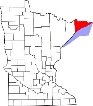
Location within the U.S. state of Minnesota
|
|
 Minnesota's location within the U.S. |
|
| Country | |
| State | |
| Founded | March 9, 1874 |
| Named for | Michael Cook |
| Seat | Grand Marais |
| Largest city | Grand Marais |
| Area | |
| • Total | 3,340 sq mi (8,700 km2) |
| • Land | 1,452 sq mi (3,760 km2) |
| • Water | 1,887 sq mi (4,890 km2) 57%% |
| Population
(2020)
|
|
| • Total | 5,600 |
| • Estimate
(2023)
|
5,639 |
| • Density | 1.677/sq mi (0.647/km2) |
| Time zone | UTC−6 (Central) |
| • Summer (DST) | UTC−5 (CDT) |
| Congressional district | 8th |
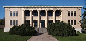
Cook County is a county located in the very eastern part of Minnesota, a state in the United States. It's the easternmost county in the state. In 2020, about 5,600 people lived here. This makes it one of Minnesota's least populated counties. The main town and county seat is Grand Marais. The Grand Portage Indian Reservation is also found within Cook County.
Contents
History of Cook County
Early Inhabitants and Explorers
Long ago, the Ojibwe people lived in this area. They were the first inhabitants. Later, French fur traders came to explore the region. Some of these traders decided to settle down here. By the 1830s, there were a few dozen French settlers.
New Settlers Arrive
In the 1830s, more settlers started coming. Many arrived from New England and upstate New York. It became easier to travel because the Erie Canal was finished in 1825. Also, the Black Hawk War ended in 1831, making the journey safer.
Most of these new settlers came from places like Orange County, Vermont and Down East Maine. They were often fishermen and farmers. By 1845, about 350 people of European background lived in the area. This number grew to about 2,000 by 1874. By 1900, Cook County had around 3,000 residents.
New Cultures and Religions
In the early 1900s, many more Europeans arrived. They came from Germany, Scandinavia, and Ireland. These new groups brought different religions with them. They introduced Lutheranism and Catholicism to Cook County.
The county was officially created on March 9, 1874. It was named after Michael Cook. He was an important senator for the state and territory.
Geography of Cook County

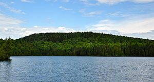
Cook County is a wild and heavily forested area. It's shaped like a triangle and sits at Minnesota's northeastern tip. The county borders Canada to the north. It is also mostly surrounded by the northern part of the Great Lakes. Many lakes, ponds, and streams are found throughout the county.
The highest point in Minnesota is located here. It's called Eagle Mountain and stands at 2,301 feet (701 meters) above sea level. The county covers a total area of 3,340 square miles (8,650 square kilometers). About 1,452 square miles (3,760 square kilometers) is land. The rest, 1,887 square miles (4,890 square kilometers), is water. This means 57% of the county is water! Cook County is the second-largest county in Minnesota by total area.
Besides Eagle Mountain, the highest lake in Minnesota, Lake Abita, is also in Cook County. It sits at 2,048 feet (624 meters). Lake Superior, one of the Great Lakes, forms the county's southern border.
Main Roads
Neighboring Areas
Cook County is in the far northeast of Minnesota. It's part of the "Arrowhead region." It shares a land border with only one other county in Minnesota. Its neighbors are:
- Rainy River District, Ontario in Canada - to the northwest
- Thunder Bay District, Ontario in Canada - to the northeast
- Lake County - to the west
- Ashland County, Wisconsin - to the south
- Keweenaw County, Michigan - to the east
- Ontonagon County, Michigan - to the southeast
Protected Natural Areas
Cook County is home to many beautiful natural places. These areas are protected for everyone to enjoy:
- Cascade River State Park
- Grand Portage National Monument
- Judge C. R. Magney State Park
- Kodunce River State Wayside Area
- North Shore State Trail (part of it)
- Pat Bayle State Forest
- Superior National Forest (part of it)
- Boundary Waters Canoe Area Wilderness (part of it)
- Temperance River State Park
Climate
| Climate data for Lutsen, Minnesota | |||||||||||||
|---|---|---|---|---|---|---|---|---|---|---|---|---|---|
| Month | Jan | Feb | Mar | Apr | May | Jun | Jul | Aug | Sep | Oct | Nov | Dec | Year |
| Mean daily maximum °F (°C) | 22 (−6) |
26 (−3) |
35 (2) |
47 (8) |
56 (13) |
64 (18) |
70 (21) |
70 (21) |
62 (17) |
52 (11) |
39 (4) |
27 (−3) |
48 (9) |
| Mean daily minimum °F (°C) | 4 (−16) |
7 (−14) |
19 (−7) |
31 (−1) |
39 (4) |
45 (7) |
52 (11) |
54 (12) |
47 (8) |
38 (3) |
26 (−3) |
11 (−12) |
31 (−1) |
| Average rainfall inches (mm) | 0.9 (23) |
0.7 (18) |
1.4 (36) |
1.9 (48) |
2.8 (71) |
3.5 (89) |
3.3 (84) |
3.3 (84) |
3.6 (91) |
2.5 (64) |
1.6 (41) |
1.1 (28) |
26.4 (670) |
| Average snowfall inches (cm) | 15.2 (39) |
8.1 (21) |
8.1 (21) |
2.2 (5.6) |
0.2 (0.51) |
0 (0) |
0 (0) |
0 (0) |
0 (0) |
0.4 (1.0) |
3.8 (9.7) |
13.3 (34) |
50.8 (129) |
| Source: Weatherbase | |||||||||||||
Northern Minnesota has very cold winters. About a third of the year, the temperature stays below freezing (0 degrees Celsius or 32 degrees Fahrenheit). On some days, the temperature can even drop below -17.8 degrees Celsius (0 degrees Fahrenheit).
Population of Cook County
| Historical population | |||
|---|---|---|---|
| Census | Pop. | %± | |
| 1880 | 65 | — | |
| 1890 | 98 | 50.8% | |
| 1900 | 810 | 726.5% | |
| 1910 | 1,336 | 64.9% | |
| 1920 | 1,841 | 37.8% | |
| 1930 | 2,435 | 32.3% | |
| 1940 | 3,030 | 24.4% | |
| 1950 | 2,900 | −4.3% | |
| 1960 | 3,377 | 16.4% | |
| 1970 | 3,423 | 1.4% | |
| 1980 | 4,092 | 19.5% | |
| 1990 | 3,868 | −5.5% | |
| 2000 | 5,168 | 33.6% | |
| 2010 | 5,176 | 0.2% | |
| 2020 | 5,600 | 8.2% | |
| 2023 (est.) | 5,639 | 8.9% | |
| U.S. Decennial Census 1790-1960 1900-1990 1990-2000 2010-2020 |
|||
The population of Cook County has grown over the years. In 1880, there were only 65 people. By 2020, the population had reached 5,600. Most people in Cook County are White. There are also many Native Americans living here, making up a significant part of the population. Smaller groups include Black or African American, Asian, and people of mixed races. About 2.2% of the population is Hispanic or Latino.
Communities in Cook County
City
- Grand Marais (This is the county seat, meaning it's the main administrative town.)
Census-designated place
- Lutsen (These are areas that look like towns but aren't officially incorporated as cities.)
Unincorporated communities
These are smaller settlements that don't have their own local government:
- Croftville
- Grand Portage
- Hovland
- Maple Hill
- Martin Landing
- Mineral Center
- Pigeon River
- Schroeder
- Taconite Harbor
- Tofte
Townships
Townships are smaller local government areas, often covering rural land:
- Lutsen Township
- Schroeder Township
- Tofte Township
Unorganized territories
These are areas that are not part of any city or township:
Ghost towns
These are towns that used to exist but are now abandoned:
See also
 In Spanish: Condado de Cook (Minnesota) para niños
 | Jessica Watkins |
 | Robert Henry Lawrence Jr. |
 | Mae Jemison |
 | Sian Proctor |
 | Guion Bluford |

