Lake Abita facts for kids
Quick facts for kids Lake Abita |
|
|---|---|
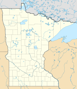
| Location | West Cook, Cook County, Minnesota, U.S. |
| Coordinates | 47°55′23″N 90°27′21″W / 47.9231°N 90.4557°W |
| Basin countries | United States |
| Surface area | 102 acres (0.41 km2) |
| Max. depth | 14 ft (4.3 m) |
| Surface elevation | 2,040.19 ft (622 m) |
Lake Abita is a beautiful lake located in West Cook, Minnesota. It sits very high up, about 2,040 feet (622 meters) above sea level. This makes it one of the highest named lakes in Minnesota! For a long time, people even thought it was the highest lake in the state.
Contents
What's in a Name?
The name 'Abita' comes from the Ojibwe language. In Ojibwe, 'Abita' means 'half'.
Where is Lake Abita Located?
Lake Abita is found in the northern part of the Misquah Hills. This area is known for its unique rock formations. The land here has many ridges that run from east to west.
Mountains and High Points
These ridges are made of a type of rock called gabbro. You can also see "red rock" sticking out in places. Some of these red rock spots are the highest points in all of Minnesota! Lake Abita sits on the southern side of one of these tall spots, called Brule Mountain.
Brule Mountain rises about 506 feet (154 meters) on its north side. The land where Lake Abita is, just south of the mountain, is only about 30 feet (9 meters) below the mountain's top. This is why Lake Abita is known as one of Minnesota's highest lakes. It is about 1,450 feet (442 meters) higher than Lake Superior. Lake Superior is Minnesota's lowest point, and it's only about 12 miles (19 kilometers) away from Lake Abita.
Water Flow and Access
Lake Abita is part of the Brule River system. Its water flows into the south branch of the Brule River. The lake is also located inside the Boundary Waters Canoe Area. This is a special wilderness area where you can only enter by water at certain spots. The closest canoe entry point is on Bower Trout Lake. You can also reach the south shore of Lake Abita by walking on a trail from Mit Lake Road.
Life in Lake Abita: Fish and Water
Lake Abita is a shallow lake. Its deepest point is about 14 feet (4.3 meters). This depth makes it a good home for smaller types of fish.
Fish Surveys
In a study done in 1990, most of the fish caught were white suckers. On average, about 58 of these fish were found in each net. They also found about one yellow perch per net. However, the study did not find any walleye fish. The state had tried to put walleye into the lake for three years, but it didn't work. Because of this, experts decided that Lake Abita is not a great place for sport fishing.
Water Clarity
The water in Lake Abita is quite clear. Scientists measured its clarity using a secchi disk. They found that you could see about seven feet (2.1 meters) down into the water.
The Rocks Around the Lake
In the late 1800s, scientists studied the rocks around Lake Abita. They found that most of the rocks were red and gray feldspar. This type of rock is called plagioclase. It had partly changed into other minerals like diallage, magnetite, and hornblende.
As you move south from the lake, the rocks change color to brown. This is because of a mineral called Limonite. Other minerals found near the lake included Eozoon quartz, apatite, and pyrite.
 | Kyle Baker |
 | Joseph Yoakum |
 | Laura Wheeler Waring |
 | Henry Ossawa Tanner |


