Ophir, Alaska facts for kids
Quick facts for kids
Ophir
|
|
|---|---|
|
Unincorporated area
|
|

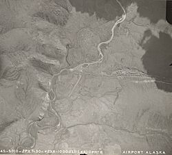
Ophir in 1942
|
|
| Country | United States |
| State | Alaska |
| Census area | Yukon-Koyukuk |
| Time zone | UTC-9 (Alaska (AKST)) |
| • Summer (DST) | UTC-8 (AKDT) |
Ophir is a place in the Yukon-Koyukuk Census Area in Alaska, a state in the United States. It is not a city or town with its own government.
Miners gave it the name Ophir. They named it after a very rich land mentioned in the Old Testament of the Bible. This area became famous for a gold rush in 1906. At its busiest, in 1910, Ophir had 122 people living there.
Today, Ophir is an abandoned place. However, it is still important. It serves as a checkpoint for the famous Iditarod Trail Sled Dog Race. There is also an old airport with a gravel runway. It was built before 1949 but is no longer used.
Gold Mining History
Ophir became a center for gold mining. Many creeks near Ophir had gold deposits. These "gold placers" were found starting around 1906. Some of these creeks include Yankee, Ganes, Little, and Spruce Creeks.
The original Iditarod Trail used to pass near Ganes Creek. Today, the race trail goes right through the old townsite. The townsite was destroyed by a brush fire in the 1970s. Now, it is a rest stop for the sled dog race.
Modern Mining Activities
Even today, some mining still happens near Ophir. People were still mining at Ganes and Little Creeks in 2006. Ophir Creek might also have active mining. Other creeks like Folger, Cripple, Bear, and Colorado Creeks also had mining operations. Bear Creek and Colorado Creek were still actively mined in 2006. In 2010, people were even mining the leftover piles of dirt, called "tailings," at Cripple Creek.
In 1949, there were at least eight mining operations near Ophir. This included two large machines called dredges. But when the price of gold dropped, most of these operations stopped by 1955. The population of Ophir was estimated to be 18 people in 1960. Some mining continued off and on after that. New mining operations started again in the 1970s.
Population Changes
Ophir was first counted in the U.S. Census in 1910. It was listed as a small, unincorporated village. It continued to be counted until 1950. Although some records show an estimated population of 18 in 1960, the official census did not count it separately after 1950. This means it was no longer considered a distinct community by the census.
| Historical population | |||
|---|---|---|---|
| Census | Pop. | %± | |
| 1910 | 122 | — | |
| 1920 | 22 | −82.0% | |
| 1930 | 19 | −13.6% | |
| 1940 | 84 | 342.1% | |
| 1950 | 68 | −19.0% | |
| U.S. Decennial Census | |||
Where is Ophir?
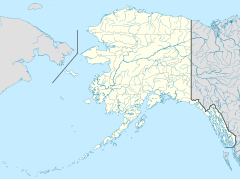
Ophir is located in western Alaska. It sits on the west bank of the Innoko River. You can find its exact spot using these coordinates: 63°08′41″N 156°31′10″W / 63.14472°N 156.51944°W.
It is about 48 kilometers (30 miles) northwest of McGrath. Ophir is also at the mouth of Ophir Creek. This creek was mined for many years by a person named Gust Utilla.
 | Chris Smalls |
 | Fred Hampton |
 | Ralph Abernathy |


