Yukon–Koyukuk Census Area, Alaska facts for kids
Quick facts for kids
Yukon–Koyukuk Census Area
|
|
|---|---|

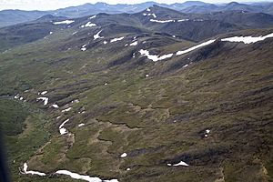
White Mountains National Recreation Area
|
|

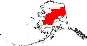
Location within the U.S. state of Alaska
|
|
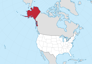
 Alaska's location within the U.S. |
|
| Country | |
| State | |
| Established | 1980 |
| Named for | Yukon River and Koyukuk River |
| Largest city | Fort Yukon |
| Area | |
| • Total | 147,805 sq mi (382,810 km2) |
| • Land | 145,505 sq mi (376,860 km2) |
| • Water | 2,300 sq mi (6,000 km2) 1.6%% |
| Population
(2020)
|
|
| • Total | 5,179 |
| • Density | 0.038/sq mi (0.015/km2) |
| Time zone | UTC−9 (Alaska) |
| • Summer (DST) | UTC−8 (ADT) |
| Congressional district | At-large |
The Yukon–Koyukuk Census Area is a very large region in the state of Alaska. It's named after two important rivers: the Yukon River and the Koyukuk River.
This area is special because it's part of Alaska's "unorganized borough." This means it doesn't have a local government like most counties in the United States. Instead, the state government handles many services.
In 2020, about 5,343 people lived here. Even though it has few people, it's incredibly big! It covers about 147,842 square miles. That makes it the largest county-equivalent area in the entire United States. It's even a bit larger than the whole state of Montana!
The biggest towns in this huge area are Galena in the west and Fort Yukon in the northeast.
Contents
Exploring the Geography of Yukon–Koyukuk
This census area is truly massive. It covers about 147,805 square miles. Most of this is land (145,505 square miles), with 2,300 square miles of water.
To give you an idea of its size, it's slightly larger than the country of Japan. It's also bigger than 47 out of the 50 U.S. states! Only California and Texas are larger.
Because it's so big and has so few people, the Yukon–Koyukuk Census Area has the lowest population density in the United States. This means there are very few people per square mile.
Neighboring Regions
The Yukon–Koyukuk Census Area shares borders with many other parts of Alaska and even another country.
- To the north: North Slope Borough, Alaska
- To the southeast: Southeast Fairbanks Census Area, Alaska, Fairbanks North Star Borough, Alaska, Denali Borough, Alaska
- To the south: Matanuska-Susitna Borough, Alaska, Bethel Census Area, Alaska
- To the west: Kusilvak Census Area, Alaska, Nome Census Area, Alaska
- To the northwest: Northwest Arctic Borough, Alaska
- To the east: Yukon Territory, a part of Canada
Special Protected Areas
A large part of the Yukon–Koyukuk Census Area is home to many national parks and wildlife refuges. These areas protect nature and animals.
- Arctic National Wildlife Refuge (part)
- Gates of the Arctic National Park and Preserve (part)
- Innoko National Wildlife Refuge
- Kanuti National Wildlife Refuge
- Koyukuk National Wildlife Refuge (part)
- Noatak National Preserve
- Nowitna National Wildlife Refuge
- Selawik National Wildlife Refuge (part)
- Steese National Conservation Area
- White Mountains National Recreation Area
- Yukon–Charley Rivers National Preserve (part)
- Yukon Flats National Wildlife Refuge
People and Population
| Historical population | |||
|---|---|---|---|
| Census | Pop. | %± | |
| 1960 | 4,097 | — | |
| 1970 | 4,752 | 16.0% | |
| 1980 | 7,873 | 65.7% | |
| 1990 | 8,478 | 7.7% | |
| 2000 | 6,551 | −22.7% | |
| 2010 | 5,588 | −14.7% | |
| 2020 | 5,343 | −4.4% | |
| 2023 (est.) | 5,129 | −8.2% | |
| U.S. Decennial Census 1790–1960 1900–1990 1990–2000 2010–2020 |
|||
In 2000, there were 6,551 people living in the Yukon–Koyukuk Census Area. This included 2,309 households and 1,480 families. The area is known for having the lowest population density of any county-equivalent in the U.S.
Most of the people living here are Native American (about 70.89%). About 24.27% are White. A small number of people are from other racial backgrounds.
Many people in the area speak Athabaskan languages at home. Some of these languages include Gwich’in and Koyukon.
The average household had about 2.81 people, and families had about 3.53 people. About 38.90% of households had children under 18 living with them.
The median age of people in the area was 31 years old. This means half the people were younger than 31 and half were older. About 35% of the population was under 18 years old.
Population by Race (2020)
The 2020 census showed the following racial makeup for the area:
| Race | Percentage of Population |
|---|---|
| White | 25.98% |
| Black or African American | 0.77% |
| American Indian or Alaska Native | 77.22% |
| Asian | 0.94% |
| Native Hawaiian and Other Pacific Islander | 0.43% |
| Some other race | 1.68% |
Ancestry and Heritage
Many people in the Yukon–Koyukuk Census Area have strong ties to their heritage. The most common self-reported ancestry is Alaskan Athabaskan.
| Ancestry | Percentage of Population |
|---|---|
| Alaskan Athabaskan | 65.52% |
| German | 9.27% |
| Irish | 3.39% |
| Iñupiat | 3.00% |
| Alaska Native tribes, not specified | 2.58% |
| English | 2.56% |
| Scottish | 2.05% |
| Norwegian | 1.85% |
| Yup'ik | 1.75% |
| Mexican | 1.68% |
| Russian | 1.66% |
Towns and Villages
The Yukon–Koyukuk Census Area has several small cities and many census-designated places (CDPs). CDPs are like towns but are not officially incorporated as cities.
Cities
- Allakaket
- Anvik
- Bettles
- Fort Yukon
- Galena
- Grayling
- Holy Cross
- Hughes
- Huslia
- Kaltag
- Koyukuk
- McGrath
- Nenana
- Nikolai
- Nulato
- Ruby
- Shageluk
- Tanana
Census-Designated Places (CDPs)
- Alatna
- Arctic Village
- Beaver
- Birch Creek
- Central
- Chalkyitsik
- Circle
- Coldfoot
- Evansville
- Flat
- Four Mile Road
- Lake Minchumina
- Livengood
- Manley Hot Springs
- Minto
- New Allakaket
- Rampart
- Stevens Village
- Takotna
- Venetie
- Wiseman
Education in the Area
Several school districts serve the students in the Yukon–Koyukuk Census Area. These districts help make sure children in this vast region get an education.
- Alaska Gateway School District
- Galena City School District
- Iditarod Area School District
- Nenana City School District
- Tanana City School District
- Yukon Flats School District
- Yukon–Koyukuk School District
See also
 In Spanish: Área censal de Yukón-Koyukuk para niños
 | Ernest Everett Just |
 | Mary Jackson |
 | Emmett Chappelle |
 | Marie Maynard Daly |

