Bethel Census Area, Alaska facts for kids
Quick facts for kids
Bethel Census Area
|
|
|---|---|

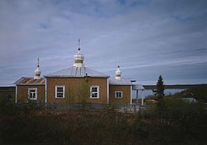
St. Sergius Chapel, Chuathbaluk
|
|

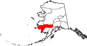
Location within the U.S. state of Alaska
|
|
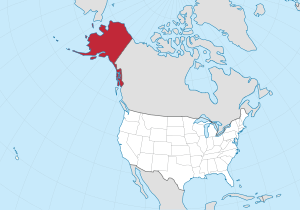
 Alaska's location within the U.S. |
|
| Country | |
| State | |
| Established | 1980 |
| Largest city | Bethel |
| Area | |
| • Total | 45,504 sq mi (117,850 km2) |
| • Land | 40,570 sq mi (105,100 km2) |
| • Water | 4,934 sq mi (12,780 km2) 10.8%% |
| Population
(2020)
|
|
| • Total | 18,666 |
| • Estimate
(2023)
|
18,224 |
| • Density | 0.42/sq mi (0.16/km2) |
| Time zone | UTC−9 (Alaska) |
| • Summer (DST) | UTC−8 (ADT) |
| Congressional district | At-large |
The Bethel Census Area is a special part of Alaska, a state in the United States. It's like a county, but in Alaska, some areas are called "census areas." This area was created in 1980.
It's part of the "unorganized borough." This means it doesn't have its own local government, like a city or county usually does. The biggest community in the Bethel Census Area is the city of Bethel. In 2020, about 18,666 people lived here.
Contents
What is the Geography of Bethel Census Area?
The Bethel Census Area is really big! It covers about 45,504 square miles. Most of this is land (about 40,570 square miles). The rest is water (about 4,934 square miles), which is about 10.8% of its total size.
To give you an idea of how big it is, its land area is similar to the size of the entire state of Kentucky. A large island called Nunivak Island in the Bering Sea is also part of this area.
What Areas are Next to Bethel Census Area?
The Bethel Census Area shares borders with several other areas in Alaska:
- Kusilvak Census Area, Alaska to the northwest
- Yukon-Koyukuk Census Area, Alaska to the north
- Matanuska-Susitna Borough, Alaska to the east
- Kenai Peninsula Borough, Alaska to the southeast
- Lake and Peninsula Borough, Alaska to the south
- Dillingham Census Area, Alaska to the south
What Protected Natural Areas are in Bethel Census Area?
A part of the Bethel Census Area is home to some amazing national protected areas. These places help keep nature safe and beautiful:
- Alaska Maritime National Wildlife Refuge (part of the Bering Sea unit)
- Lake Clark National Park and Preserve (part)
- Lake Clark Wilderness (part)
- Togiak National Wildlife Refuge (part)
- Togiak Wilderness (part)
- Yukon Delta National Wildlife Refuge (part)
How Many People Live in Bethel Census Area?
The population of the Bethel Census Area has grown over the years. Here's how many people have lived there during different census counts:
| Historical population | |||
|---|---|---|---|
| Census | Pop. | %± | |
| 1960 | 5,537 | — | |
| 1970 | 7,579 | 36.9% | |
| 1980 | 10,999 | 45.1% | |
| 1990 | 13,656 | 24.2% | |
| 2000 | 16,006 | 17.2% | |
| 2010 | 17,013 | 6.3% | |
| 2020 | 18,666 | 9.7% | |
| 2023 (est.) | 18,224 | 7.1% | |
| U.S. Decennial Census 1790-1960 1900-1990 1990-2000 2010-2020 |
|||
What Communities are in Bethel Census Area?
The Bethel Census Area has many different types of communities, from cities to smaller villages.
Cities
Census-Designated Places (CDPs)
CDPs are areas that are like towns but are not officially incorporated as cities.
Unincorporated Communities
These are smaller settlements that are not officially organized as cities or CDPs.
What About Education in Bethel Census Area?
Students in the Bethel Census Area attend schools that are part of several different school districts. These districts help make sure kids get a good education:
- Iditarod Area School District
- Kuspuk School District
- Lower Kuskokwim School District
- Lower Yukon School District
- Yupiit School District
See also
 In Spanish: Área censal de Bethel para niños
 | Tommie Smith |
 | Simone Manuel |
 | Shani Davis |
 | Simone Biles |
 | Alice Coachman |

