Kenai Peninsula Borough, Alaska facts for kids
Quick facts for kids
Kenai Peninsula Borough
|
||
|---|---|---|
|
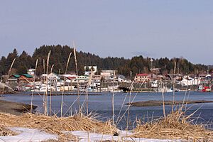
Left to right, from top: Overhead view of Homer and Kachemak Bay, sunrise on Kachemak Bay, view of Kenai Lake, the Coral Seymour Memorial Ballpark, view of Mount Alice at Seward, view of the Kenai Mountains
|
||
|
||
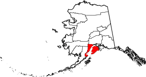
Location within the U.S. state of Alaska
|
||
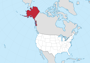 Alaska's location within the U.S. |
||
| Country | ||
| State | ||
| Incorporated | January 1, 1964 | |
| Named for | Kenai Peninsula | |
| Seat | Soldotna | |
| Largest city | Kalifornsky | |
| Area | ||
| • Total | 24,752 sq mi (64,110 km2) | |
| • Land | 16,075 sq mi (41,630 km2) | |
| • Water | 8,677 sq mi (22,470 km2) 35.1%% | |
| Population
(2020)
|
||
| • Total | 58,799 | |
| • Estimate
(2022)
|
60,690 |
|
| • Density | 2.37553/sq mi (0.917195/km2) | |
| Time zone | UTC−9 (Alaska) | |
| • Summer (DST) | UTC−8 (ADT) | |
| Congressional district | At-large | |
The Kenai Peninsula Borough is a special area in Alaska, a state in the United States. It's like a county, but in Alaska, they call these areas 'boroughs'. In 2020, about 58,799 people lived here. The main town where the government offices are is Soldotna. This is called the borough seat. The biggest city is Kenai, and the place with the most people is Kalifornsky.
This borough covers most of the Kenai Peninsula and a big part of the mainland across Cook Inlet.
Contents
Exploring Kenai Peninsula's Geography
The Kenai Peninsula Borough is a very large area. It covers about 24,752 square miles (64,100 square kilometers). A big part of this area is land, about 16,075 square miles (41,630 square kilometers). The rest is water, which makes up about 35% of the total area.
Neighboring Regions
The Kenai Peninsula Borough shares its borders with several other areas in Alaska:
- Bethel Census Area, Alaska - to the northwest
- Matanuska-Susitna Borough, Alaska - to the north
- Municipality of Anchorage, Alaska - also to the north
- Chugach Census Area, Alaska - to the east
- Lake and Peninsula Borough, Alaska - to the west
- Kodiak Island Borough, Alaska - to the south
Protected Natural Areas
A lot of the Kenai Peninsula Borough is protected land. These areas help keep nature safe and beautiful. Some of these important places include:
- Alaska Maritime National Wildlife Refuge (part of the Gulf of Alaska unit)
- This refuge includes the Chiswell Islands and the Tuxedni Wilderness.
- Chugach National Forest (a part of it)
- Katmai National Park and Preserve (a part of it)
- This park also has a part of the Katmai Wilderness.
- Kenai Fjords National Park
- Kenai National Wildlife Refuge
- This refuge includes the Kenai Wilderness.
- Lake Clark National Park and Preserve (a part of it)
- This park also has a part of the Lake Clark Wilderness.
Understanding the Local Environment
The Kenai Peninsula Borough is a great place for salmon. Places like Bear Lake, Tutka Bay, and the Trail Lakes are important for helping salmon grow. These areas are managed by the Cook Inlet Aquaculture Association. Some of the young fish from these places are released into the famous Homer fishing hole, where people love to fish.
Groups like Cook Inlet Keeper and the Cook Inlet Regional Citizen's Advisory Council work to protect the area's natural resources. They try to make sure that the land and water are used wisely.
Population and People
| Historical population | |||
|---|---|---|---|
| Census | Pop. | %± | |
| 1960 | 6,097 | — | |
| 1970 | 14,250 | 133.7% | |
| 1980 | 25,282 | 77.4% | |
| 1990 | 40,802 | 61.4% | |
| 2000 | 49,691 | 21.8% | |
| 2010 | 55,400 | 11.5% | |
| 2020 | 58,799 | 6.1% | |
| 2023 (est.) | 61,223 | 10.5% | |
| U.S. Decennial Census 1790-1960 1900-1990 1990-2000 2010-2020 |
|||
The number of people living in the Kenai Peninsula Borough has grown a lot over the years. In 1960, there were about 6,097 people. By 2020, the population had increased to 58,799 people. This shows how the area has developed and become home to more families.
Communities of Kenai Peninsula Borough
The Kenai Peninsula Borough has many different towns and communities. Some are officially called cities, while others are known as census-designated places or unincorporated communities.
Cities in the Borough
These are the main cities located within the Kenai Peninsula Borough:
- Homer
- Kachemak
- Kenai
- Seldovia
- Seward
- Soldotna (This is the borough seat, where the main government offices are.)
Census-Designated Places
Census-designated places are areas that are like towns but are not officially incorporated as cities. They are recognized for collecting census data.
- Anchor Point
- Bear Creek
- Beluga
- Clam Gulch
- Cohoe
- Cooper Landing
- Crown Point
- Diamond Ridge
- Fox River
- Fritz Creek
- Funny River
- Halibut Cove
- Happy Valley
- Hope
- Kalifornsky
- Kasilof
- Lowell Point
- Moose Pass
- Nanwalek
- Nikiski
- Nikolaevsk
- Ninilchik
- Point Possession
- Port Graham
- Primrose
- Ridgeway
- Salamatof
- Seldovia Village
- Sterling
- Sunrise
- Tyonek
Unincorporated Communities
These are smaller communities that are not officially part of a city or a census-designated place.
Ghost Town
- Portlock is a ghost town, meaning it was once a community but is now abandoned.
Education in the Borough
The schools for the entire Kenai Peninsula Borough are part of the Kenai Peninsula Borough School District. This district manages all the public schools in the area.
See also
 In Spanish: Borough de Península de Kenai para niños
 | Percy Lavon Julian |
 | Katherine Johnson |
 | George Washington Carver |
 | Annie Easley |


