Kasilof, Alaska facts for kids
Quick facts for kids
Kasilof, Alaska
Ggasilat
|
|
|---|---|

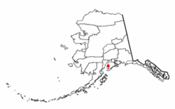
Location of Kasilof, Alaska
|
|
| Country | United States |
| State | Alaska |
| Borough | Kenai Peninsula |
| Area | |
| • Total | 10.63 sq mi (27.52 km2) |
| • Land | 10.43 sq mi (27.00 km2) |
| • Water | 0.20 sq mi (0.52 km2) |
| Elevation | 125 ft (38 m) |
| Population
(2020)
|
|
| • Total | 525 |
| • Density | 50.36/sq mi (19.44/km2) |
| Time zone | UTC-9 (Alaska (AKST)) |
| • Summer (DST) | UTC-8 (AKDT) |
| ZIP code |
99610
|
| Area code(s) | 907 |
| FIPS code | 02-38090 |
| GNIS feature ID | 1413283 |
Kasilof (pronounced kə-SEE-lof) is a small community in Alaska, United States. It's known as a census-designated place (CDP). This means it's an area that the government counts for population, but it's not officially a city or town with its own local government. Kasilof is located in the Kenai Peninsula Borough. In 2020, about 525 people lived there.
Contents
Where is Kasilof Located?
Kasilof is found at 60.335274 degrees North and -151.233594 degrees West. It sits on the eastern side of the Cook Inlet, which is a large body of water. The community is part of the Kenai Peninsula, a big piece of land that sticks out into the ocean.
Kasilof's Surroundings
You can find Kasilof along the Sterling Highway. It's about 19 kilometers (12 miles) south of Kenai and 62 miles (100 kilometers) north of Homer.
The Kasilof River runs along its southwest side. On the other side of this river is the community of Cohoe. To the north, past Coal Creek, is another community called Kalifornsky.
Land and Water Area
The Kasilof census-designated place covers a total area of about 27.5 square kilometers (10.6 square miles). Most of this area, about 27.0 square kilometers (10.4 square miles), is land. The remaining 0.5 square kilometers (0.2 square miles), or about 1.89%, is water.
Who Lives in Kasilof?
The population of Kasilof has changed over the years. A "census" is like a big count of all the people living in an area. It helps us understand how communities grow or shrink.
| Historical population | |||
|---|---|---|---|
| Census | Pop. | %± | |
| 1880 | 31 | — | |
| 1890 | 117 | 277.4% | |
| 1900 | 159 | 35.9% | |
| 1930 | 45 | — | |
| 1940 | 62 | 37.8% | |
| 1950 | 62 | 0.0% | |
| 1960 | 89 | 43.5% | |
| 1970 | 71 | −20.2% | |
| 1980 | 201 | 183.1% | |
| 1990 | 383 | 90.5% | |
| 2000 | 471 | 23.0% | |
| 2010 | 549 | 16.6% | |
| 2020 | 525 | −4.4% | |
| U.S. Decennial Census | |||
Kasilof first appeared in the U.S. Census in 1880. Back then, it was called "Kassilof." By 1900, its name was shortened to the current "Kasilof." It became a census-designated place (CDP) in 1980.
Community Life
In 2000, there were 180 households in Kasilof. Many of these households (about 57.8%) were married couples living together. Some households (about 33.9%) had children under 18 living with them.
The people in Kasilof are of different ages. In 2000, about 27.4% of the population was under 18 years old. About 8.1% of the people were 65 years or older. The average age in Kasilof was 40 years.
Kasilof's Past: A Brief History
Kasilof has a long history, going back to the late 1700s.
Early Settlements
In 1786, some Russians working for a company called Lebedev-Lastochkin Company built a fishing station in the area. This station was called an artel, which is like a workshop or cooperative. Even though it grew, it wasn't a major place in the history of Russian settlements in Alaska.
A farming community of Dena'ina people, who are Native Alaskans, also grew up around this station.
Becoming Kasilof
Later, a big company called the Russian-American Company took over the fur trade in Russian America. The fishing station's assets were sold off. The area became known as Kasilof in the 1800s, named after the Kasilof River.
In 1937, archaeologists did some digging in the area. They found 31 old houses from the settlement that were very well preserved. Today, most people living in Kasilof are not Native Alaskans.
See also
 In Spanish: Kasilof (Alaska) para niños
 | Sharif Bey |
 | Hale Woodruff |
 | Richmond Barthé |
 | Purvis Young |

