Diamond Ridge, Alaska facts for kids
Quick facts for kids
Diamond Ridge, Alaska
Ch’aqiniggech’
|
|
|---|---|
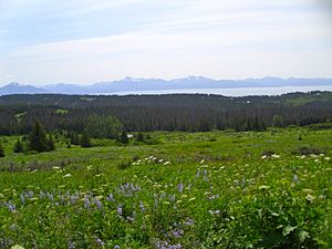
View from Diamond Ridge on the Homestead Trail, showing Kachemak Bay and the Kenai Mountains
|
|
| Country | United States |
| State | Alaska |
| Borough | Kenai Peninsula |
| Area | |
| • Total | 42.40 sq mi (109.81 km2) |
| • Land | 42.40 sq mi (109.81 km2) |
| • Water | 0.00 sq mi (0.00 km2) |
| Elevation | 1,060 ft (323 m) |
| Population
(2020)
|
|
| • Total | 1,330 |
| • Density | 31.37/sq mi (12.11/km2) |
| Time zone | UTC-9 (Alaska (AKST)) |
| • Summer (DST) | UTC-8 (AKDT) |
| Area code(s) | 907 |
| FIPS code | 02-18925 |
| GNIS feature ID | 1865549 |
Diamond Ridge is a special kind of community in Alaska. It's called a census-designated place (CDP). This means it's an area that the government counts for population, but it's not an officially organized city or town. Diamond Ridge is located near Homer in the Kenai Peninsula Borough. In the Dena'ina language, it's called Ch’aqiniggech’.
In 2010, about 1,156 people lived here. By 2020, the population grew to 1,330 people.
Contents
Where is Diamond Ridge?
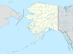
Diamond Ridge is located at 59°39′55″N 151°34′15″W / 59.66528°N 151.57083°W. It's bordered by the city of Homer to the south. To the southeast, you'll find the city of Kachemak.
East of Diamond Ridge is the Fritz Creek community. To the north and west is the Anchor Point area. The westernmost part of Diamond Ridge touches Cook Inlet. This is where Kachemak Bay meets the larger Cook Inlet.
The Ridge Itself
The area gets its name from the high ground it sits on, called Diamond Ridge. This ridge is about 1,202 feet (366 m) (366 meters) above sea level. It's in the southern part of the community.
North of Diamond Ridge are other similar landforms. These include Crossman Ridge in the center. Further north, there's a ridge connecting Ohlson Mountain (1,513-foot (461 m)) and Lookout Mountain (1,622-foot (494 m)). The land gently slopes down from these ridges towards the Anchor River. This river forms the northern edge of the Diamond Ridge community.
The total area of Diamond Ridge is about 42.4 square miles (109.8 km2). Almost all of this area is land. The main way to get around is via Diamond Ridge Road. This road runs along the top of the ridge, which is about 5-mile-long (8.0 km). Smaller roads branch off from it.
Who Lives in Diamond Ridge?
Diamond Ridge was first counted as a census-designated place (CDP) in the year 2000.
| Historical population | |||
|---|---|---|---|
| Census | Pop. | %± | |
| 2000 | 1,802 | — | |
| 2010 | 1,156 | −35.8% | |
| 2020 | 1,330 | 15.1% | |
| U.S. Decennial Census | |||
In 2000, there were 1,802 people living in Diamond Ridge. The population density was about 37.8 inhabitants per square mile (14.6/km2). This means there were about 38 people per square mile.
By 2010, the population decreased to 1,156 people. However, it grew again to 1,330 people by the 2020 census.
Fun Outdoors: Parks and Trails
Diamond Ridge has two great outdoor areas with trails for exploring.
Homer Demonstration Forest
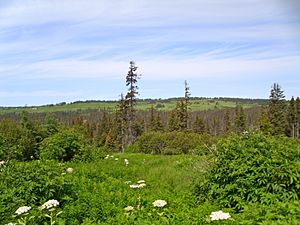
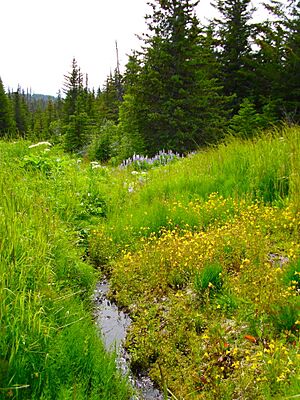
One of these is the Homer Demonstration Forest. It's a preserved area located on the slopes just below Diamond Ridge. Here, you can find an arboretum, which is like a tree garden. There are also self-guided nature trails to walk on.
The forest is also one end of the Homestead Trail. This trail goes through the forest, climbs up Diamond Ridge, and crosses a deep valley. It eventually reaches Crossman Ridge and ends at the Homer Reservoir. In winter, the forest has special groomed trails for cross-country skiing. There's also a separate trail for snowshoeing.
Diamond Creek State Recreation Area
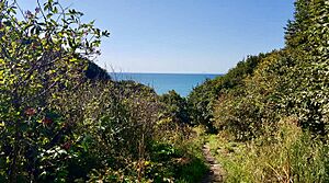
Another outdoor spot is the Diamond Creek State Recreation Area. This is a newer part of Alaska State Parks. It doesn't have many buildings or facilities. You can only visit during the day; camping is not allowed here.
The road to this area can be very steep and rough in some places. Large vehicles, over 25 feet (7.6 m) long, are not allowed on the lower part of the road. The road leads to parking areas where you can access hiking and biking trails. A local cycling club builds and takes care of the bike trails.
See also
 In Spanish: Diamond Ridge (Alaska) para niños
 | James Van Der Zee |
 | Alma Thomas |
 | Ellis Wilson |
 | Margaret Taylor-Burroughs |


