
Katmai National Park and Preserve facts for kids
Quick facts for kids Katmai National Park and Preserve |
|
|---|---|
|
IUCN Category V (Protected Landscape/Seascape)
|
|

The summit crater lake of Mount Katmai
|
|

Katmai National Park and Preserve
Location in Alaska

Katmai National Park and Preserve
Location in North America
|
|
| Location | Lake and Peninsula, Kodiak Island, Kenai Peninsula, and Bristol Bay boroughs, Alaska, United States |
| Nearest city | King Salmon |
| Area | 4,093,077 acres (16,564.09 km2) |
| Established | December 2, 1980 |
| Visitors | 37,818 (in 2015 – latest count) |
| Governing body | National Park Service |
| Website | Katmai National Park & Preserve |
Katmai National Park and Preserve is a special place in southern Alaska, USA. It's famous for its many brown bears and a unique area called the Valley of Ten Thousand Smokes. This huge park covers about 4 million acres, which is bigger than the state of Connecticut! Most of Katmai is a protected wilderness where hunting is not allowed.
The park gets its name from Mount Katmai, a large stratovolcano at its center. It's located on the Alaska Peninsula, right across from Kodiak Island. The park's main office is in King Salmon. Katmai was first made a national monument in 1918. This was to protect the land around the huge 1912 volcanic eruption of Novarupta. This eruption created the Valley of Ten Thousand Smokes, a large area covered by volcanic ash. The park has 18 volcanoes, and seven of them have been active since 1900.
Even though it was first protected for its volcanoes, people later realized how important Katmai was for its amazing wildlife. This includes lots of sockeye salmon and the brown bears that eat them. The park was expanded several times and became a national park and preserve in 1980.
Contents
Exploring Katmai National Park


Katmai National Park is on the Pacific Ocean side of the Alaska Peninsula. It faces Kodiak Island across the Shelikof Strait. The park has a long coastline, a chain of fifteen volcanoes in the Aleutian Range, and several large lakes.
The closest town to the park is King Salmon, where the park's main office is. You can reach King Salmon by plane, but there are no roads connecting it to the main Alaska road system. To get into the park's wild areas, you usually need to take a boat on Naknek Lake or a special plane called a floatplane.
The park includes the McNeil River State Game Sanctuary and Refuge, which is famous for bear viewing. The Alagnak River and Naknek River also start within the park. Katmai is divided into two parts: the national park and the national preserve. In the national park, all hunting is forbidden. In the preserve, some hunting is allowed.
Volcanoes of Katmai

Katmai is home to many volcanoes. The active ones include Mount Katmai, Novarupta, Trident Volcano, Mount Mageik, Mount Martin, and Fourpeaked Mountain. Some of these volcanoes, like Mount Martin and Mount Mageik, often release steam.
The Great 1912 Eruption

The biggest volcanic event in Katmai's recent history happened in June 1912. Both Mount Katmai and Novarupta erupted at the same time. Novarupta's eruption was massive, sending a hot cloud of ash and gas (called a pyroclastic flow) across a nearby valley. This ash layer was as thick as 300 feet (90 meters)! At the same time, the top of Mount Katmai collapsed, forming a large bowl-shaped crater called a caldera.
As the ash in the valley slowly cooled, steam escaped from cracks in the ground. This created thousands of steam vents, giving the area its name: the "Valley of Ten Thousand Smokes." Over time, the valley has cooled, and the steam vents have mostly disappeared. Streams have now cut deep canyons through the ash.
Other Notable Volcanoes
_(12292001613).jpg)

- Trident Volcano is made of three volcanoes. It has erupted several times, especially between 1953 and 1974. A new peak, Southwest Trident, formed during this time.
- Mount Martin is a tall volcano that often releases steam from its top.
- Mount Mageik has four vents and also releases steam.
- Fourpeaked Mountain is mostly covered by a glacier. It had small eruptions in 2006.
Other volcanoes in the park, like Mount Griggs and Snowy Mountain, are also impressive. Many of them are covered in ice and glaciers.
Fun Activities in Katmai

Katmai National Park offers many outdoor activities. You can go hiking, backpacking, camping, backcountry skiing, fishing, and kayaking. There are also boat tours and ranger-led programs.
Bear Viewing
Katmai is famous for its large population of Alaskan brown bears. It's home to the world's largest protected brown bear population, with an estimated 2,200 bears! These bears gather in large numbers to catch sockeye salmon as they swim upstream to lay their eggs.
The best place to see bears is at Brooks Falls. Here, you can watch bears fishing for salmon from special viewing platforms. Many famous photos of Alaskan brown bears have been taken at Brooks Falls. Salmon arrive early at Brooks Falls, so July and September are the best months to see many bears. Coastal areas like Hallo Bay also have many bears year-round. They find clams, plants, and fish to eat there.

Most visitors to Katmai go to Brooks Camp, which is one of the few developed areas in the park. Park rangers work hard to make sure bears don't get human food or have bad encounters with people. Because of this, the bears at Katmai are usually not afraid of humans. This allows visitors to get closer (and take photos) than they might elsewhere. You can even watch the bears of Brooks Camp on live webcams!
You can find places to stay inside the park at Brooks Camp and Grosvenor Lodge, as well as other lodges on private lands within the park.
Katmai's Climate and Wildlife

The weather in Katmai can change quickly, and it often rains or drizzles. Summer temperatures are usually around 63°F (17°C). Winter lows are between -4°F and 40°F (-20°C and 4°C). The coast gets the most rain.
Katmai is home to many animals. There are 29 types of mammals, including moose, wolves, brown bears, coyotes, beavers, lynx, wolverines, and different kinds of foxes. You might also see marine mammals like harbor seals, sea lions, sea otters, and even beluga whales or killer whales in the coastal waters. Sometimes, caribou visit the park in winter.
The most important fish in the park are sockeye salmon. They are a vital food source for bears, bald eagles, and other animals. Salmon enter the Naknek River in June and July and lay their eggs from August to October.
History of Katmai
Early Human History
People have lived in the Katmai area for a very long time. Ancient tools and artifacts have been found dating back about 6,000 years near the old Katmai village. Other sites along the coast, like Kaguyak and Kukak, show that people lived there until the 1912 eruption. The Amalik Bay Archeological District has evidence of human activity from over 7,000 years ago.
Brooks Camp is also an important archaeological site, showing human activity from about 4,500 years ago.
Russian and American Explorers
Russian fur traders were the first Europeans to arrive in the area. They met the local Aglegmuit and Koniag Eskimo people. Katmai Village was one of the few places where Europeans lived in the mid-1800s. Later, American traders took over. As sea otters became rare, the fur trade slowed down, and villages like Katmai were abandoned in the early 1900s.
In the 1890s, some people traveled through the region on their way to the gold rush in Nome.
The 1912 Eruption and Protection

Before the 1912 eruption, there were many earthquakes around Katmai Pass. These earthquakes made the few local residents leave. Mount Katmai and Novarupta erupted on June 6, 1912. The noise was heard hundreds of miles away! Ash fell heavily on nearby Kodiak Island and even reached as far as Puget Sound. The ash also caused a haze around the world and lowered temperatures in the Northern Hemisphere.
At first, people thought Mount Katmai was the main volcano. But in 1954, scientists discovered that Novarupta was actually the main source of the eruption. The land around the volcanoes was completely changed by the thick ashfall.
The National Geographic Society sent several expeditions to Katmai starting in 1915. Robert Fiske Griggs, a botanist, led these trips. In 1916, his team discovered and named the Valley of Ten Thousand Smokes. The National Geographic Society was very excited by these discoveries. They helped Griggs push for the area to be protected as a national park.
Since creating a national park takes a long time, it was suggested that the area be made a national monument by the President. On September 24, 1918, President Woodrow Wilson signed a declaration making Katmai National Monument. It protected about 1.08 million acres, including Mount Katmai and the Valley of Ten Thousand Smokes. Even then, it was half the size of Yellowstone National Park!
Growing the Monument

For many years, not many people visited Katmai. But in the 1930s, the Park Service realized that Katmai was one of the best places for grizzly bears in Alaska. They wanted to protect the bears and the salmon spawning grounds. In 1931, President Herbert Hoover expanded the monument to over 2.6 million acres, more than doubling its size! This expansion included the important Brooks Falls area.
After World War II, more people started visiting. The Park Service began to improve visitor services, building a headquarters in King Salmon and a road from Brooks Camp to the Valley of Ten Thousand Smokes.
In 1967, the state of Alaska created the McNeil River State Game Sanctuary next to Katmai. This sanctuary protects important bear fishing grounds.
Becoming a National Park and Preserve

In the 1970s, there were many discussions about expanding Katmai and other protected areas in Alaska. Some people wanted to allow hunting, while others wanted full protection. To solve this, the idea of "national preserve" lands was created. These areas would be protected but still allow some regulated hunting.
On December 2, 1980, the Alaska National Interest Lands Conservation Act (ANILCA) was passed. This law officially made Katmai a National Park and Preserve. It added more land, bringing the total to over 4 million acres. Most of this land is wilderness, where hunting is not allowed. However, in the preserve areas, both sport and subsistence hunting are permitted.
Images for kids
-
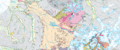
Katmai National Park Geologic map

See also
 In Spanish: Parque nacional y reserva Katmai para niños
