Kodiak Island facts for kids
|
Nickname: Emerald Isle
|
|
|---|---|
 |
|
| Geography | |
| Location | Pacific Ocean |
| Coordinates | 57°28′N 153°26′W / 57.467°N 153.433°W |
| Archipelago | Kodiak Archipelago |
| Total islands | 25 |
| Area | 3,595.09 sq mi (9,311.2 km2) |
| Highest elevation | 4,469 ft (1,362.2 m) |
| Highest point | Koniag Peak |
| Administration | |
|
United States
|
|
| State | Alaska |
| Borough | Kodiak Island |
| Largest settlement | Kodiak (pop. 5,581) |
| Demographics | |
| Population | 13,101 (2020 Census) |
| Pop. density | 3.64 /sq mi (1.405 /km2) |
| Ethnic groups | Alutiiq, European, Filipino other Asian and Indigenous peoples, Hispanics, including Filipino Hispanics |
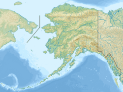
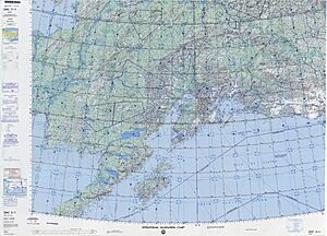
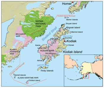
Kodiak Island is a really big island located off the south coast of Alaska, a state in the United States. It's separated from the mainland by the Shelikof Strait. People sometimes call it the "Emerald Isle" because it's so green!
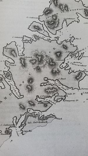
Kodiak Island is the second largest island in the United States. It covers about 3,595 square miles (9,311 square kilometers). That's a bit bigger than the country of Cyprus! The island is about 160 miles (257 km) long and can be anywhere from 10 to 60 miles (16 to 97 km) wide.
The island is quite mountainous, especially in the north and east, where you'll find lots of trees. The southern part, however, has fewer trees. Kodiak Island has many deep bays that don't freeze, which are perfect for boats to anchor safely. A big part of the island is protected as the Kodiak National Wildlife Refuge.
The main city on the island is also called Kodiak. It's one of seven communities here. All travel to and from the island, whether by ferry or plane, goes through this city. Other small villages include Akhiok, Old Harbor, Karluk, Larsen Bay, and Port Lions.
Kodiak is also home to the largest U.S. Coast Guard base. This base includes several important facilities like Coast Guard Air Station Kodiak. The island also has a spaceport called the Pacific Spaceport Complex – Alaska.
You might know Kodiak Island for its famous animals! The Kodiak bear, one of the largest brown bears in the world, lives here. King crab are also native to the island. Fishing is super important for the island's economy, with lots of Pacific salmon, Pacific halibut, and crab caught. The Karluk River is especially known for its amazing salmon run. Other jobs on the island include logging, ranching, and working in canneries.
Contents
Kodiak Island's Past
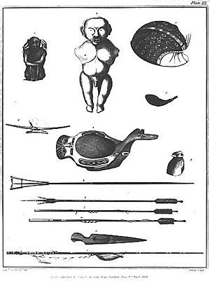
Kodiak Island is the traditional home of the Sugpiaq people, who are part of the Alutiiq nation of Native Americans. For a long time, these original inhabitants lived by hunting sea animals, fishing, and gathering food.
European explorers first arrived in the 1700s. A Russian fur trader named Stepan Glotov explored Kodiak Island in 1763. Later, in 1784, another Russian fur trader, Grigory Shelikhov, started the first Russian settlement on the island at Three Saints Bay. This settlement later moved to where the city of Kodiak is today. It became a big center for trading furs with the Native Alaskans.
During this time, the Russian traders made the Alutiiq people work for them, hunting and preparing furs. This was a very hard time for the Alutiiq, as their traditional way of life was disrupted, and families faced challenges. A place called Awa'uq, which means "to become numb" in Alutiiq, is a sacred spot that reminds people of a difficult event where many native people lost their lives.
In 1794, a group of monks from Russia set up an Orthodox mission on Kodiak Island. The Russian fur trade grew, and the Alutiiq men were forced to hunt for longer periods in areas far from home. This meant they couldn't always provide food for their families, leading to hardship.
Between 1837 and 1839, a terrible smallpox sickness spread across Russian Alaska. It caused about one-third of the Native population to die. Luckily, the sickness was eventually stopped when people started getting vaccinated.
In 1867, the United States bought Alaska from Russia. Kodiak Island then became part of the U.S. Over time, more Americans moved to the island, continuing to hunt and fish.
The 1912 Novarupta Volcano Eruption
Novarupta is a volcano about 100 miles (160 km) northwest of Kodiak Island. From June 6 to June 8, 1912, it had the biggest volcanic eruption of the 20th century!
Life on Kodiak Island stopped completely during the 60-hour eruption. It became dark, and the air was full of ash and sulfur gas, making it hard to breathe and hurting people's eyes. Water became undrinkable, and roofs in the village collapsed under the heavy ash.
The eruption also badly affected the wildlife. Bears and other large animals were blinded by the thick ash and many starved because plants and smaller animals were buried. Birds covered in ash fell from the sky. Even mosquitoes disappeared! Fish in the rivers and ocean died in the ash-filled waters. The salmon fishing industry in southwestern Alaska was badly hurt for several years after the eruption.
The 1964 Good Friday Earthquake
Kodiak Island was also hit by a very strong earthquake and tsunami in 1964. This event, known as the Good Friday earthquake, destroyed much of the waterfront, the main business area, and several villages on the island.
Kodiak Island's Weather
Kodiak has milder weather compared to many other parts of Alaska. The coldest months are from December to March, and the warmest months are from June to August. It gets a good amount of rain and snow throughout the year.
| Climate data for Kodiak, Alaska | |||||||||||||
|---|---|---|---|---|---|---|---|---|---|---|---|---|---|
| Month | Jan | Feb | Mar | Apr | May | Jun | Jul | Aug | Sep | Oct | Nov | Dec | Year |
| Record high °F (°C) | 54 (12) |
60 (16) |
57 (14) |
70 (21) |
80 (27) |
86 (30) |
82 (28) |
84 (29) |
80 (27) |
74 (23) |
60 (16) |
62 (17) |
86 (30) |
| Mean daily maximum °F (°C) | 35 (2) |
36 (2) |
38 (3) |
43 (6) |
49 (9) |
55 (13) |
60 (16) |
61 (16) |
56 (13) |
46 (8) |
39 (4) |
36 (2) |
46 (8) |
| Mean daily minimum °F (°C) | 25 (−4) |
24 (−4) |
27 (−3) |
32 (0) |
38 (3) |
44 (7) |
48 (9) |
49 (9) |
43 (6) |
34 (1) |
29 (−2) |
25 (−4) |
35 (2) |
| Record low °F (°C) | −16 (−27) |
−12 (−24) |
−6 (−21) |
7 (−14) |
18 (−8) |
30 (−1) |
35 (2) |
34 (1) |
26 (−3) |
7 (−14) |
0 (−18) |
−9 (−23) |
−16 (−27) |
| Average precipitation inches (mm) | 8.17 (208) |
5.72 (145) |
5.22 (133) |
5.48 (139) |
6.31 (160) |
5.38 (137) |
4.12 (105) |
4.48 (114) |
7.84 (199) |
8.36 (212) |
6.63 (168) |
7.64 (194) |
75.35 (1,914) |
| Average snowfall inches (cm) | 14.5 (37) |
14.7 (37) |
10.3 (26) |
7.5 (19) |
0.2 (0.51) |
0 (0) |
0 (0) |
0 (0) |
0 (0) |
1.4 (3.6) |
7.3 (19) |
15.6 (40) |
71.5 (182.11) |
Learning on Kodiak Island
The University of Alaska Anchorage has a campus on Kodiak Island. It opened in 1968 and is located about 2 miles (3 km) northwest of Kodiak City.
Parks and Protected Areas

Almost two-thirds of Kodiak Island is part of the Kodiak National Wildlife Refuge. This area is wild and has no roads. The refuge headquarters are located near the Buskin River State Recreation Site. Here, you can find places for camping, picnics, beaches, and fishing for salmon and trout.
The Pasagshak River State Recreation Site is a 25-acre park. It has a small campground and offers some of the best salmon and trout fishing on the island. The island is also home to the Fort Abercrombie State Historical Park, which is a great place to learn about history.
See also
 In Spanish: Isla Kodiak para niños
 | Janet Taylor Pickett |
 | Synthia Saint James |
 | Howardena Pindell |
 | Faith Ringgold |


