1964 Alaska earthquake facts for kids
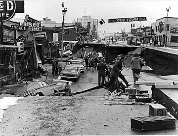
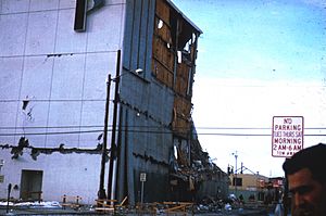
Fourth Avenue in Anchorage, Alaska, looking east from near C Street. This area was affected by a large landslide.
|
|
| UTC time | 1964-03-28 03:36:16 |
|---|---|
| ISC event | 869809 |
| USGS-ANSS | ComCat |
| Local date | March 27, 1964 |
| Local time | 17:36:16 AKST |
| Duration | 4–5 minutes |
| Magnitude | Mw 9.2–9.3 |
| Depth | 25 kilometers (16 mi) |
| Epicenter | 60°54′28″N 147°20′20″W / 60.9079°N 147.3389°W |
| Type | Megathrust |
| Areas affected | United States, Canada |
| Total damage | $311 million (1964 USD) [$3.05 billion (2025 USD)] |
| Max. intensity | X (Extreme) |
| Peak acceleration | 0.14-0.18 g |
| Tsunami | Major. Run-up of 67 m (220 ft) at Shoup Bay, Alaska. |
| Casualties | 139 |
The 1964 Alaska earthquake, also known as the Great Alaska earthquake or Good Friday earthquake, happened on March 27, 1964, at 5:36 PM AKST. This powerful earthquake caused the ground to crack, buildings to fall, and giant ocean waves called tsunamis. These events led to about 139 deaths across south-central Alaska.
The earthquake lasted for four minutes and thirty-eight seconds. It was a megathrust earthquake with a magnitude of 9.2–9.3. This makes it the strongest earthquake ever recorded in North America. It is also the second most powerful earthquake recorded worldwide since 1900. A fault line stretching Six hundred miles (970 km) broke at once. The ground moved up to 60 ft (18 m), releasing stress that had built up over 500 years.
The shaking caused the ground to become like liquid in some places, creating cracks and landslides. This led to major damage in many towns. Anchorage suffered a lot of destruction. Many homes, buildings, and roads were badly damaged. This was especially true in areas where landslides occurred along Knik Arm. Southwest of Anchorage, some areas near Kodiak were lifted permanently by 30 feet (9 m). Other areas, like those near Girdwood and Portage, dropped by as much as 8 feet (2.4 m). This required rebuilding parts of the Seward Highway to raise it above the new high tide mark.
In Prince William Sound, a huge underwater landslide happened at Port Valdez. This caused 32 deaths as the city's harbor and docks collapsed. A ship docked there was also destroyed. Nearby, a 27-foot (8.2 m) tsunami wiped out the village of Chenega. Twenty-three of the 68 residents died. The survivors ran to high ground to escape the wave. Tsunamis after the earthquake also hit Whittier, Seward, Kodiak, and other Alaskan towns. They also caused damage in British Columbia, Washington, Oregon, and California. Even Hawaii and Japan saw tsunami damage. The earthquake's effects were even felt as far away as Florida and Texas.
Contents
How the Earth Moved
On March 27, 1964, at 5:36 PM AKST, a fault broke. This fault was between the Pacific and North American plates. It happened near College Fjord in Prince William Sound. The earthquake's epicenter was 12.4 mi (20.0 km) north of Prince William Sound. It was also 78 miles (126 km) east of Anchorage and 40 miles (64 km) west of Valdez. The earthquake started deep underground, about 15.5 mi (24.9 km) below the surface.
Tectonic Plates and Faults
This earthquake was a subduction zone earthquake. This means one oceanic plate slid beneath a continental plate. The fault involved was the Aleutian Megathrust. This type of fault is caused by strong pushing forces. The movement of the ocean floor created huge tsunamis. Some waves reached up to 220 feet (67 m) high. These waves caused many deaths and a lot of property damage. Large rockslides also happened, adding to the destruction. The ground moved vertically by as much as 38 feet (12 m). This affected a huge area of 100,000 square miles (260,000 km2) in Alaska.
Ground Shaking and Intensity
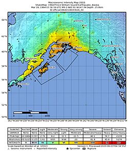
Scientists estimate the ground shook with a force of 0.14–0.18 g. The earthquake was rated as X (Extreme) on the Modified Mercalli intensity scale. People felt the shaking across most of Alaska. It was also felt in parts of western Yukon and British Columbia in Canada. The ground uplifted across 520,000 km2 (200,000 sq mi) from southern Kodiak to Prince William Sound. The highest uplift was on Montague Island, where the ground rose 13–15 m (43–49 ft) above sea level. Other islands like Kodiak also saw uplift. In contrast, some areas, like the Chugach Mountains and Kenai Peninsula, sank. This subsidence covered 285,000 km2 (110,000 sq mi).
Giant Waves: The Tsunami
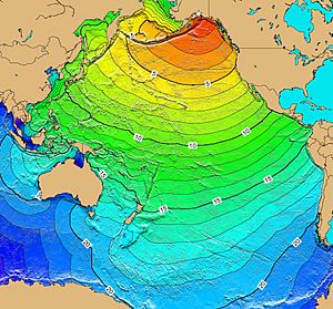
- Red: 1- to 4-hour arrival times
- Yellow: 5- to 6-hour arrival times
- Green: 7- to 14-hour arrival times
- Blue: 15- to 21-hour arrival times.
This earthquake created two kinds of tsunamis. One was a tectonic tsunami, caused by the movement of the Earth's plates. There were also about 20 smaller, local tsunamis. These smaller waves were caused by underwater and above-ground landslides. They were responsible for most of the tsunami damage. Tsunami waves were observed in over 20 countries. These included Peru, New Zealand, Papua New Guinea, Japan, Mexico, and even Antarctica. The tallest tsunami wave was recorded in Shoup Bay, near Valdez, Alaska. It reached a height of about 220 ft (67 m).
Impact and Damage
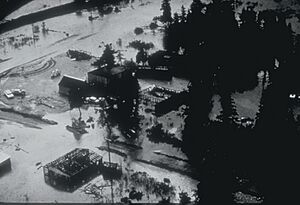
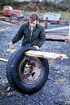
About 139 people died because of the earthquake. Fifteen people died directly from the shaking. Another 124 died from the tsunamis that followed. These tsunami deaths occurred in Alaska, Oregon, and California. Five people died in Oregon, and 13 in California. Most of the California deaths were in or near Crescent City. The total property damage was estimated at $116 million in 1964. This would be about $785 million in 2025 dollars.
Damage in Anchorage
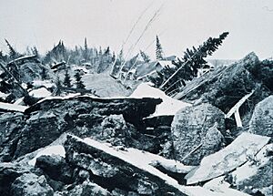
Most of the damage happened in Anchorage, about 75 mi (121 km) northwest of where the earthquake started. Anchorage did not get hit by tsunamis. However, downtown Anchorage was severely damaged. Parts of the city built on sandy bluffs, especially the Turnagain neighborhood, suffered from huge landslides. This neighborhood lost 75 houses. The destroyed area is now Earthquake Park. The Government Hill school was split into two broken pieces by a landslide. Land near the Ship Creek valley also slid, destroying many buildings downtown. Other parts of the city had moderate damage. The concrete control tower at Anchorage International Airport collapsed, killing the air traffic controller inside.
The small towns of Girdwood and Portage were also destroyed. They are located southeast of Anchorage on the Turnagain Arm. The ground sank, and then tidal waters flooded the area. Girdwood was rebuilt further inland, but Portage was abandoned. About 20 miles (32 km) of the Seward Highway sank below the high-water mark. The highway and its bridges had to be rebuilt.
Damage Across Alaska
Many coastal towns in the Prince William Sound, Kenai Peninsula, and Kodiak Island areas were badly damaged. Major ports like Seward, Whittier, and Kodiak suffered from shaking, sinking ground, tsunamis, and fires. Valdez was not completely destroyed, but after three years, the town moved to higher ground. Some Alaska Native villages, like Chenega and Afognak, were also destroyed. The earthquake even caused the Clear Air Force Station radar to stop working for six minutes. Near Cordova, the Million Dollar Bridge was damaged. One span slipped off its support and collapsed.
Impact Beyond Alaska
A 4.5 ft (1.4 m) tsunami wave reached Prince Rupert, British Columbia, Canada, three hours after the earthquake. The tsunami then hit Tofino and traveled up a fjord to Port Alberni. It hit Port Alberni twice, washing away 55 homes and damaging 375 others. Other Canadian towns like Hot Springs Cove also saw damage. The damage in British Columbia was estimated at CA$10 million in 1964. This is about $86 million in 2025 Canadian dollars.
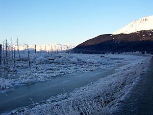
Ten people died from the tsunami in Crescent City, California. One man died near Requa, California while fishing. Four children camping at Beverly Beach State Park on the Oregon coast also died. Crescent City was hit very hard, with 30 blocks of its waterfront destroyed. The total damage there was estimated at $7.4 million in 1964, which is about $76 million in 2025 dollars. Other coastal towns and harbors in the Pacific Northwest, California, and Hawaii were also damaged. The earthquake's effects were even noticed in Freeport, Texas. Water levels in wells around the world, including England, Namibia, and Australia, also showed changes.
Aftershocks: More Tremors
After the main earthquake, there were hundreds of smaller earthquakes called aftershocks. In the first day alone, eleven large aftershocks with a magnitude greater than 6.0 occurred. Nine more struck over the next three weeks. Thousands of aftershocks happened in the months following the quake. Smaller aftershocks continued to shake the region for over a year.
Helping Hands: Recovery Efforts
Alaska had never faced such a big disaster in a populated area before. It had very few resources to deal with the damage. In Anchorage, a team of 40 scientists, including geologists and engineers, was formed. Led by Dr. Ruth A. M. Schmidt, a geology professor, their job was to study the damage. They wanted to make sure that new buildings would be safe from future earthquakes. This team worked quickly and released a report just over a month after the earthquake.
The United States military, which has a large presence in Alaska, helped immediately. The U.S. Army quickly re-established communication with the rest of the country. They sent troops to help Anchorage citizens and sent supplies to Valdez. President Lyndon B. Johnson declared all of Alaska a major disaster area the day after the quake.
The U.S. Navy and U.S. Coast Guard sent ships to isolated coastal towns to provide aid. Bad weather made air rescues difficult at first. But soon, helicopters and planes were able to help. A military airlift began bringing in relief supplies, delivering over 2,570,000 pounds (1,170,000 kg) of food and other items.
Broadcast journalist Genie Chance played a key role in recovery. She stayed on the radio for over 24 hours, providing calm and important information. She helped coordinate rescue efforts, connected people with resources, and shared messages between families.
For the long term, the U.S. Army Corps of Engineers led the effort to rebuild roads and clear debris. They also helped establish new town sites for destroyed communities. This cost $110 million. The West Coast and Alaska Tsunami Warning Center was created because of this disaster. Federal disaster relief funds paid for reconstruction. They also supported Alaska's government, which helped the state stay financially stable. This was before the discovery of huge oil deposits at Prudhoe Bay. The Alaska National Guard also created the Alaska Division of Emergency Services to prepare for future disasters.
See also
 In Spanish: Terremoto de Alaska de 1964 para niños
- List of earthquakes in Alaska
 | William L. Dawson |
 | W. E. B. Du Bois |
 | Harry Belafonte |


