Turnagain Arm facts for kids
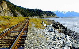
Turnagain Arm is a waterway in the northwestern part of the Gulf of Alaska. It is one of two narrow branches at the north end of Cook Inlet. The other branch is called Knik Arm. Turnagain Arm is known for its extreme weather and very large tides.
Contents
What is Turnagain Arm Like?
Turnagain Arm stretches about 40 to 45 miles long from east to west. It forms part of the northern edge of the Kenai Peninsula. This area is famous for its incredibly large tides, which can reach up to 40 feet (12 meters). These are the biggest tides in the United States!
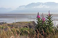
Sometimes, the incoming tide starts with a special wave called a tidal bore. This wave can be as tall as 6 feet and moves quickly at 5 to 6 miles per hour. When the tide is low, the arm turns into a wide, muddy flat area.
Mountains and Glaciers Around Turnagain Arm
The land around Turnagain Arm is very rugged and mountainous. On the north side, South Suicide Peak is the tallest mountain. On the south side, Mount Alpenglow is the highest. These mountains rise sharply on both sides of the arm, reaching heights of 5,000 to 6,000 feet. Their tops are rocky and bare.
Trees usually do not grow higher than 1,500 to 2,000 feet up the mountains. Many valleys here are narrow and steep. However, some larger valleys have a U-shape, which shows that glaciers used to be there. You can still see glaciers in several spots. Important ones include Portage Glacier, Explorer Glacier, and Skookum Glacier.
The Seward Highway runs along the southern edge of the Chugach State Park next to Turnagain Arm.
Fun Activities and Safety Tips
Turnagain Arm has the second highest tides in North America, only after the Bay of Fundy. These fast-moving tides create the special bore wave. Some adventurous people enjoy riding this wave for an extreme sport like kayaking or surfing.
If you like hiking, be careful! The beaches along Turnagain Arm are made of quicksand-like mudflats. It is easy to get stuck in them if you are not careful.
Communities Near Turnagain Arm
Several communities are located along Turnagain Arm within the Municipality of Anchorage. These include Indian, Bird, and Girdwood. All of these are on the north shore of the arm.
Portage is at the eastern end of the arm. It was a settlement that was destroyed during the 1964 Alaska earthquake. The Beluga Point Site is an important archaeological spot on the north shore. The Alaska Wildlife Conservation Center is also located near Portage.
Rivers Flowing into Turnagain Arm
Many rivers and streams flow into Turnagain Arm. The main ones are the Twentymile River, Portage River, and Placer River. Smaller streams include Resurrection Creek, Bear Creek, Sixmile Creek, and Glacier Creek.
Resurrection Creek flows into the south side of the arm. The town of Hope is located near its mouth. Bear Creek is another stream that flows into Turnagain Arm.
Sixmile Creek is much larger. It is formed by two big branches that meet about 10 miles south of Sunrise. One of its branches, Canyon Creek, has been a major source of gold in the past.
Glacier Creek flows into Turnagain Arm from the north. It is one of the larger northern streams.
History of Turnagain Arm
Turnagain Arm was named by William Bligh, who was famous for the HMS Bounty. Bligh was a sailing master on Captain Cook's third voyage in 1778. They were looking for the Northwest Passage.
When they reached the end of Cook Inlet, Bligh thought both Knik Arm and Turnagain Arm were just mouths of rivers, not the Northwest Passage. Cook sent a team up Knik Arm, and they quickly reported it was just a river.
Then, a second team went up Turnagain Arm. They also came back saying it was only a river. Because of this disappointment, the water was given the name "Turn Again." Early maps even called it the "Turnagain River."
The area around Turnagain Arm and Knik Arm is known for its gold. From 1896 to 1898, many gold claims were made on streams flowing into Turnagain Arm. Gold mining happened on some of these claims, especially on lower Crow Creek.
Rocks and Land Formation
The eastern part of the Kenai Peninsula and the area around Turnagain Arm have many similar-looking rocks. These rocks were formed from sediment and are mostly fine-grained gray and bluish-black slates and gray sandstones. There are also some thinner layers of quartz and occasional small conglomerates.
In some places north of Turnagain Arm, these rocks are cut by igneous rocks. These are rocks formed from cooled lava or magma. The whole rock area is tightly folded.
Huge gravel deposits are found in many places, especially in the valleys of Sixmile Creek, Resurrection Creek, and Kenai River. These flat-topped gravel areas are about 1,000 feet above sea level.
You can see signs of past glaciers everywhere. There are U-shaped valleys, smooth rock surfaces, and large boulders moved by ice. The shores of Turnagain Arm also show marks from glaciers and scratched pebbles.
Plants and Animals
The eastern shore along the Kenai Peninsula is mostly low and flat, with heavy forests. The plants found in the mountains around Turnagain Arm are different from those on the coastal plains.
The low-lying area near Hope has grassy tide flats and forests. You can find balsam poplars, paper birches, alders, and willows near the streams. Spruces (like Picea canadensis and Picea sitchensis) and hemlocks (Tsuga mertensiana) grow on the slopes.
In small peat bogs, you might see another type of spruce (Picea mariana) and smaller plants like Ledum, crowberry (Empetrum), and dwarf birch (Betula glandulosa). Hemlocks are common, but spruces grow even larger.
Conifer trees grow up to about 2,000 feet on the mountain slopes. Above this height, they quickly disappear. Higher up, you will find alder bushes, small patches of dwarf willows and birches, and large areas of tall grass.
Even higher, the slopes are covered with heather and heather-like shrubs, mainly Empetrum nigrum. This plant grows up to about 5,000 feet. Above that, very few plants can grow. The whole area is known for its abundant tall grass.
Animals Living in the Area
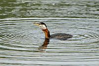
Many animals live around Turnagain Arm. You might spot Dall sheep, hoary marmots, American black bears, American martens, and long-tailed chickadees.
 | Dorothy Vaughan |
 | Charles Henry Turner |
 | Hildrus Poindexter |
 | Henry Cecil McBay |


