Freeport, Texas facts for kids
Quick facts for kids
Freeport, Texas
|
|
|---|---|
| Motto(s):
"Where Fun Happens"
|
|

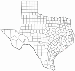
Location in the state of Texas
|
|
 |
|
| Country | United States |
| State | Texas |
| County | Brazoria |
| Incorporated | February 10, 1917 |
| Government | |
| • Type | Council-Manager |
| Area | |
| • Total | 17.70 sq mi (45.84 km2) |
| • Land | 15.40 sq mi (39.88 km2) |
| • Water | 2.30 sq mi (5.96 km2) |
| Elevation | 5 ft (2 m) |
| Population
(2020)
|
|
| • Total | 10,696 |
| • Density | 788.15/sq mi (304.31/km2) |
| Time zone | UTC-6 (CST) |
| • Summer (DST) | UTC-5 (CDT) |
| ZIP codes |
77541-77542
|
| Area code(s) | 979 |
| FIPS code | 48-27420 |
| GNIS feature ID | 1357720 |
Freeport is a city in Brazoria County, Texas, United States. It is located right on the Gulf of Mexico. In 2020, about 10,696 people lived there.
Contents
A Look at Freeport's History
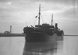
Freeport was started in November 1912 by a company called the Freeport Sulphur Company. At first, only about 300 people lived there. But the city grew quickly! By 1929, the population was 3,500, and by 1939, it reached 4,100. This growth helped Freeport's economy get stronger.
In 1937, the Freeport School District was created. It had different schools for different groups of students and 27 teachers.
Freeport's biggest growth spurt happened in 1939. This was when the Dow Chemical Company built its facilities in the city. Today, Dow Chemical is the largest employer in Freeport. It has the company's biggest manufacturing site in the world right here!
In July 1957, Freeport joined with a nearby town called Velasco. Velasco used to be a temporary capital of the Republic of Texas a long time ago. After they joined, Freeport's population grew to 11,619 people. Later, in 2003, the city added Bryan Beach to its area.
Where is Freeport Located?
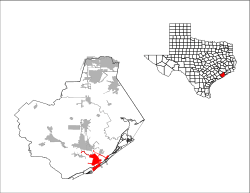
Freeport is in the southern part of Brazoria County. It's very close to where the Brazos River meets the Gulf of Mexico.
In 2003, the city added about 3.5 miles of beach. This beach is called Bryan Beach. It's near other popular beaches like Surfside and Quintana beaches.
You can get to Freeport by driving on Texas State Highway 288. This highway goes north to Angleton, which is the county seat, and then on to downtown Houston. Texas State Highway 36 goes northwest to Brazoria.
Freeport covers a total area of about 17.7 square miles (45.8 square kilometers). Most of this is land, and a smaller part is water.
Freeport's Climate
The weather in Freeport is usually hot and humid in the summer. Winters are generally mild or cool. Freeport has what is called a humid subtropical climate. This means it gets a lot of rain throughout the year, and the temperatures are warm for most of the year.
| Climate data for Freeport, Texas (1991–2020 normals, extremes 1959–present) | |||||||||||||
|---|---|---|---|---|---|---|---|---|---|---|---|---|---|
| Month | Jan | Feb | Mar | Apr | May | Jun | Jul | Aug | Sep | Oct | Nov | Dec | Year |
| Record high °F (°C) | 83 (28) |
83 (28) |
88 (31) |
95 (35) |
98 (37) |
103 (39) |
100 (38) |
104 (40) |
105 (41) |
96 (36) |
90 (32) |
84 (29) |
105 (41) |
| Mean maximum °F (°C) | 76.9 (24.9) |
78.5 (25.8) |
81.3 (27.4) |
85.6 (29.8) |
90.0 (32.2) |
93.5 (34.2) |
95.0 (35.0) |
96.6 (35.9) |
94.4 (34.7) |
89.7 (32.1) |
84.1 (28.9) |
79.2 (26.2) |
97.3 (36.3) |
| Mean daily maximum °F (°C) | 64.1 (17.8) |
67.2 (19.6) |
72.7 (22.6) |
78.1 (25.6) |
84.2 (29.0) |
89.7 (32.1) |
91.5 (33.1) |
92.0 (33.3) |
89.0 (31.7) |
82.5 (28.1) |
73.6 (23.1) |
66.9 (19.4) |
79.3 (26.3) |
| Daily mean °F (°C) | 55.2 (12.9) |
58.7 (14.8) |
64.5 (18.1) |
70.5 (21.4) |
77.4 (25.2) |
83.1 (28.4) |
84.9 (29.4) |
85.1 (29.5) |
81.2 (27.3) |
73.9 (23.3) |
64.3 (17.9) |
57.8 (14.3) |
71.4 (21.9) |
| Mean daily minimum °F (°C) | 46.2 (7.9) |
50.1 (10.1) |
56.3 (13.5) |
62.8 (17.1) |
70.6 (21.4) |
76.4 (24.7) |
78.3 (25.7) |
78.1 (25.6) |
73.4 (23.0) |
65.3 (18.5) |
55.0 (12.8) |
48.7 (9.3) |
63.4 (17.4) |
| Mean minimum °F (°C) | 31.7 (−0.2) |
36.2 (2.3) |
39.7 (4.3) |
48.0 (8.9) |
59.4 (15.2) |
68.4 (20.2) |
72.4 (22.4) |
72.0 (22.2) |
63.4 (17.4) |
49.1 (9.5) |
39.0 (3.9) |
34.1 (1.2) |
29.3 (−1.5) |
| Record low °F (°C) | 15 (−9) |
15 (−9) |
25 (−4) |
36 (2) |
41 (5) |
57 (14) |
64 (18) |
65 (18) |
45 (7) |
34 (1) |
26 (−3) |
13 (−11) |
13 (−11) |
| Average precipitation inches (mm) | 4.02 (102) |
2.44 (62) |
2.91 (74) |
2.87 (73) |
3.87 (98) |
4.74 (120) |
4.18 (106) |
4.98 (126) |
7.06 (179) |
4.37 (111) |
4.69 (119) |
3.80 (97) |
49.93 (1,268) |
| Average snowfall inches (cm) | 0.0 (0.0) |
0.0 (0.0) |
0.0 (0.0) |
0.0 (0.0) |
0.0 (0.0) |
0.0 (0.0) |
0.0 (0.0) |
0.0 (0.0) |
0.0 (0.0) |
0.0 (0.0) |
0.0 (0.0) |
0.0 (0.0) |
0.0 (0.0) |
| Average precipitation days (≥ 0.01 in) | 9.7 | 8.2 | 6.9 | 6.1 | 6.1 | 7.8 | 8.2 | 7.9 | 9.6 | 6.6 | 7.4 | 9.6 | 94.1 |
| Average snowy days (≥ 0.1 in) | 0.0 | 0.0 | 0.0 | 0.0 | 0.0 | 0.0 | 0.0 | 0.0 | 0.0 | 0.0 | 0.0 | 0.0 | 0.0 |
| Source: NOAA | |||||||||||||
People of Freeport: Demographics
|
||||||||||||||||||||||||||||||||||||||||||||||||||||||||
| Race | Number | Percentage |
|---|---|---|
| White (NH) | 2,423 | 22.65% |
| Black or African American (NH) | 1,125 | 10.52% |
| Native American or Alaska Native (NH) | 32 | 0.3% |
| Asian (NH) | 53 | 0.5% |
| Some Other Race (NH) | 26 | 0.24% |
| Mixed/Multi-Racial (NH) | 239 | 2.23% |
| Hispanic or Latino | 6,798 | 63.56% |
| Total | 10,696 |
In 2020, the city of Freeport had 10,696 people living in it. There were 4,224 households and 2,993 families.
In 2016, there were 12,153 people living in Freeport. On average, about 3.17 people lived in each household. Many different groups of people make up the city's population. About 52% of the people were Hispanic or Latino. Also, almost half of the households spoke a language other than English.
The average age for females in Freeport is 29 years old, and for males, it's 28 years old. About 34.1% of the people living in Freeport are 18 years old or younger.
Freeport's Economy
Port Freeport is a very important seaport located on the Gulf of Mexico. It is ranked 26th in the world for the amount of international goods it handles. The chemical plants in the area, especially the Dow Chemical Company's large facility, help keep the economy strong. Dow Chemical's Texas Operations site in Freeport is the company's biggest location.
News and Media
The local newspaper for Freeport and the surrounding area is called Brazosport Facts. It used to be based in Freeport but moved to Clute in 1976.
For bigger news from the whole metropolitan area, people in Freeport read the Houston Chronicle.
Learning in Freeport: Education
Public Schools
Students in Freeport attend schools that are part of the Brazosport Independent School District. These schools include:
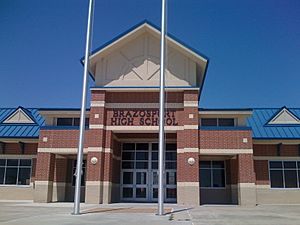
- Brazosport High School (for grades 9–12)
- Freeport Intermediate School (for grades 7–8)
- Lanier Middle School (for grades 5–6)
- Freeport Elementary (for grades Pre-K–4)
A new Freeport Elementary facility opened in 2018. It cost $19.2 million to build and can hold up to 750 students.
College Education
Freeport is in the area served by Brazosport College. This means that students from the Brazosport Independent School District can attend Brazosport College.
Libraries
The Freeport Library is a part of the Brazoria County Library System. It's a great place to find books, learn, and use computers.
See also
 In Spanish: Freeport (Texas) para niños
 | James B. Knighten |
 | Azellia White |
 | Willa Brown |


