
Surfside Beach, Texas facts for kids
Quick facts for kids
Surfside Beach, Texas
|
|
|---|---|

The entrance sign to Surfside Beach
|
|
| Motto(s):
"Island Life, Texas Style"
|
|

Location of Surfside Beach, Texas
|
|
| Country | United States |
| State | Texas |
| County | Brazoria |
| Area | |
| • Total | 1.87 sq mi (4.83 km2) |
| • Land | 1.59 sq mi (4.12 km2) |
| • Water | 0.28 sq mi (0.72 km2) |
| Elevation | 7 ft (2 m) |
| Population
(2020)
|
|
| • Total | 640 |
| • Density | 364.38/sq mi (140.70/km2) |
| Time zone | UTC-6 (Central (CST)) |
| • Summer (DST) | UTC-5 (CDT) |
| ZIP code |
77541
|
| Area code(s) | 979 |
| FIPS code | 48-71384 |
| GNIS feature ID | 1369430 |
Surfside Beach, also known as Surfside, is a small city in Brazoria County, Texas, United States. It is located on Follet's Island right by the Gulf of Mexico, close to the city of Freeport. In 2020, about 640 people lived there.
Surfside Beach is special because it's known as the "Cradle of Texas Liberty." This is because the Treaty of Velasco, which ended the fighting between Texas and Mexico, was signed nearby at Fort Velasco. This historic spot was located near where the city's current City Hall stands. A well-known former politician, Ron Paul, used to have a home near Surfside Beach.
Contents
Exploring Surfside Beach's Location

Surfside Beach is found in the southern part of Brazoria County. It sits on the very southwestern tip of Follet's Island. The city is bordered by the Gulf of Mexico to the southeast. To the southwest, you'll find the entrance to Freeport Harbor, with the village of Quintana just across the water.
The Intracoastal Waterway flows through the northwestern part of Surfside Beach. The Bluewater Highway runs all the way through Surfside Beach. It continues northeast on Follet's Island for about 13 miles (21 km) to San Luis Pass, where a bridge connects to Galveston Island. Texas State Highway 332 starts in Surfside Beach and goes northwest past Freeport for about 12 miles (19 km) to Lake Jackson.
The United States Census Bureau says that Surfside Beach covers a total area of about 2.2 square miles (5.8 km²). Of this, 1.7 square miles (4.3 km²) is land, and 0.6 square miles (1.5 km²), or about 25%, is water.
People of Surfside Beach
|
||||||||||||||||||||||||||||||||
Population Changes Over Time
The number of people living in Surfside Beach has changed over the years.
- In 1980, there were 577 people.
- By 2000, the population grew to 763.
- In 2010, it dropped to 482.
- The most recent count in 2020 showed 640 people living in the city.
Who Lives in Surfside Beach?
As of the 2020 United States census, there were 640 people living in Surfside Beach. These people made up 327 households and 156 families.
The city's population is mostly White (81.1%). Other groups include:
- Black or African American: 1.7%
- Native American: 0.5%
- Asian: 1.4%
- People of two or more races: 5.3%
- Hispanic or Latino people make up 8.9% of the population.
In 2010, the average household had about 1.86 people, and the average family had 2.50 people. The median age of people in the city was 50.9 years old. This means half the people were younger than 50.9, and half were older.
Education in Surfside Beach
Surfside Beach is part of the Brazosport Independent School District (BISD). This district provides schooling for students from pre-kindergarten all the way through high school.
Local Schools
Students in Surfside Beach attend these schools:
- Freeport Elementary School (Pre-Kindergarten to grade 1)
- Velasco Elementary School (grades 2–4)
- Lanier Middle School (grades 5–6)
- Freeport Intermediate School (grades 7–8)
- Brazosport High School (grades 9–12)
Higher Education and Libraries
The city is also served by Brazosport College, which offers higher education opportunities. For reading and research, residents can use the Brazoria County Library System.
Images for kids
-
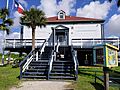
City hall
-
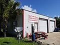
EMS & Rescue
-
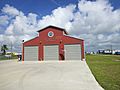
Fire station


See also
 In Spanish: Surfside Beach (Texas) para niños
