Tyonek, Alaska facts for kids
Quick facts for kids
Tyonek, Alaska
Qaggeyshlat
|
|
|---|---|

Location of Tyonek, Alaska
|
|
| Country | United States |
| State | Alaska |
| Borough | Kenai Peninsula |
| Area | |
| • Total | 69.03 sq mi (178.80 km2) |
| • Land | 67.93 sq mi (175.94 km2) |
| • Water | 1.10 sq mi (2.86 km2) |
| Population
(2020)
|
|
| • Total | 152 |
| • Density | 2.24/sq mi (0.86/km2) |
| Time zone | UTC-9 (Alaska (AKST)) |
| • Summer (DST) | UTC-8 (AKDT) |
| ZIP code |
99682
|
| Area code(s) | 907 |
| FIPS code | 02-79890 |
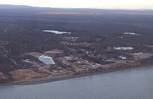
Tyonek, also known as New Tyonek, is a small community in Alaska, a state in the United States. Its name in the Dena'ina language is Qaggeyshlat, which means "little place between toes." Tyonek is a special type of community called a census-designated place (CDP). This means it is an area with people living in it that the government counts for the census.
Tyonek is located in the Kenai Peninsula Borough. In 2020, about 152 people lived there. In 1973, the community created the Tyonek Native Corporation (TNC). This was done under a law called the Alaska Native Claims Settlement Act. The corporation helps manage land and resources for the Native people of Tyonek.
Contents
Tyonek's Past: A Brief History
The Dena'ina people, who are Alaska Natives, have lived in the Tyonek area for a long time. The explorer James Cook first wrote about a Dena'ina village here in 1778. Later, a Russian company called Lebedev-Lastochkin set up a small station. They traded for furs in the area.
In 1794, a group from the Vancouver Expedition visited this trading post. They found 19 Russians living in a large house. In the late 1830s, a serious sickness spread through the village. This sickness, called smallpox, caused about half the people to die.
Tyonek became a busy port in the 1880s. This was during the Resurrection Creek gold rush, when many people came looking for gold. But after the city of Anchorage was built in 1915, Tyonek became less important. Anchorage was on the other side of Cook Inlet. The original village of Tyonek was on low ground. In the 1930s, it flooded. So, the people moved the village to its current, higher location.
Where is Tyonek? Geography and Location
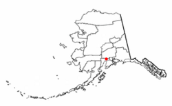
Tyonek is located at 61°3′38″N 151°13′51″W / 61.06056°N 151.23083°W. Even though it is part of the Kenai Peninsula Borough, it is actually on the mainland. It sits on the northwest side of Cook Inlet. This is across the water from the main Kenai Peninsula. The community of Beluga is to its northeast.
The United States Census Bureau says that the Tyonek CDP covers about 178.6 square kilometers (69.0 square miles). Most of this area, about 175.8 square kilometers (67.9 square miles), is land. The rest, about 2.9 square kilometers (1.1 square miles), is water. The CDP stretches from Trading Bay in the west. It goes all the way to the mouth of the Chuitna River in the northeast. The current village of Tyonek has an airstrip. It is in the northeast part of the CDP, between the Chuitna River and Tyonek Creek.
Tyonek's People: Population and Community
| Historical population | |||
|---|---|---|---|
| Census | Pop. | %± | |
| 1880 | 117 | — | |
| 1890 | 115 | −1.7% | |
| 1900 | 107 | −7.0% | |
| 1920 | 58 | — | |
| 1930 | 78 | 34.5% | |
| 1940 | 136 | 74.4% | |
| 1950 | 132 | −2.9% | |
| 1960 | 187 | 41.7% | |
| 1970 | 232 | 24.1% | |
| 1980 | 239 | 3.0% | |
| 1990 | 154 | −35.6% | |
| 2000 | 193 | 25.3% | |
| 2010 | 171 | −11.4% | |
| 2020 | 152 | −11.1% | |
| U.S. Decennial Census | |||
Tyonek first appeared in the U.S. Census in 1880. It was listed as "Toyonok Station and Village." At that time, 117 people lived there. Most were Tinneh (a Native group), along with some Creole (mixed Russian and Native) and White people. This first settlement was at Beshta Bay.
In 1890, it was called "Toyonok" and had 115 Native residents. By 1900, it was called Tyonek. It was not counted in the 1910 census. In the early 1930s, people started moving about 7 miles northeast. They moved to a new site because of flooding. This new place became known as "New Tyonek." The old site was called "Old Tyonek" or Tubughnen, meaning "beach land."
Since the 1940 census, the numbers have been for "New Tyonek." The "Present / New Tyonek" or Qaggeyshlat became a census-designated place (CDP) in 1980. Today, the CDP boundaries include both the old and new village sites.
In 2000, there were 193 people living in Tyonek. Most of the people, about 95%, were Native American. About 5% were White. A small number, about 2.5%, were Hispanic or Latino. There were 66 households in the community. Many households, about 42%, had children under 18 living with them.
The average age of people in Tyonek was 28 years old. About 37% of the population was under 18. About 5% were 65 years or older. The median income for a household was $26,667. This means half the households earned more, and half earned less. About 14% of the population lived below the poverty line.
See also
 In Spanish: Tyonek (Alaska) para niños
 | John T. Biggers |
 | Thomas Blackshear |
 | Mark Bradford |
 | Beverly Buchanan |


