Vancouver Expedition facts for kids
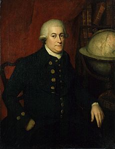
The Vancouver Expedition (1791–1795) was a four-and-a-half-year journey of discovery. Captain George Vancouver of the Royal Navy led this British expedition. His ships sailed all around the world and visited five continents. The expedition used between two and four ships and had up to 153 men. Almost everyone returned home safely.
Contents
Why the Expedition Started
Many voyages before this one, like those by Ferdinand Magellan and James Cook, showed how important the Pacific Ocean was. Countries wanted to explore and claim parts of it. The Pacific had valuable resources like whales and furs. It was also a good trade route to Asia.
Britain especially wanted to learn more about whale fishing in the Southern Pacific. They also wanted to find places like Australia, New Zealand, and the famous Isla Grande. A big goal was to find the Northwest Passage, a sea route through North America.
A new ship was bought and named HMS Discovery. This name honored one of Captain Cook's ships. Captain Henry Roberts was supposed to lead, with Vancouver as his first officer.
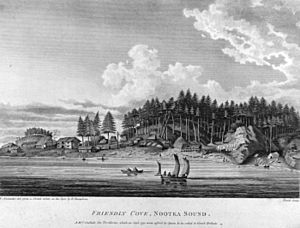
Plans changed because of a problem with Spain. An adventurer named John Meares said Spain had taken his ship and goods at Nootka Sound. Britain and Spain almost went to war over this, in what was called the Nootka Crisis.
Vancouver then became the leader of the Discovery expedition. He understood his main job was to get back land and property from the Spanish at Nootka Sound. He also needed to set up a British presence there to help the fur trade. Britain had thought about starting a colony on the Northwest Coast. This idea was encouraged by the success of colonies like Botany Bay in Australia.
Vancouver was told to survey the coast from 30 degrees north latitude up towards Cook's River. He also needed to gather information about the land and its people. These explorations aimed to find a water route into North America. This could be the Northwest Passage or navigable rivers. The expedition also had a botanist, Archibald Menzies, who studied plants.
A change in British policy towards Spain happened after Vancouver left England. This was due to problems from the French Revolution. Vancouver did not know about this change. This made his talks with the Spanish commander at Nootka difficult. Vancouver and the Spanish commander, Bodega y Quadra, were friendly. But they could not agree on the land boundaries. They decided to let their governments sort it out.
To be safe, the British Navy ordered that ships should not travel alone on such long voyages. So, the small armed ship HMS Chatham joined the expedition. Another ship, the Daedalus, was supposed to meet them later with supplies. The expedition was planned to last two or three years.
The Crew
The expedition had 153 men. Most were naval officers or sailors. Many of them became important in the navy later. These included Peter Puget, Joseph Baker, Joseph Whidbey, William Broughton, and Robert Barrie. There was also a group of Marines.
Among the extra people was Menzies, the botanist. He kept a detailed journal of the trip. His servant, John Ewin, was also there. A Hawaiian man named Towereroo, who had been brought to England, was on Discovery to return home.
1791: The Journey Begins
On April 1, 1791, Discovery and Chatham set sail. They reached Santa Cruz in Tenerife on April 28. This was a stop for rest and to study plants.
On May 7, the ships left Tenerife. Chatham arrived at Cape Town on June 6, and Discovery two days later. After more plant study and getting new crew members, they left on August 17. The ship's doctor became sick, so Menzies took over his duties for the rest of the trip.
On September 29, they landed in Australia. Vancouver named the place King George the Third's Sound. They quickly surveyed the south coast of Australia. Then they landed at Dusky Sound, New Zealand, on November 2 for supplies and plant collecting. They left on November 21.
The ships sailed separately and both found the sub-Antarctic Snares Islands on November 23. Vancouver thought these islands were dangerous for ships, so he named them "Snares." On the way to Tahiti, the crew of Chatham also found the Chatham Islands. Chatham reached Tahiti on November 26, and Discovery arrived three days later.
In Tahiti, Vancouver kept strict rules. He wanted to avoid problems like the mutiny on the Bounty that had happened on another ship.
1792: Exploring North America
The ships spent the winter in Hawaiʻi, arriving in March 1792. Vancouver had been a young sailor on Captain Cook's last voyage, where Cook was killed. So, Vancouver avoided landing at Kealakekua Bay. He was worried about the frequent requests for guns. He tried not to get involved in the local civil war. He spent the winter in Oʻahu. He arranged for his ships to stay and get supplies in Hawaiʻi for the rest of the expedition.
Discovery and Chatham then sailed to North America. On April 16, they landed around 39°N latitude and began a detailed survey northwards. On April 28, they met American Captain Gray. They shared useful information. Captain Gray told them that much of what Meares had said about his explorations was not true.
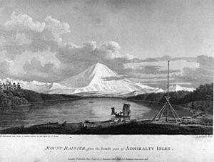
In June 1792, Discovery and Lieutenant Broughton's Chatham anchored in a bay they named Birch Bay. On June 4, the King's Birthday, Vancouver formally claimed the coast and land around the Strait of Juan de Fuca. This included Puget Sound, and he named it New Georgia. This was done at Admiralty Inlet, near Possession Point. He expected to receive this land from the Spanish at Nootka Sound.
Vancouver decided to use the ships' small boats for detailed exploration. This was because the waterways were complex and sometimes shallow. On June 12, Vancouver and his crew sailed north from Birch Bay in two small boats. In four days, they found and mapped many places. These included Point Roberts, Point Grey, Burrard Inlet, Howe Sound, and the Jervis Inlet. On June 13, near Point Roberts, Chatham met the Spanish ships Sutil and Mexicana.
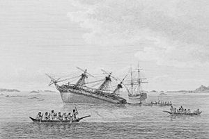
On June 21, 1792, with bad weather and low food, Vancouver decided to return to Discovery. On their way back, they met the Spanish ships led by Captain Galiano and Valdés. They met near present-day Vancouver, British Columbia. Both groups were mapping the Strait of Georgia. They were looking for a Northwest Passage and trying to see if Vancouver Island was an island or part of the mainland.
The two commanders became friends. They agreed to help each other by splitting the survey work and sharing maps. They worked together until July 13. After that, each group continued exploring Vancouver Island separately. Galiano's ships reached Nootka Sound on August 31, finishing their trip around the island. Vancouver's ships had arrived earlier. So, Vancouver was the first European to prove that Vancouver Island was an island. Galiano was the first to sail all the way around it.
In August, while Vancouver was exploring north in small boats, Daedalus arrived at Nootka Sound. It brought bad news: her Captain, Richard Hergest, and the expedition's astronomer, William Gooch, had been killed in Oahu. Vancouver and Whidbey shared the astronomer duties. On August 11, the expedition sailed south. They reached Nootka Sound on August 28. They exchanged friendly salutes with a Spanish ship led by Juan Francisco de la Bodega y Quadra.
Bodega y Quadra and Vancouver were very friendly. But they could not agree on how to follow their different instructions about the Nootka Convention. They agreed to meet again in Monterey, California. On September 21, Bodega y Quadra left Nootka Sound. Vancouver sent Lieutenant Mudge back to England on a Portuguese merchant ship to get more instructions.
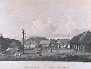
The captain of a trading ship asked Vancouver to take two Hawaiians back home. The expedition then moved south. Whidbey on Daedalus surveyed Grays Harbor. The other two ships sailed into the Columbia River. The smaller Chatham crossed the river bar and sent small boats upstream. Discovery sailed to northern Spanish California. Its crew was starting to get sick. They reached the Golden Gate and Royal Presidio of San Francisco on November 14. The Spanish welcomed them warmly. The other ships arrived by November 26. Vancouver sailed south along the coast of California, visiting villages.
After resting and getting new supplies, the expedition returned to Hawaiʻi for the winter.
1793: More Exploration
During their winter in Hawaii, Discovery sailed around the north side of the Island of Hawaiʻi. Chatham sailed around the south side. They met at Kealakekua Bay. Vancouver left some cattle, sheep, and plants that Menzies had collected in California. He met John Young, a former British sailor who was now an advisor to King Kamehameha. Young helped Vancouver talk with King Kamehameha. Vancouver surveyed the islands while Menzies collected plant samples. Vancouver gave Kamehameha a Red Ensign flag. This flag was the unofficial flag of the Kingdom of Hawaii until 1816.
Over the winter, Vancouver made many improvements to the small boats. This was to give the crew better shelter and supplies for their detailed survey work. These changes helped the crews continue mapping one of the world's most complex coastlines. They explored as far north as 56°30'N on the west coast of North America. They continued until the weather stopped their survey season in 1793.
They reached Fitz Hugh Sound on May 26. Vancouver and two boats explored several inlets and channels. Johnstone explored other channels. They proved that King Island was an island. Johnstone also explored many other inlets and channels.
They left their anchorage on June 19. They sailed up Finlayson and Princess Royal Channels. Johnstone and Barrie explored the northern parts of Princess Royal Channel. They also sailed around Gil Island. Whidbey explored what was named "Hawkesbury's Island." This was actually four islands. He also explored Gardner Canal and other channels.
The ships anchored off the north coast of Gil Island. Whidbey and Barrie returned on July 15. They had explored Gilttoyees Inlet and Grenville Channel. The ships then sailed up Principe Channel. On July 21, a storm hit them. A whaleboat from the ship Butterworth helped them. From this ship, they learned about a "large opening" to the north, Clarence Strait.
The ships reached Salmon Cove on July 24. Johnstone and Barrie were sent out. Vancouver left the next day. Vancouver explored to the ends of Portland Canal and other inlets. He sailed around Revillagigedo Island. During this, he was attacked by Tlingit people. Two of his men were hurt. Johnstone and Barrie explored channels to the southeast.
They left Salmon Cove on August 18. They arrived in Port Stewart a few days later. From here, Johnstone went north. He sailed around what was named "Duke of York's Island." This was actually three islands. He also saw Mitkof Island and explored Duncan Canal. On September 6, they sailed to Port Protection. This was on the northwest coast of Prince of Wales Island. The boats were sent out again. Johnstone mapped the south coast of Kupreanof Island. Whidbey explored the southeast part of Kuiu Island. He reached the end of Affleck Canal. Whidbey returned on September 21. The ships left Port Protection the next day.
Again, the expedition visited Nootka Sound. There was still no agreement on the conflicting orders. They also visited Spanish California and Hawaiʻi.
1794: Final Surveys
During the expedition's last winter in Hawaiʻi, Baker, Menzies, and others climbed Mauna Loa. They reached the top on February 16. They measured its height very accurately using a barometer.
Vancouver continued talking with Kamehameha. On February 25, the King formally declared that his people were "Tanata no Britanee" (People of Britain). Vancouver helped the King by lending tools and skilled workers. They built an armed 36-foot boat called the Britannia. This boat may have helped Kamehameha win the Battle of Nu'uanu. This victory allowed him to unite the islands.
The expedition left Hawaiʻi for the last time on March 15, 1794. In late April and early May, they mapped the farthest parts of what Vancouver renamed Cook Inlet. Vancouver himself reached the end of Knik Arm. Whidbey reached the end of Turnagain Arm. The end of May and June were spent mapping Prince William Sound. Whidbey mapped the western half. Johnstone mapped from there east and south.
From here, the expedition moved eastward. The weather was often freezing. Their live turtles, kept for meat, froze. Menzies' greenhouse on deck also froze, killing all his plants. While at Cook Inlet and Prince William Sound, they traded with Russian settlements and local people.
By July 9, they anchored in Port Althorp, a cove on Chichagof Island. Whidbey was sent to survey the area. He returned on July 27. Despite constant rain and some unfriendly meetings with Tlingit groups, he explored up Lynn Canal. He reached the ends of both Chilkat and Chilkoot Inlets. He also followed the west coast of what was later named Admiralty Island.
They left Port Althorp a few days later. They sailed south along the west coasts of Chichagof and Baranof Islands. On August 2, they reached a cove on Baranof Island. Vancouver later named it Port Conclusion. Two boat parties, led by Whidbey and Johnstone, were sent out the next morning. Both returned on August 20 in heavy rain. Whidbey went up Stephens Passage. He completed the survey of the east coast of Admiralty Island. Johnstone mapped the west, north, and east coasts of Kuiu Island, proving it was an island. The two met off the northeast coast of Kupreanof Island.
According to the officers' diaries, they felt great joy when their survey was done. They knew they could finally go home. A few days after their return, they left Port Conclusion. Sadly, as they sailed for Nootka, Isaac Wooden was lost in a boating accident. He was one of the few to die on the expedition. The dangerous rocks off the Cape were named Wooden Rocks.
Vancouver was promoted on August 28, 1794. Four days later, Discovery and Chatham arrived at Nootka. Everyone was sad to learn that Quadra had died suddenly. The new Governor of Nootka, Brigadier General José Manuel de Álava, was helpful and friendly. But no new instructions had arrived to solve the land dispute. Álava and Vancouver were friendly. They explored together and had a big celebration with Maquinna. On October 6, the ships left for Monterey. Daedalus was sent back to England with Mr. Pitt, who had caused many problems.
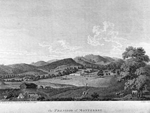
On November 6, Discovery arrived in Monterey, California. They learned that negotiations in Europe were probably finished, but there were still no instructions. The expedition left on December 2. They reached the Tres Maria Islands on December 17 for supplies and plant collecting. They spent Christmas at sea.
1795: The Return Home
On their way home, the expedition stopped at Cocos Island, the Galapagos Islands, and the Juan Fernández Islands. They got supplies whenever possible. But the crew started to suffer from scurvy, a disease caused by lack of Vitamin C.
They had orders to avoid Spanish areas in the Pacific. But they needed repairs and also had to survey as much coast as possible. So, Vancouver stopped at Valparaiso in Chile on March 25. They stayed for five weeks for repairs with Spanish help. The officers visited the Governor of Chile, Don Ambrosio O'Higgins de Vallenar, in Santiago.
On May 5, Discovery and Chatham sailed from Valparaiso. They planned to meet at St. Helena if they got separated. The start of winter in the Southern Hemisphere and the ships' worn condition made further survey of the Chilean coast difficult. Sailing around Cape Horn was also dangerous. Still, Vancouver spent time looking for the island of Isla Grande, which had been reported earlier. He confirmed it did not exist.
Around this time, Lieutenant Broughton and Lieutenant Mudge left England to help Vancouver. They reached Monterey long after the expedition had left. They correctly guessed that Vancouver would have finished his survey. So, they decided to map the coast of East Asia instead.
On July 2, Discovery and Chatham stopped at St. Helena. They learned that Britain was at war. Their damaged ships were very weak compared to other ships in the Atlantic. However, they captured a Dutch merchant ship by surprise. This meant Vancouver needed more crew members to sail the captured ship. During a storm, he ordered Menzies' servant to help the crew. This left Menzies' plants to be damaged, which made Menzies even angrier.
Off the Cape Verde Islands, Discovery caught up with a British group of ships. This group was protected by HMS Sceptre. In relative safety, they arrived at Shannon. Vancouver left the ship to report. Baker brought Discovery safely home to Long Reach on the Thames. The four-and-a-half-year mission ended on October 20, 1795.
What Happened Next
The expedition returned to a Britain that was more interested in its ongoing war than in Pacific explorations. Vancouver was criticized by Menzies and others. Pitt even challenged Vancouver to a duel and tried to attack him. Vancouver was not strong enough to fight his political opponents. He was also dying. His huge map-making work was almost finished when he died on May 10, 1798. Puget finished it for him.
The expedition reduced Spanish power in the Pacific Northwest. It also helped set the boundaries for the Oregon boundary dispute almost a century later. It helped unite the Kingdom of Hawai'i, which lasted until it was overthrown in 1893. The expedition left the world hundreds, maybe thousands, of place-names and plant species names.
Vancouver's Book
George Vancouver wrote a book about his journey called A Voyage of Discovery to the North Pacific Ocean, and Round the World. You can find a 1798 edition of the book online.
A newer edition (1984) by W. Kaye Lamb was called The Voyage of George Vancouver 1791–1795. It was published by the Hakluyt Society in London, England.
|
See also
 In Spanish: Expedición Vancouver para niños
 | Selma Burke |
 | Pauline Powell Burns |
 | Frederick J. Brown |
 | Robert Blackburn |


