Portland Canal facts for kids
Quick facts for kids Portland Canal |
|
|---|---|
| French: Canal Portland | |

|
|
| Location | Alaska and British Columbia |
| Coordinates | 55°27′00″N 130°02′00″W / 55.45000°N 130.03333°W |
| Type | Fjord |
| Native name | Kʼalii Xkʼalaan Error {{native name checker}}: parameter value is malformed (help) |
| Part of | Portland Inlet |
| Basin countries | Canada and United States |
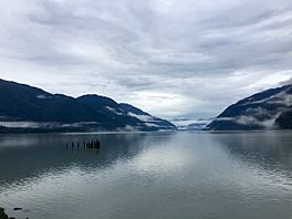
The Portland Canal is a long, narrow arm of the sea. It is part of the Portland Inlet, which is a major fjord on the British Columbia Coast. This waterway is about 114 kilometers (71 miles) long. It forms an important part of the border between southeastern Alaska in the United States and British Columbia in Canada.
In the Nisga'a language, the entire inlet is called Kʼalii Xkʼalaan. The word xkʼalaan means "at the back of (someplace)". Long ago, the Tsetsaut people lived at the upper end of this inlet. After facing wars and diseases, they were protected by the Laxsgiik (Eagle) chief of the Nisga'a people. This chief still holds the title to the inlet under native law.
What is a Fjord?
Even though it's called a "canal," the Portland Canal is actually a fjord. A fjord is a long, narrow, deep inlet of the sea. It is formed when a glacier carves out a valley, and then the sea fills it. This means the Portland Canal is a completely natural feature, not something built by people.
The Portland Canal stretches about 114.6 kilometers (71.2 miles) north. It starts from the Portland Inlet near Pearse Island, British Columbia. It reaches all the way to the towns of Stewart, British Columbia and Hyder, Alaska. Another inlet called Observatory Inlet joins the Portland Canal at Ramsden Point. Both of these then meet the larger Portland Inlet. The Pearse Canal also connects to the Portland Canal at the northern end of Pearse Island.
How Portland Canal Got Its Name
The Portland Canal was named in 1793 by George Vancouver. He was a British explorer who mapped the coast. He named it to honor William Cavendish-Bentinck, 3rd Duke of Portland.
You might wonder why it's called a "canal" when it's a natural fjord. This is because Spanish explorers in the 1700s used the word canal for many inlets. For example, Haro Strait, which is between Victoria and the San Juan Islands, was first called Canal de Haro. The English word for the Spanish canal is "channel." You can find many places along the coast named "channel," like Dean Channel. George Vancouver used both "canal" and "channel" when naming these waterways.
The Border Between Countries
The exact location of the international border in the Portland Canal was a big topic. It was part of the Alaska boundary dispute. This dispute became very important during the Klondike Gold Rush in the late 1800s. Many people rushed to Alaska to find gold. The dispute was finally settled in 1903 through a process called arbitration. This is when a neutral third party helps solve a disagreement.
The Hay-Herbert Treaty defined the Portland Canal, along with Pearse Canal and Tongass Passage, as part of the "Portland Channel (Canal)." This term was used in an earlier agreement, the Anglo-Russian Treaty of 1825. However, it wasn't clearly defined until the 1903 settlement.
 | Leon Lynch |
 | Milton P. Webster |
 | Ferdinand Smith |


