Snares Islands / Tini Heke facts for kids
|
Tini Heke (Māori)
|
|
|---|---|

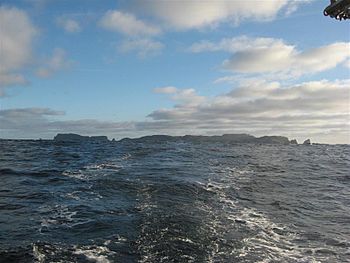
The Snares Islands seen from the northeast, with Broughton Island on the left and Dapton Rocks on the right
|
|

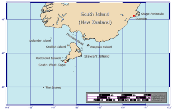
The position of The Snares relative to New Zealand
|
|
| Geography | |
| Coordinates | 48°01′S 166°32′E / 48.017°S 166.533°E |
| Area | 3.5 km2 (1.4 sq mi) |
| Highest elevation | 130 m (430 ft) |
| Administration | |
| Demographics | |
| Population | Uninhabited (2013) |

The Snares Islands/Tini Heke, also known as The Snares, are a small group of islands. They are located about 200 kilometers (124 miles) south of New Zealand's South Island. These islands are uninhabited, meaning no people live there permanently.
The Snares group includes a main island called North East Island. There is also a smaller island named Broughton Island. Further to the west, you'll find the Western Chain Islands. All together, the Snares Islands cover a total land area of about 3.5 square kilometers (1.4 square miles).
These islands are considered part of New Zealand. They are not part of any specific region or district within New Zealand. Instead, they are an "Area Outside Territorial Authority." This is similar to other remote islands belonging to New Zealand.
Contents
History of the Snares Islands
European explorers first saw the Snares Islands on November 23, 1791. Two ships, HMS Discovery and HMS Chatham, discovered them independently. Captain George Vancouver of the Discovery named them "The Snares." He thought they were dangerous for ships. One small island is named Vancouver Rock, and the second largest island is named after Lieutenant William Robert Broughton of the Chatham.
The Māori already knew about these islands. They called one of the larger islands Te Taniwha, which means "The sea-monster." Unlike many other islands in the southern oceans, the Snares were not heavily affected by whaling and seal hunting in the 1800s. This means they are still very natural and untouched.
In 1998, the official name of the islands was changed to "Snares Islands/Tini Heke." This change was part of an agreement with the Ngāi Tahu Māori tribe.
Exploring the Snares Islands
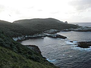
The Snares Islands have interesting shapes and features. They are mostly made up of cliffs and rocky areas.
North East Island
North East Island is the largest island in the group. It is shaped a bit like a triangle. The island has high cliffs and reefs along some of its coasts. The highest point on the island is 130 meters (427 feet) tall. This high point is on a long piece of land that sticks out to the west.
The eastern coast of North East Island is flatter. This is where it's easiest to land on the island. There are a few small bays along this coast, like Punui Bay, Ho Ho Bay, and Mollymawk Bay. Small rocky islets called the Daption Rocks are at the northern tip of the island.
Broughton Island and Western Chain
Broughton Island is the second largest island. It lies southeast of North East Island. This island is also steep and surrounded by cliffs. Only its northern side is somewhat easy to reach.
To the southwest of North East Island, about 4 kilometers (2.5 miles) away, is the Western Chain. This is a line of small rocky stacks. Their names are Tahi, Rua, Toru, Wha, and Rima. These are the Māori words for one, two, three, four, and five. Between the Western Chain and North East Island is a small stack called Vancouver Rock.
Amazing Wildlife of the Snares
The Snares Islands and the waters around them are very important for birds. BirdLife International has recognized them as Important Bird Areas (IBAs). This means they are crucial breeding grounds for many seabirds.
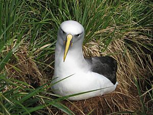
The eastern islands are home to many unique birds. These include the Snares penguins, Buller's albatrosses, and sooty shearwaters. You can also find mottled petrels, common diving petrels, and the Snares snipe here. The Western Chain also has colonies of Snares penguins and different types of albatrosses.
The islands are also home to the endemic (meaning found nowhere else) Snares tomtit. There are also several unique insects that live only on these islands. North East Island has forests and is the most important breeding area for sooty shearwaters. Up to three million of these birds can be found there during their breeding season, from November to April.
Protecting the Islands
The Snares Islands are highly protected. The New Zealand Department of Conservation calls them "minimum impact islands." This means that landing on the islands is usually not allowed. Only people with special research permits can visit.
The Snares Islands are part of the New Zealand Subantarctic Islands. This group of five island chains is a World Heritage Site recognized by UNESCO. This special status helps protect their unique environment and wildlife for the future.
See also
 In Spanish: Islas Snares para niños
 | Frances Mary Albrier |
 | Whitney Young |
 | Muhammad Ali |


