
Arctic Village, Alaska facts for kids
Quick facts for kids
Arctic Village
Vashrąįį K'ǫǫ
|
|
|---|---|

Aerial view of Arctic Village in wintertime.
|
|

Location of Arctic Village, Alaska
|
|
| Country | United States |
| State | Alaska |
| Census Area | Yukon-Koyukuk |
| Area | |
| • Total | 69.97 sq mi (181.23 km2) |
| • Land | 63.78 sq mi (165.20 km2) |
| • Water | 6.19 sq mi (16.03 km2) |
| Population
(2020)
|
|
| • Total | 151 |
| • Density | 2.37/sq mi (0.91/km2) |
| Time zone | UTC-9 (Alaska (AKST)) |
| • Summer (DST) | UTC-8 (AKDT) |
| ZIP code |
99722
|
| Area code(s) | 907 |
| FIPS code | 02-03990 |
Arctic Village (called Vashrąįį K'ǫǫ in the Gwich'in language) is a small Native American village in Alaska, United States. It is located in the Yukon-Koyukuk Census Area. In 2010, about 152 people lived there. This number stayed the same from 2000.
Arctic Village is in a large area where the Gwich'in language is spoken. The local way of speaking Gwich'in is called Di'haii Gwich’in. In 1999, more than 95% of the people in the village spoke and understood this language. In 2019, the village chief spoke out against oil drilling. He was worried about how it would affect the caribou.
Contents
Exploring the History of Arctic Village
People might have lived in the Arctic Village area as far back as 4500 BC. Around 500 AD, the Athabascan-speaking Gwich'in people came to this area. They were also known as Neets'aii Gwich'in, meaning "those who dwell to the north." They used to set up seasonal camps for hunting and fishing. Around 1900, Arctic Village became a place where people lived all year round.
Understanding Arctic Village's Geography
Arctic Village is located at 68°7′19″N 145°31′40″W / 68.12194°N 145.52778°W. It sits on the east fork of the Chandalar River. This is about 100 miles (160 km) north of Fort Yukon. The area near the river is flat floodlands. However, most of the land around the village is made up of wooded hills.
The total area of Arctic Village is about 69.9 square miles (181.2 square kilometers). Most of this area, about 61.71 square miles (160 square kilometers), is land. The rest, about 8.12 square miles (21 square kilometers), is water.
Discovering Arctic Village's Climate
Arctic Village has a subarctic climate. This means it has very cold, long winters and short, cool summers. On September 30, 1970, Arctic Village recorded a temperature of -13°F (-25°C). This was the coldest temperature ever recorded in Alaska for September.
The village warms up quickly in May and June. Temperatures reach their highest in July, with an average daily high of 68.9°F (20.5°C). After July, temperatures start to drop fast, especially in August and September. Even though it is far north, summer temperatures can be quite mild.
| Climate data for Arctic Village, Alaska | |||||||||||||
|---|---|---|---|---|---|---|---|---|---|---|---|---|---|
| Month | Jan | Feb | Mar | Apr | May | Jun | Jul | Aug | Sep | Oct | Nov | Dec | Year |
| Record high °F (°C) | 38 (3) |
28 (−2) |
43 (6) |
64 (18) |
77 (25) |
89 (32) |
87 (31) |
78 (26) |
72 (22) |
42 (6) |
40 (4) |
49 (9) |
89 (32) |
| Mean daily maximum °F (°C) | −13.3 (−25.2) |
−6.2 (−21.2) |
13.0 (−10.6) |
29.9 (−1.2) |
49.6 (9.8) |
64.8 (18.2) |
68.9 (20.5) |
59.7 (15.4) |
42.0 (5.6) |
20.9 (−6.2) |
−1.1 (−18.4) |
−6.5 (−21.4) |
26.8 (−2.9) |
| Daily mean °F (°C) | −23.2 (−30.7) |
−18.3 (−27.9) |
−2.1 (−18.9) |
14.1 (−9.9) |
38.3 (3.5) |
54.5 (12.5) |
57.8 (14.3) |
49.1 (9.5) |
32.4 (0.2) |
11.0 (−11.7) |
−10.5 (−23.6) |
−12.5 (−24.7) |
15.9 (−9.0) |
| Mean daily minimum °F (°C) | −33.1 (−36.2) |
−30.3 (−34.6) |
−17.1 (−27.3) |
−1.8 (−18.8) |
26.9 (−2.8) |
44.1 (6.7) |
46.6 (8.1) |
38.5 (3.6) |
22.8 (−5.1) |
1.0 (−17.2) |
−19.9 (−28.8) |
−22.4 (−30.2) |
4.6 (−15.2) |
| Record low °F (°C) | −68 (−56) |
−66 (−54) |
−62 (−52) |
−43 (−42) |
−21 (−29) |
24 (−4) |
27 (−3) |
17 (−8) |
−13 (−25) |
−35 (−37) |
−56 (−49) |
−57 (−49) |
−68 (−56) |
| Average precipitation inches (mm) | 0.44 (11) |
0.26 (6.6) |
0.41 (10) |
0.23 (5.8) |
0.61 (15) |
1.41 (36) |
1.68 (43) |
1.42 (36) |
1.38 (35) |
0.60 (15) |
0.45 (11) |
0.40 (10) |
9.29 (234.4) |
| Average snowfall inches (cm) | 4.4 (11) |
4.4 (11) |
6.4 (16) |
4.0 (10) |
2.3 (5.8) |
1.5 (3.8) |
0.0 (0.0) |
0.1 (0.25) |
4.7 (12) |
8.0 (20) |
6.7 (17) |
6.8 (17) |
49.3 (123.85) |
| Source: WRCC | |||||||||||||
Population and People of Arctic Village
| Historical population | |||
|---|---|---|---|
| Census | Pop. | %± | |
| 1910 | 40 | — | |
| 1930 | 40 | — | |
| 1940 | 24 | −40.0% | |
| 1950 | 53 | 120.8% | |
| 1960 | 110 | 107.5% | |
| 1970 | 85 | −22.7% | |
| 1980 | 111 | 30.6% | |
| 1990 | 96 | −13.5% | |
| 2000 | 152 | 58.3% | |
| 2010 | 152 | 0.0% | |
| 2020 | 151 | −0.7% | |
| U.S. Decennial Census | |||
Arctic Village first appeared on the U.S. Census in 1910. It was listed as "Arctic." It was not on the 1920 census. From 1930 to 1960, it was again listed as "Arctic." In 1970, it was called Arctic Village, which is its current name. In 1980, it became a census-designated place (CDP). Interestingly, the population was 40 in both 1910 and 1930. Also, it was 152 in both 2000 and 2010.
In 2000, there were 152 people living in Arctic Village. They lived in 52 households, and 30 of these were families. Most of the people, about 86%, were Native American. About 8% were White. A small number, about 6%, were of two or more races. Less than 1% were Hispanic or Latino.
In the village, about 41% of the people were under 18 years old. The average age of people in Arctic Village was 24 years. For every 100 females, there were about 114 males. The average household had about 2.9 people. The average family had about 3.6 people.
The average income for a household was $20,250. For families, it was $19,000. About 46% of all people and 31% of families lived below the poverty line. This included more than half of the children under 18.
Education in Arctic Village
The Yukon Flats School District is in charge of the school in Arctic Village.
Images for kids
-
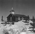
Episcopal church at Arctic Village.

See also
 In Spanish: Arctic Village (Alaska) para niños
