Minto, Alaska facts for kids
Quick facts for kids
Minto, Alaska
|
|
|---|---|

Minto, Alaska
|
|
| Country | United States |
| State | Alaska |
| Census Area | Yukon-Koyukuk |
| Area | |
| • Total | 136.17 sq mi (352.68 km2) |
| • Land | 132.61 sq mi (343.45 km2) |
| • Water | 3.56 sq mi (9.23 km2) |
| Population
(2020)
|
|
| • Total | 150 |
| • Density | 1.13/sq mi (0.44/km2) |
| Time zone | UTC-9 (Alaska (AKST)) |
| • Summer (DST) | UTC-8 (AKDT) |
| ZIP code |
99758
|
| Area code | 907 |
| FIPS code | 02-49530 |
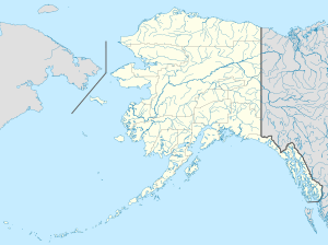
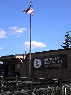
Minto is a small community in Alaska, United States. It is known as a census-designated place (CDP). This means it's a special area set up by the government for counting people. The name Minto comes from the Tanana word Menhti, which means 'among the lakes'.
In 2020, about 150 people lived in Minto. This number was 210 in 2010. The village had to move to its current spot in 1969 because of many floods. The old village site is now called Old Minto.
Contents
Geography
Minto is an Athabaskan Indian village. It is located at the end of the Minto Spur Road. This road connects to the Elliot Highway. The village sits on a high area above the Tolovana River flats. These flats have many lakes. The lakes were formed by the river flowing through low areas.
The community covers about 138.6 square miles (359 square kilometers). Most of this area, about 135.1 square miles (349.9 square kilometers), is land. The rest, about 3.6 square miles (9.3 square kilometers), is water.
Population and People
Minto first appeared on the U.S. Census in 1920. It was an unincorporated native village back then. This first village was along the Tanana River and is now called Old Minto. In 1920, 55 people lived there. The population changed over the years: 135 in 1940, 152 in 1950, and 161 in 1960.
After the floods, the new village took the name "Minto" starting with the 1970 census. In 1980, it became a census-designated place (CDP).
| Historical population | |||
|---|---|---|---|
| Census | Pop. | %± | |
| 1970 | 168 | — | |
| 1980 | 153 | −8.9% | |
| 1990 | 218 | 42.5% | |
| 2000 | 258 | 18.3% | |
| 2010 | 210 | −18.6% | |
| 2020 | 150 | −28.6% | |
| U.S. Decennial Census | |||
In 2000, there were 258 people living in Minto. There were 74 households and 54 families. About 39% of households had children under 18. The average household had about 3.5 people.
The population's age spread showed that about 39% were under 18. About 12% were between 18 and 24. The median age, which is the middle age of all people, was 25 years old.
Getting Around
Minto is a small community, but it has its own small airport called Minto Airport. You can take direct flights from here to Fairbanks. The community is also connected by the Old Minto Road. This road links up with the Elliot Highway. The Elliot Highway goes between Fairbanks and Manley Hot Springs.
History
Minto is in the western part of the traditional land of the Tanana Athabaskan people. In the late 1800s, some people from the Minto group traveled. They went to places like Tanana, Rampart, and Fort Yukon. They traded animal furs for things like manufactured goods, tea, and flour.
After gold was found near Fairbanks in 1902, steamboats started using the Tanana River. These boats brought goods and people to the area. Old Minto, which was on the Tanana River, became a permanent village. Some people from the Minto group built log cabins there. Other families lived in tents during certain seasons.
A school was built in 1937. However, most families did not live in Minto all year until the 1950s. People from the Minto group were later joined by families from other villages. These included Nenana, Toklat, Crossjacket, and Chena.
Minto had to move in 1969. This was because of many floods and land erosion. The new village site is about 65 kilometers (40 miles) north of the old one. People had used this new site as a camp in the fall and winter since the early 1900s. New homes and a new school were finished by 1971.
The Old Minto Family Recovery Camp is a simple treatment center. It is run by the Tanana Chiefs Conference. This center is located away from the old village site by the river. The old village site is still used for special celebrations. The Cultural Heritage and Education Institute also uses it. They help create lessons for the school in New Minto.
Notable Residents
- Chief Peter John (1900-2003) was a respected leader from Minto.
Education
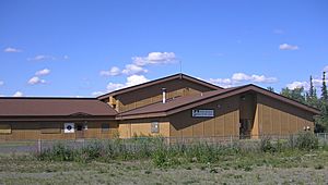
The Yukon–Koyukuk School District is in charge of the Minto School. This school helps the children of Minto get their education.
Language
The traditional language of Minto is Lower Tanana. This is one of eleven Athabaskan languages spoken in Alaska. As of 2010, only people who grew up speaking Lower Tanana as their first language can be found in Minto.
See also
- Minto City, British Columbia
- Mount Minto, Yukon
 In Spanish: Minto (Alaska) para niños
 | Chris Smalls |
 | Fred Hampton |
 | Ralph Abernathy |


