Tanana, Alaska facts for kids
Quick facts for kids
Tanana
Hohudodetlaatl Denh
|
|
|---|---|

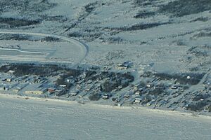
Aerial view of Tanana
|
|
| Country | United States |
| State | Alaska |
| Census Area | Yukon-Koyukuk |
| Incorporated | June 7, 1961 |
| Area | |
| • Total | 15.00 sq mi (38.84 km2) |
| • Land | 10.67 sq mi (27.64 km2) |
| • Water | 4.33 sq mi (11.21 km2) |
| Elevation | 207 ft (63 m) |
| Population
(2020)
|
|
| • Total | 246 |
| • Density | 23.06/sq mi (8.90/km2) |
| Time zone | UTC-9 (Alaska (AKST)) |
| • Summer (DST) | UTC-8 (AKDT) |
| ZIP code |
99777
|
| Area code | 907 |
| FIPS code | 02-75160 |
Tanana is a small city in Alaska, a state in the United States. It is located in the Yukon-Koyukuk Census Area. A census area is like a county, but without a local government.
In 2010, about 246 people lived in Tanana. The city was once known as Clachotin. The local Koyukon Athabascan name for the village is Hohudodetlaatl Denh. This name means ‘where the area has been chopped’. Many people in Tanana are Native American, mostly from the Koyukon (Denaakk'e) group. They speak a language from the large Athabaskan family.
Some residents of Tanana were featured in the 2012 TV show Yukon Men.
Contents
Tanana's Early History
Before European settlers arrived in the 1860s, the land where the Tanana and Yukon Rivers meet was a special meeting and trading spot. Different Native groups used this place, called Nuchalawoyyet.
In 1868, a French-Canadian trader named François Xavier Mercier set up the first fur trading post. It was called Noukelakayet Station, later known as Fort Adams. This post was about 15 miles downstream from the Tanana River's mouth.
Fort Gibbon and the Mission
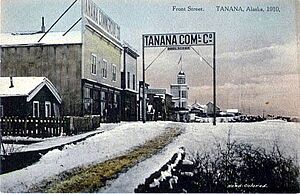
Later, an Anglican mission and other trading posts were built nearby. In 1898, the U.S. Army built Fort Gibbon at Tanana's current location. This fort helped manage shipping and trade. It also kept order and set up telegraph lines to connect to other towns like Nome and Valdez.
All other activities in the area moved closer to Fort Gibbon. St. James Church moved to serve the new settlers. The Mission of Our Savior was built for the Native people. Fort Gibbon closed in 1923, but the town and mission stayed.
Changes in the 20th Century
In the 1930s, a hospital was built in Tanana. It served people across much of northern Alaska until 1982. In 1939, the Native Village of Tanana was officially recognized by the U.S. government.
During World War II, Tanana's airfield was a stop for planes going to Russia. After the war, a special communication site was built nearby. This was part of the Cold War's Distant Early Warning system. In the 1950s, the mission closed, and Native families moved into the main town.
Geography and Climate
Tanana is located where two rivers meet: the Tanana River and the Yukon River.
The city covers about 15.6 square miles (40.4 square kilometers). Most of this area, about 11.6 square miles (30.0 square kilometers), is land. The rest, about 4.0 square miles (10.4 square kilometers), is water.
Tanana is about 130 miles (209 kilometers) west of Fairbanks. The weather in Tanana can be very extreme. The coldest temperature ever recorded was -76°F (-60°C) in January 1989. The hottest was 94°F (34°C) in June 1969.
| Climate data for Tanana, Alaska (1991–2020 normals, extremes 1901–present) | |||||||||||||
|---|---|---|---|---|---|---|---|---|---|---|---|---|---|
| Month | Jan | Feb | Mar | Apr | May | Jun | Jul | Aug | Sep | Oct | Nov | Dec | Year |
| Record high °F (°C) | 41 (5) |
45 (7) |
60 (16) |
70 (21) |
89 (32) |
94 (34) |
92 (33) |
90 (32) |
78 (26) |
66 (19) |
45 (7) |
46 (8) |
94 (34) |
| Mean maximum °F (°C) | 25.6 (−3.6) |
29.5 (−1.4) |
37.4 (3.0) |
56.4 (13.6) |
75.4 (24.1) |
83.1 (28.4) |
84.1 (28.9) |
77.7 (25.4) |
64.9 (18.3) |
48.0 (8.9) |
29.1 (−1.6) |
23.7 (−4.6) |
85.5 (29.7) |
| Mean daily maximum °F (°C) | −1.2 (−18.4) |
8.2 (−13.2) |
18.9 (−7.3) |
39.3 (4.1) |
58.9 (14.9) |
70.1 (21.2) |
70.8 (21.6) |
63.9 (17.7) |
51.8 (11.0) |
31.3 (−0.4) |
10.5 (−11.9) |
2.4 (−16.4) |
35.4 (1.9) |
| Daily mean °F (°C) | −9.3 (−22.9) |
−1.2 (−18.4) |
6.3 (−14.3) |
27.4 (−2.6) |
46.1 (7.8) |
57.8 (14.3) |
59.8 (15.4) |
53.6 (12.0) |
42.6 (5.9) |
24.3 (−4.3) |
3.3 (−15.9) |
−5.2 (−20.7) |
25.5 (−3.6) |
| Mean daily minimum °F (°C) | −17.4 (−27.4) |
−10.6 (−23.7) |
−6.3 (−21.3) |
15.6 (−9.1) |
33.4 (0.8) |
45.4 (7.4) |
48.8 (9.3) |
43.2 (6.2) |
33.5 (0.8) |
17.4 (−8.1) |
−4.0 (−20.0) |
−12.9 (−24.9) |
15.5 (−9.2) |
| Mean minimum °F (°C) | −49.6 (−45.3) |
−38.8 (−39.3) |
−32.1 (−35.6) |
−10.3 (−23.5) |
20.2 (−6.6) |
34.8 (1.6) |
38.4 (3.6) |
30.8 (−0.7) |
19.8 (−6.8) |
−2.7 (−19.3) |
−27.6 (−33.1) |
−40.6 (−40.3) |
−51.5 (−46.4) |
| Record low °F (°C) | −76 (−60) |
−68 (−56) |
−57 (−49) |
−40 (−40) |
−14 (−26) |
23 (−5) |
29 (−2) |
20 (−7) |
4 (−16) |
−27 (−33) |
−53 (−47) |
−64 (−53) |
−76 (−60) |
| Average precipitation inches (mm) | 0.38 (9.7) |
0.44 (11) |
0.24 (6.1) |
0.30 (7.6) |
0.64 (16) |
1.48 (38) |
1.95 (50) |
2.68 (68) |
1.68 (43) |
0.71 (18) |
0.56 (14) |
0.41 (10) |
11.47 (291) |
| Average snowfall inches (cm) | 7.7 (20) |
8.0 (20) |
5.4 (14) |
2.5 (6.4) |
0.3 (0.76) |
0.0 (0.0) |
0.0 (0.0) |
0.0 (0.0) |
0.8 (2.0) |
5.0 (13) |
10.0 (25) |
10.3 (26) |
50.0 (127) |
| Average extreme snow depth inches (cm) | 20.3 (52) |
22.2 (56) |
24.0 (61) |
18.6 (47) |
1.8 (4.6) |
0.0 (0.0) |
0.0 (0.0) |
0.0 (0.0) |
0.3 (0.76) |
4.3 (11) |
10.5 (27) |
15.6 (40) |
26.4 (67) |
| Average precipitation days (≥ 0.01 in) | 5.4 | 5.5 | 4.3 | 3.5 | 6.9 | 10.8 | 12.2 | 14.5 | 12.0 | 8.4 | 6.8 | 7.3 | 97.6 |
| Average snowy days (≥ 0.1 in) | 7.5 | 7.7 | 5.9 | 3.3 | 0.4 | 0.0 | 0.0 | 0.0 | 0.6 | 6.8 | 10.4 | 10.8 | 53.4 |
| Source: NOAA | |||||||||||||
Population of Tanana
| Historical population | |||
|---|---|---|---|
| Census | Pop. | %± | |
| 1880 | 27 | — | |
| 1890 | 120 | 344.4% | |
| 1900 | 186 | 55.0% | |
| 1910 | 398 | 114.0% | |
| 1920 | 213 | −46.5% | |
| 1930 | 185 | −13.1% | |
| 1940 | 170 | −8.1% | |
| 1950 | 228 | 34.1% | |
| 1960 | 349 | 53.1% | |
| 1970 | 406 | 16.3% | |
| 1980 | 388 | −4.4% | |
| 1990 | 345 | −11.1% | |
| 2000 | 308 | −10.7% | |
| 2010 | 246 | −20.1% | |
| 2020 | 246 | 0.0% | |
| U.S. Decennial Census | |||
Tanana first appeared in the U.S. Census in 1880. It was listed as "Nuklukaiet," a Native village and trading post. At that time, 29 people lived there. In 1890, it was called "Nuklukayet" and had 120 residents.
In 1900, the community was first called Tanana in the census. It officially became a city in 1961. Fort Gibbon, a military base next to Tanana, had 181 residents in 1920. It closed in 1923 and became part of Tanana.
The Saint James Mission, also known as the Tanana Native Village, was east of Tanana. It was counted separately from 1900 to 1940. It also later became part of Tanana.
Who Lives in Tanana?
According to the 2000 census, 308 people lived in Tanana. Most of the people, about 80%, were Native American. About 18% were White, and a small number were from two or more races.
The average household had about 2.5 people. The average family had about 3.4 people. Many households (41.3%) had children under 18 living with them.
Most of the population is under 65 years old. About 35% are under 18, and 8.4% are 65 or older. The average age in Tanana was 34 years. For every 100 females, there were about 131 males.
The average income for a household in the city was $29,750. For families, it was $34,028. About 23% of the population lived below the poverty line. This included 15% of those under 18.
Education in Tanana
The Tanana City School District provides education for the children and teens living in the area.
Getting Around Tanana
Tanana has an airport called the Ralph M. Calhoun Memorial Airport. It is located about 1 mile from the city center. Only one airline, Wright Air Service, flies there regularly from Fairbanks.
During the summer, people can travel by boat on the river. Tanana also has a one-lane dirt road. This road connects Tanana to the Elliott Highway in Manley Hot Springs. The road ends about 6 miles upstream from the town. When the river freezes in winter, an ice road is built. The dirt road officially opened in August 2016. The last twelve miles of the road are private land. This land belongs to a local company called Tozitna Limited. The parking lot by the river is only for residents and members of the community.
Famous People from Tanana
- Morris Thompson (1939–2000) was a politician born and raised in Tanana. After he passed away, he was buried in the city.
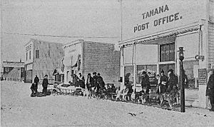
- Jules Louis Prevost (1863–1937) was an early missionary and language expert in the area. He was also the first postmaster.
- Walter Harper (1893–1918) was a Koyukuk man. He was the first person to reach the top of Denali (Mount McKinley) in 1913.
See also
 In Spanish: Tanana (Alaska) para niños
 | Kyle Baker |
 | Joseph Yoakum |
 | Laura Wheeler Waring |
 | Henry Ossawa Tanner |


