Lake Minchumina, Alaska facts for kids
Quick facts for kids
Lake Minchumina
Menchuh Mene’ / Minchu Mina'
|
|
|---|---|

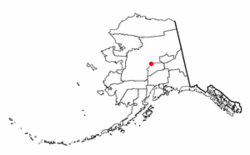
Location of Lake Minchumina, Alaska
|
|
| Country | United States |
| State | Alaska |
| Census Area | Yukon-Koyukuk |
| Area | |
| • Total | 249.95 sq mi (647.38 km2) |
| • Land | 226.97 sq mi (587.85 km2) |
| • Water | 22.99 sq mi (59.53 km2) |
| Population
(2020)
|
|
| • Total | 30 |
| • Density | 0.13/sq mi (0.05/km2) |
| Time zone | UTC-9 (Alaska (AKST)) |
| • Summer (DST) | UTC-8 (AKDT) |
| ZIP code |
99757
|
| Area code | 907 |
| FIPS code | 02-42820 |
Lake Minchumina is a small community in Alaska, United States. It is a census-designated place (CDP). This means it is an area defined by the government for collecting population data. The name Minchumina comes from the Koyukon language and the Upper Kuskokwim language. In 2020, only 30 people lived there.
Contents
Geography
Lake Minchumina is located in Yukon-Koyukuk Census Area, Alaska. It is very close to the exact middle of Alaska. The area covers about 244 square miles (632 square kilometers). Most of this area is land, but about 27.7 square miles (71.7 square kilometers) is water.
Climate
Lake Minchumina has a continental subarctic climate. This type of climate means it has very cold winters and short, cool summers. The weather can change a lot throughout the year.
| Climate data for Minchumina, Alaska, 1991–2020 normals, extremes 1945–2022 | |||||||||||||
|---|---|---|---|---|---|---|---|---|---|---|---|---|---|
| Month | Jan | Feb | Mar | Apr | May | Jun | Jul | Aug | Sep | Oct | Nov | Dec | Year |
| Record high °F (°C) | 47 (8) |
40 (4) |
51 (11) |
67 (19) |
84 (29) |
90 (32) |
92 (33) |
85 (29) |
74 (23) |
61 (16) |
44 (7) |
42 (6) |
92 (33) |
| Mean maximum °F (°C) | 24.1 (−4.4) |
30.1 (−1.1) |
37.0 (2.8) |
54.5 (12.5) |
74.0 (23.3) |
79.7 (26.5) |
82.7 (28.2) |
75.0 (23.9) |
65.7 (18.7) |
50.3 (10.2) |
30.7 (−0.7) |
27.8 (−2.3) |
83.9 (28.8) |
| Mean daily maximum °F (°C) | 3.1 (−16.1) |
9.7 (−12.4) |
20.6 (−6.3) |
40.6 (4.8) |
57.4 (14.1) |
68.0 (20.0) |
69.0 (20.6) |
62.6 (17.0) |
51.4 (10.8) |
32.2 (0.1) |
13.3 (−10.4) |
4.7 (−15.2) |
36.1 (2.3) |
| Daily mean °F (°C) | −3.6 (−19.8) |
2.5 (−16.4) |
10.9 (−11.7) |
30.4 (−0.9) |
47.2 (8.4) |
57.9 (14.4) |
59.9 (15.5) |
54.4 (12.4) |
44.0 (6.7) |
26.7 (−2.9) |
7.1 (−13.8) |
−1.4 (−18.6) |
28.0 (−2.2) |
| Mean daily minimum °F (°C) | −10.3 (−23.5) |
−4.6 (−20.3) |
1.3 (−17.1) |
20.2 (−6.6) |
37.0 (2.8) |
47.8 (8.8) |
50.8 (10.4) |
46.3 (7.9) |
36.6 (2.6) |
21.2 (−6.0) |
1.0 (−17.2) |
−7.5 (−21.9) |
20.0 (−6.7) |
| Mean minimum °F (°C) | −37.5 (−38.6) |
−27.4 (−33.0) |
−21.9 (−29.9) |
0.9 (−17.3) |
24.1 (−4.4) |
38.6 (3.7) |
42.6 (5.9) |
36.6 (2.6) |
26.1 (−3.3) |
6.3 (−14.3) |
−17.8 (−27.7) |
−29.2 (−34.0) |
−40.8 (−40.4) |
| Record low °F (°C) | −66 (−54) |
−62 (−52) |
−44 (−42) |
−38 (−39) |
−8 (−22) |
31 (−1) |
34 (1) |
25 (−4) |
9 (−13) |
−21 (−29) |
−48 (−44) |
−62 (−52) |
−66 (−54) |
| Average precipitation inches (mm) | 0.66 (17) |
0.51 (13) |
0.35 (8.9) |
0.31 (7.9) |
0.64 (16) |
2.21 (56) |
2.64 (67) |
3.15 (80) |
1.63 (41) |
0.95 (24) |
0.83 (21) |
0.61 (15) |
14.49 (366.8) |
| Average snowfall inches (cm) | 8.2 (21) |
6.7 (17) |
3.4 (8.6) |
3.7 (9.4) |
0.7 (1.8) |
0.0 (0.0) |
0.0 (0.0) |
0.0 (0.0) |
1.5 (3.8) |
6.9 (18) |
13.2 (34) |
9.6 (24) |
53.9 (137.6) |
| Average precipitation days (≥ 0.01 in) | 6.7 | 6.1 | 4.9 | 3.5 | 6.0 | 13.4 | 18.1 | 18.4 | 13.8 | 9.2 | 9.7 | 7.7 | 117.5 |
| Average snowy days (≥ 0.1 in) | 6.9 | 6.7 | 5.1 | 2.4 | 0.7 | 0.0 | 0.0 | 0.0 | 0.9 | 5.9 | 9.7 | 8.6 | 46.9 |
| Source 1: NOAA | |||||||||||||
| Source 2: XMACIS2 | |||||||||||||
Population Facts
| Historical population | |||
|---|---|---|---|
| Census | Pop. | %± | |
| 1950 | 60 | — | |
| 1960 | 34 | −43.3% | |
| 1990 | 32 | — | |
| 2000 | 32 | 0.0% | |
| 2010 | 13 | −59.4% | |
| 2020 | 30 | 130.8% | |
| U.S. Decennial Census | |||
Lake Minchumina first appeared in the U.S. Census in 1950. At that time, 60 people lived there. The population has changed over the years. In 2020, there were 30 residents.
In 2000, there were 32 people living in Lake Minchumina. About 18.8% of the people were under 18 years old. The average age was 36 years.
Education
The community used to have a school called Minchumina School. It was part of the Iditarod Area School District.
See also
 In Spanish: Lake Minchumina (Alaska) para niños
 | Precious Adams |
 | Lauren Anderson |
 | Janet Collins |

