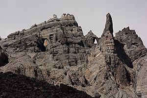
Gates of the Arctic National Park and Preserve facts for kids
Quick facts for kids Gates of the Arctic National Park and Preserve |
|
|---|---|
|
IUCN Category V (Protected Landscape/Seascape)
|
|
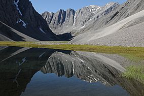
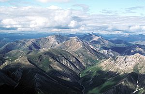
Oolah Valley in the Itkillik Preserve
|
|
| Location | Bettles, Alaska |
| Area | 8,472,506 acres (34,287.02 km2) |
| Established | December 2, 1980 |
| Visitors | 2,872 (in 2020) |
| Governing body | National Park Service |
| Website | Gates of the Arctic National Park & Preserve |
Gates of the Arctic National Park and Preserve is a huge national park in northern Alaska. It protects a big part of the Brooks Range mountains. This park is the northernmost national park in the United States. It is completely north of the Arctic Circle, which is an imaginary line around the Earth.
The park and preserve together are the second largest protected area in the U.S. They cover about 8.5 million acres. That's a bit bigger than the country of Belgium! Gates of the Arctic became a national park and preserve in 1980. A large part of the park is also a special "wilderness area." This means it's kept as wild as possible. This wilderness area connects with another one called Noatak Wilderness. Together, they form the largest wild area in the United States.
Contents
Exploring Gates of the Arctic
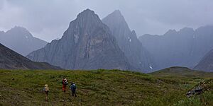
This park is super wild! There are no roads or official trails here. Because it's so far away and has no visitor buildings, it's the least visited national park in the U.S. In 2021, only about 7,362 people visited. To compare, Grand Canyon National Park had about 4.5 million visitors that same year!
You can go camping anywhere in the park. But sometimes, you might need to be careful when crossing lands owned by Native groups inside the park. The main office for the park is in Fairbanks. But park activities are managed from the Bettles Ranger Station, which is south of the park.
Where is the Park Located?
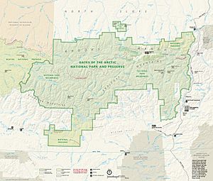
Gates of the Arctic National Park and Preserve is west of the Dalton Highway. It covers both the north and south sides of the Brooks Range mountains. The park includes the Endicott Mountains and part of the Schwatka Mountains. Most of this area is a "national park." This means only local people who live nearby can hunt for food. But in the "national preserve" part, sport hunting is allowed if you have the right licenses.
The park's eastern edge is a few miles from the Dalton Highway. The Arctic National Wildlife Refuge is about 10 miles further east. The Noatak National Preserve is next to the park's western side. Almost all of the park is a wilderness area. This means it's protected to stay wild and untouched.
Ten small towns near the park are called "resident zone communities." People in these towns depend on the park's natural resources for their food and way of life. Some of these towns are Alatna, Anaktuvuk Pass, and Wiseman. There are no roads, trails, or campgrounds inside the park itself. The Dalton Highway gets close to the park, but you need to cross a river to reach it from the road. There's a visitor center in Coldfoot that gives information about the parks in this area.
The park has amazing mountains like the Arrigetch Peaks and Mount Igikpak. It also has six special "Wild and Scenic Rivers." These rivers are protected because they are so beautiful and natural:
- Alatna River (83 miles long)
- John River (52 miles long)
- Kobuk River (110 miles long)
- North Fork of the Koyukuk River (102 miles long)
- Part of the Noatak River
- Tinayguk River (44 miles long)
Weather and Climate
The weather in Gates of the Arctic is very cold for most of the year. It's a "Subarctic" climate. This means it has cool summers and rain all year. In winter, temperatures can drop to a super cold -75°F (-59°C)! But in summer, it can get warm, sometimes up to 90°F (32°C) for a short time.
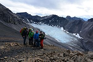
The park has snowfields and glaciers that are important for the environment. But these are shrinking fast because the Earth is getting warmer. From 1985 to 2017, the area of these snowfields got smaller by 13 square kilometers. The warmer temperatures are also melting the "permafrost." Permafrost is ground that stays frozen all year. When it melts, the soil becomes unstable, which can cause erosion and landslides.
Park's Landscape and Rocks
The park covers a lot of the central and eastern Brooks Range mountains. It stretches east to the Middle Fork of the Koyukuk River. This river runs next to the Dalton Highway and the Trans-Alaska Pipeline. The park sits on the continental divide. This is a high line that separates rivers flowing to the Pacific Ocean from those flowing to the Arctic Ocean.
The northern part of the park has small areas of "Arctic foothills tundra." The Brooks Range mountains run through the middle of the park from east to west. South of the Brooks Range, there are valleys and lakes. The very southern part of the park has the beginnings of the Kobuk River. The Brooks Range has been covered by glaciers many times in the past. The most recent time was about 24,000 years ago.
Wildlife and Plants
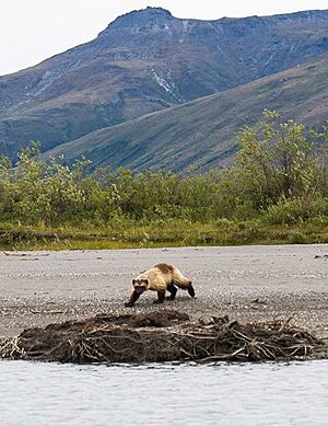
The park is home to many amazing animals. You can find brown bears, black bears, muskoxen, moose, and Dall sheep. There are also wolves, wolverines, coyotes, and lynxes. Smaller animals include Arctic ground squirrels, lemmings, and porcupines. Many birds live here too, like bald eagles, golden eagles, and different kinds of owls.
More than half a million caribou travel through the Brooks Range twice a year. They move north in summer and south in winter. Caribou are a very important food source for the native people who live here. However, as the snowfields in the park shrink, the caribou population might also get smaller. The park is also the northernmost place where Dall sheep live. About 132 brown bears live in the park and preserve.
A Look at History
People have lived in the Brooks Range for a very long time, maybe as long as 12,500 years! They mostly lived by hunting caribou and other animals. Later, the Inupiat people arrived around 1200 AD and became the Nunamiut people. The Nunamiut lived a traditional life, depending on hunting and nature. In 1949, the last two groups of these people settled together and formed the community of Anaktuvuk Pass. The Gwich'in people, another Native group, also lived in this area.
Explorers didn't really come to this part of Alaska until the late 1800s. This was just before gold was found in the Klondike. A few small mining operations started in the early 1900s, but they didn't last long.
The park got its name in 1929 from a wilderness explorer named Bob Marshall. He was exploring the North Fork of the Koyukuk River and saw two mountains, Frigid Crags and Boreal Mountain, on each side of the river. He called this opening the "Gates of the Arctic."
In the 1960s, people started suggesting that this part of Alaska should be a national park. In 1978, President Jimmy Carter used a special law to make many new national monuments in Alaska, including Gates of the Arctic National Monument. Then, in 1980, Congress passed a law called the Alaska National Interest Lands Conservation Act. This law officially made Gates of the Arctic a national park and preserve.
Images for kids
See also
 In Spanish: Parque nacional y reserva Puertas del Ártico para niños
 | Selma Burke |
 | Pauline Powell Burns |
 | Frederick J. Brown |
 | Robert Blackburn |


