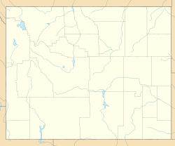
Orin, Wyoming facts for kids
Quick facts for kids
Orin, Wyoming
|
|
|---|---|
| Country | United States |
| State | Wyoming |
| County | Converse |
| Area | |
| • Total | 1.1 sq mi (2.9 km2) |
| • Land | 1.0 sq mi (2.6 km2) |
| • Water | 0.1 sq mi (.3 km2) |
| Elevation | 4,705 ft (1,434 m) |
| Population
(2010)
|
|
| • Total | 46 |
| • Density | 41.1/sq mi (15.9/km2) |
| Time zone | UTC-7 (Mountain (MST)) |
| • Summer (DST) | UTC-6 (MDT) |
| Area code(s) | 307 |
| FIPS code | 56-58100 |
| GNIS feature ID | 1592478 |
Orin is a very small community, sometimes called a hamlet, located in Converse County, Wyoming, in the United States. It is also known as a census-designated place (CDP). This means it's an area the government defines for counting people, but it's not an official town or city. In 2010, only 46 people lived in Orin.
Contents
History of Orin
How Orin Got Its Name
The community of Orin was named after a person named Orin Hughitt. He was the uncle of someone important who worked for the railroad.
Early Days and the Post Office
A post office first opened in the area in 1891. It was called Orin Junction back then. A few years later, in 1895, its name was changed to just Orin. The post office served the community for many years before it closed around 1962.
A Place for Outlaws
Orin was also known as the last place where a famous outlaw named Doc Middleton owned and ran a saloon. This was before he passed away in 1913.
Geography of Orin
Where Orin is Located
Orin is found where several important roads meet. These include Interstate 25, U.S. Route 26, and U.S. Route 87. It's also where U.S. Route 18 and U.S. Route 20 cross paths.
Nearby Towns and Transportation
This small community is about 10 miles (16 kilometers) southeast of a larger town called Douglas. A railway line, run by the BNSF Railway, also goes through Orin.
Land and Water Areas
According to official measurements, the entire area of Orin is about 1.1 square miles (2.9 square kilometers). Most of this area, about 1.0 square mile (2.6 square kilometers), is land. The rest, about 0.1 square mile (0.26 square kilometers), is water. This means about 9.1% of Orin's area is covered by water.
See also
 In Spanish: Orin (Wyoming) para niños
 | Victor J. Glover |
 | Yvonne Cagle |
 | Jeanette Epps |
 | Bernard A. Harris Jr. |


