Orito facts for kids
Quick facts for kids
Orito
|
|||
|---|---|---|---|
|
Municipality and town
|
|||
|
|||

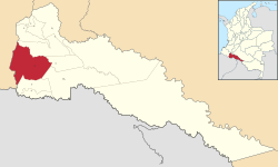
Location of the municipality and town of Orito in the Putumayo Department of Colombia.
|
|||
| Country | |||
| Department | |||
| Founded | 1963 | ||
| Area | |||
| • Municipality and town | 1,939 km2 (749 sq mi) | ||
| • Urban | 6.99 km2 (2.70 sq mi) | ||
| Elevation | 310 m (1,020 ft) | ||
| Population
(2018 census)
|
|||
| • Municipality and town | 37,745 | ||
| • Density | 19.466/km2 (50.417/sq mi) | ||
| • Urban | 19,833 | ||
| • Urban density | 2,837.3/km2 (7,349/sq mi) | ||
| Time zone | UTC-5 (Colombia Standard Time) | ||
Orito is a town and a municipality in the Putumayo Department of Colombia. It's a place with beautiful green rainforests. The town is located just south of where two rivers, the Patascoy and Luzonyaco River, meet.
Orito is about 43 kilometers (about 27 miles) north of the border with Ecuador. The town also has its own airport, called Orito Airport, which helps people travel to and from the area.
What's the Weather Like in Orito?
Orito has a tropical rainforest climate. This means the weather is warm and rainy all year round. It's a bit like living in a giant, lush greenhouse!
The average temperature stays around 24 to 25 degrees Celsius (75 to 77 degrees Fahrenheit) throughout the year. There is a lot of rainfall, especially from March to May, making the area very green.
See Also
 In Spanish: Orito (Putumayo) para niños
Black History Month on Kiddle
African-American Artists you should know:
 | John T. Biggers |
 | Thomas Blackshear |
 | Mark Bradford |
 | Beverly Buchanan |

All content from Kiddle encyclopedia articles (including the article images and facts) can be freely used under Attribution-ShareAlike license, unless stated otherwise. Cite this article:
Orito Facts for Kids. Kiddle Encyclopedia.


