Ouderkerk facts for kids
Quick facts for kids
Ouderkerk
|
|||
|---|---|---|---|
|
Former municipality
|
|||

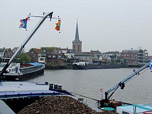
View over Ouderkerk aan den IJssel
|
|||
|
|||

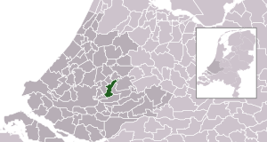
Location in South Holland
|
|||
| Country | Netherlands | ||
| Province | South Holland | ||
| Municipality | Krimpenerwaard | ||
| Established | 1 January 1985 | ||
| Area | |||
| • Total | 28.57 km2 (11.03 sq mi) | ||
| • Land | 27.07 km2 (10.45 sq mi) | ||
| • Water | 1.50 km2 (0.58 sq mi) | ||
| Elevation | 0 m (0 ft) | ||
| Population
(May 2014)
|
|||
| • Total | 8,200 | ||
| • Density | 303/km2 (780/sq mi) | ||
| Demonym(s) | Ouderkerker | ||
| Time zone | UTC+1 (CET) | ||
| • Summer (DST) | UTC+2 (CEST) | ||
| Postcode |
2830–2831, 2935
|
||
| Area code | 0180, 0182 | ||
Ouderkerk is a place in the western part of the Netherlands. It is located in the province of South Holland. Until 2015, Ouderkerk was its own municipality, which is like a local government area.
Since January 1, 2015, Ouderkerk has become part of a larger municipality called Krimpenerwaard. This change happened because of a reorganization of local governments in the Netherlands.
About Ouderkerk
Ouderkerk used to cover an area of about 28.57 km2 (11.03 sq mi). A small part of this area, about 1.50 km2 (0.58 sq mi), was water. This means it had rivers or canals running through it.
The former municipality of Ouderkerk was created on January 1, 1985. This was when several smaller areas joined together.
Places in Ouderkerk
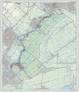
The former municipality of Ouderkerk included several smaller towns and villages. These places were Gouderak, Lageweg, Ouderkerk aan den IJssel, and IJssellaan.
All these places are located along the Hollandse IJssel river. Rivers are often important for towns because they can be used for transport or trade.
 | William L. Dawson |
 | W. E. B. Du Bois |
 | Harry Belafonte |


