Pacific Junction, Iowa facts for kids
Quick facts for kids
Pacific Junction, Iowa
|
|
|---|---|

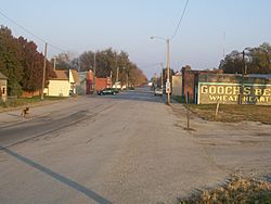
View of Pacific Junction looking east down Lincoln Avenue from Front Street
|
|

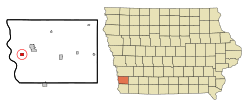
Location of Pacific Junction, Iowa
|
|
| Country | |
| State | |
| County | Mills |
| Area | |
| • Total | 0.76 sq mi (1.96 km2) |
| • Land | 0.76 sq mi (1.96 km2) |
| • Water | 0.00 sq mi (0.00 km2) |
| Elevation | 955 ft (291 m) |
| Population
(2020)
|
|
| • Total | 96 |
| • Density | 126.82/sq mi (48.97/km2) |
| Time zone | UTC-6 (Central (CST)) |
| • Summer (DST) | UTC-5 (CDT) |
| ZIP code |
51561
|
| Area code(s) | 712 |
| FIPS code | 19-60825 |
| GNIS feature ID | 0459983 |
Pacific Junction is a small city in Mills County, Iowa, United States. It is located in the western part of Iowa. In 2020, about 96 people lived there.
Contents
History of Pacific Junction
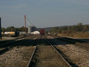
Pacific Junction was started in 1871 because of the railroad. It was an important meeting point for three different railroad lines. These lines later became part of the BNSF system, which is still active today.
The city officially became a town in 1882. For a while, it grew quite a bit. In the early 1900s, over 700 people lived there. Even though many trains still pass through, the town's direct connection to the railroad has changed over time.
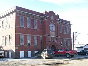
One important building was the Pacific Junction Public School, built in 1914. It stopped being a high school in 1961 and closed completely in 1986.
In December 2021, two trains collided in Pacific Junction. This caused two locomotives and 16 train cars to go off the tracks.
Impact of the 2019 Floods
Pacific Junction faced a very difficult time during the 2019 Midwestern U.S. floods. In March 2019, the levees (walls that hold back water) in Mills County broke. This caused the entire city to be completely covered in floodwater.
After the flood, many damaged buildings were torn down. The government offered a program to buy out properties, so many empty lots are now left. The local post office has not returned, and the town hall is still not usable. Because of the flood, the city's population dropped a lot. The 2020 census showed that only about 20% of the people who lived there before the flood remained.
Geography of Pacific Junction
Pacific Junction is located at 41°01′06″N 95°48′00″W / 41.018319°N 95.799883°W.
The city covers a total area of about 0.76 square miles (1.96 square kilometers). All of this area is land.
Population Changes Over Time
| Historical populations | ||
|---|---|---|
| Year | Pop. | ±% |
| 1880 | 123 | — |
| 1890 | 744 | +504.9% |
| 1900 | 732 | −1.6% |
| 1910 | 501 | −31.6% |
| 1920 | 666 | +32.9% |
| 1930 | 594 | −10.8% |
| 1940 | 558 | −6.1% |
| 1950 | 550 | −1.4% |
| 1960 | 560 | +1.8% |
| 1970 | 505 | −9.8% |
| 1980 | 511 | +1.2% |
| 1990 | 548 | +7.2% |
| 2000 | 507 | −7.5% |
| 2010 | 471 | −7.1% |
| 2020 | 96 | −79.6% |
| Source: and Iowa Data Center Source: |
||
The population of Pacific Junction has changed a lot over the years. It grew quickly after it was founded, reaching its highest point in the early 1900s. After that, the number of people living there slowly went down. The 2019 flood caused a very big drop in population, from 471 people in 2010 to just 96 in 2020.
Who Lives in Pacific Junction?
According to the 2020 census, there were 96 people living in Pacific Junction.
- Most residents (95.8%) were White.
- About 26% of households had children under 18.
- The average age of people in the city was 52 years old.
- The population was split evenly between males and females.
Education
Students in Pacific Junction attend schools within the Glenwood Community School District.
See also
 In Spanish: Pacific Junction (Iowa) para niños


