Palmdale, Pennsylvania facts for kids
Quick facts for kids
Palmdale, Pennsylvania
|
|
|---|---|

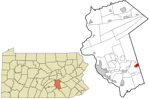
Location in Dauphin County and state of Pennsylvania
|
|
| Country | United States |
| State | Pennsylvania |
| County | Dauphin |
| Township | Derry |
| Area | |
| • Total | 1.49 sq mi (3.85 km2) |
| • Land | 1.49 sq mi (3.84 km2) |
| • Water | 0.00 sq mi (0.00 km2) |
| Elevation | 433 ft (132 m) |
| Population
(2020)
|
|
| • Total | 1,308 |
| • Density | 880.81/sq mi (340.19/km2) |
| Time zone | UTC-5 (Eastern (EST)) |
| • Summer (DST) | UTC-4 (EDT) |
| ZIP Code |
17033
|
| FIPS code | 42-57648 |
| GNIS feature ID | 1193079 |
Palmdale is a small community located in Derry Township, within Dauphin County, Pennsylvania, United States. It is known as a "census-designated place" (CDP). This means it's an area identified by the government for counting people, even though it doesn't have its own separate local government like a city or town.
Contents
Welcome to Palmdale, Pennsylvania!
Palmdale is a quiet community. It is part of the larger Harrisburg–Carlisle metropolitan statistical area. This area includes several cities and towns that are connected by work and daily life.
Where is Palmdale Located?
Palmdale is in the eastern part of Derry Township. It shares its borders with the well-known community of Hershey to the north, west, and south. To the east, Palmdale meets the borough of Palmyra. Palmyra is located in Lebanon County.
Getting Around Palmdale
The main road that goes through Palmdale is U.S. Route 422. This road is also called E. Chocolate Avenue. If you travel east on Route 422, you will reach Lebanon in about 12 miles. Going further, you can reach Reading in about 40 miles.
If you head west from Palmdale on Route 422, it connects to US 322. This route will take you to Harrisburg, which is about 17 miles away.
How Many People Live Here?
According to the 2020 census, the population of Palmdale was 1,308 people. This number helps us understand how many residents call Palmdale home.
| Historical population | |||
|---|---|---|---|
| Census | Pop. | %± | |
| 2020 | 1,308 | — | |
| U.S. Decennial Census | |||
See also
 In Spanish: Palmdale (Pensilvania) para niños
 | Georgia Louise Harris Brown |
 | Julian Abele |
 | Norma Merrick Sklarek |
 | William Sidney Pittman |

