Pampa de los Guanacos facts for kids
Quick facts for kids
Pampa de los Guanacos
|
|
|---|---|
|
Municipality and village
|
|

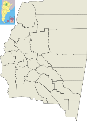
Location of Pampa de los Guanacos in the province of Santiago del Estero
|
|
| Country | |
| Province | Santiago del Estero Province |
| Department | Copo Department |
| Population
(2001)
|
|
| • Total | 4,393 |
| Postal code |
3712
|
| Area code(s) | 03841 |
| Climate | BSh |
Pampa de los Guanacos is a town and municipality located in the Santiago del Estero Province in Argentina. It was established in 1932. This area is known for its connection to nature and its important role in local transportation.
Contents
Getting Around Pampa de los Guanacos
Pampa de los Guanacos is connected to other places mainly by roads and railways. The most important road is Ruta Nacional 16. This road helps people travel to cities like Salta and Resistencia.
Railways and Their History
Running next to the main road is a railway line. This line is part of the General Manuel Belgrano Railroad. In the past, railways were built before roads in Argentina. This was especially true in areas like Chaco Austral. The railway helped move valuable resources. Workers used it to transport timber from the thick forests. They also used it to carry cotton that was grown in the region.
Local and Regional Connections
From Pampa de los Guanacos, Provincial Route 6 goes south. It connects the town to Sacháyoj, which is about 48 miles away. To reach the capital city of Santiago del Estero, the journey is a bit longer. You have to use Provincial Routes 5 and 4, which have winding paths.
Nature and Environment
Close to Pampa de los Guanacos, you can find the Copo National Park. This park was created in the year 2000. It is a special place for protecting nature. The town also gets its water from the Salado del norte river. The water travels through an aqueduct called Canal de Dios.
See also
 In Spanish: Pampa de los Guanacos para niños
 | Frances Mary Albrier |
 | Whitney Young |
 | Muhammad Ali |

