Parua Bay facts for kids
Quick facts for kids
Parua Bay
|
|
|---|---|

Parua Bay, showing the Pacific oyster aquaculture farm
|
|
| Country | New Zealand |
| Region | Northland Region |
| District | Whangarei District |
| Ward | Whangarei Heads Ward |
| Electorates |
|
| Area | |
| • Total | 1.87 km2 (0.72 sq mi) |
| Population
(June 2023)
|
|
| • Total | 670 |
| • Density | 358/km2 (928/sq mi) |
Parua Bay is a lovely bay and small town located on the northern side of the Whangārei Harbour in Northland, New Zealand. It's about 19 kilometers (12 miles) west of the city of Whangārei. The Whangārei Heads are just 10 kilometers (6 miles) to the southeast.
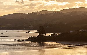
The bay is very calm and protected, stretching about 4 kilometers (2.5 miles) wide. It has deep water in the middle, but also wide areas along the coast that are covered and uncovered by the tide. You can find Motukiore Island near Manganese Point, which is connected by a causeway at low tide. On this island, you can still see the old shapes of a defensive Māori fort. Solomon's Point divides the bay into two parts, and it's named after a Māori chief called Horomona-Kaikou.
Contents
History of Parua Bay
Long ago, in the early 1800s, there was a Māori fort called Raro-ngaua on the eastern side of Parua Bay's entrance. Around 1821 or 1822, this fort was attacked by warriors from the Ngāti Paoa and Waikato tribes. This happened during a time known as the Musket Wars, when different Māori tribes fought using new muskets (guns).
Early European Settlers
In 1838, a man named Thomas Stewart Scott and his two friends bought land on the western side of the bay. They started a shipbuilding business there. One of the ships they built was a schooner (a type of sailing ship) called the Governor Fitzroy, which was about 13 meters (43 feet) long.
Nearby, at a place now called Manganese Point, there were lumps of Manganese ore. This ore was dug up and sold in 1844. Later, in 1849, a survey of the Whangārei Harbour was done by Captain Lort Stokes. He gave Parua Bay the name "Bad Maori Bay" and Manganese Point the name "Annoyance Point."
By the mid-1850s, a small group of four European families lived in the area. In 1858, the government bought a large piece of land (about 4,000 hectares or 10,000 acres) at Parua Bay. This land was then given to new settlers, mostly through a plan called the "Forty Acre Scheme." This scheme offered 40 acres of land to any settler over 18 years old, as long as they met a few simple rules.
A Local Love Story
In 1858, an Irish surveyor named James Irwin Wilson settled in a small bay called The Nook. He fell in love with Joanna Munro, whose father, John Munro, was a settler from Nova Scotia living in Munro Bay. John Munro was not happy because James had bought land that he wanted, and he didn't approve of their relationship.
James and Joanna tried to run away together, but they were caught. However, their second attempt to elope was successful, and they got married in Auckland. Eventually, John Munro accepted the marriage. Later, one of James's brothers even married Joanna's sister!
Population and Community
Parua Bay is considered a rural settlement by Statistics New Zealand. The settlement covers about 1.87 square kilometers (0.72 square miles).
In the 2023 New Zealand census, the population of the Parua Bay settlement was 636 people. This was an increase of 39 people (6.5%) since the 2018 census, and a bigger increase of 162 people (34.2%) since the 2013 census. This shows that more people are choosing to live in Parua Bay.
The wider Parua Bay statistical area, which is a larger region, had a population of 2,574 people in the 2023 census.
Education
Parua Bay School is a school for students in years 1 to 8 (ages 5 to 13). It's a coeducational school, meaning both boys and girls attend. As of February 2024. , the school has 268 students.
The school first opened in 1871 on Owhiwa Road. The very next year, it moved to its current location. When it first started, it was called Kirikiri School.
 | Leon Lynch |
 | Milton P. Webster |
 | Ferdinand Smith |


