Passapatanzy, Virginia facts for kids
Quick facts for kids
Passapatanzy, Virginia
|
|
|---|---|

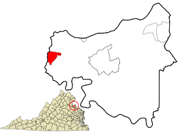
Location in King George County and the state of Virginia
|
|
| Country | United States |
| State | Virginia |
| County | King George |
| Area | |
| • Total | 2.04 sq mi (5.28 km2) |
| • Land | 2.03 sq mi (5.27 km2) |
| • Water | 0.004 sq mi (0.01 km2) |
| Elevation | 214 ft (65 m) |
| Population
(2010)
|
|
| • Total | 1,283 |
| • Density | 630/sq mi (243.3/km2) |
| Time zone | UTC−5 (Eastern (EST)) |
| • Summer (DST) | UTC−4 (EDT) |
| ZIP code |
22485 (King George)
|
| Area code(s) | 540 |
| FIPS code | 51-60888 |
| GNIS feature ID | 1497075 |
Passapatanzy is a small community in King George County, Virginia, in the United States. It is known as an unincorporated community, which means it doesn't have its own local government like a city or town. It's also a census-designated place (CDP), which is an area the U.S. Census Bureau defines for gathering population data. In 2010, about 1,283 people lived there.
Contents
History of Passapatanzy
Passapatanzy was once a village of the Patawomeck Native American people. A leader named Japazaws ruled this village. He was the older brother of the weroance, who was a powerful chief.
Pocahontas and the English
In 1613, Japazaws worked with an English explorer named Samuel Argall. They planned to capture Pocahontas, who was the daughter of Chief Powhatan. The English wanted to use Pocahontas as a hostage. They hoped to trade her for English prisoners and stolen property.
Native American stories from the Mattaponi and Patawomeck tribes say that Pocahontas was living in Passapatanzy at that time. She was with her husband, Kocoum. After Kocoum died, their daughter, Ka-Okee, was cared for by other Patawomeck people.
Today, you can find a special marker near the Potomac Creek Bridge in Stafford. This marker tells the story of Pocahontas and this event. It is located on U.S. Route 1.
Geography of Passapatanzy
Passapatanzy is located in the western part of King George County. It is situated along Virginia State Route 218. This road goes west for about 9 miles (14 km) to Fredericksburg. It also goes east for about 15 miles (24 km) to U.S. Route 301 near Dahlgren.
The main town of King George, which is the county seat, is about 10 miles (16 km) southeast of Passapatanzy.
Land and Water
The U.S. Census Bureau reports that the Passapatanzy CDP covers a total area of about 5.3 square kilometers (2.0 square miles). Most of this area, about 5.27 square kilometers (2.03 square miles), is land. Only a very small part, about 0.01 square kilometers (0.0039 square miles), is water.
See also
 In Spanish: Passapatanzy (Virginia) para niños
 | James Van Der Zee |
 | Alma Thomas |
 | Ellis Wilson |
 | Margaret Taylor-Burroughs |

