Fredericksburg, Virginia facts for kids
Quick facts for kids
Fredericksburg, Virginia
|
|||||
|---|---|---|---|---|---|
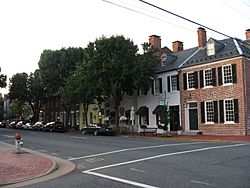
Historic Downtown Fredericksburg
|
|||||
|
|||||
| Motto(s):
America's Most Historic City
|
|||||
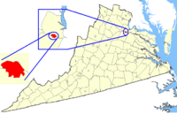
Location of Fredericksburg in Virginia
|
|||||
| Country | United States | ||||
| State | Virginia | ||||
| County | None (Independent city since 1879, adjacent to Spotsylvania County) | ||||
| Founded | 1728 | ||||
| Incorporated | 1781 | ||||
| Named for | Frederick, Prince of Wales | ||||
| Area | |||||
| • Independent city | 10.52 sq mi (27.24 km2) | ||||
| • Land | 10.45 sq mi (27.07 km2) | ||||
| • Water | 0.07 sq mi (0.18 km2) | ||||
| Elevation | 59 ft (18 m) | ||||
| Population
(2020)
|
|||||
| • Independent city | 27,982 | ||||
| • Density | 2,659.9/sq mi (1,027.24/km2) | ||||
| • Urban | 167,679 (US: 216th) | ||||
| Time zone | UTC−05:00 (Eastern (EST)) | ||||
| • Summer (DST) | UTC−04:00 (EDT) | ||||
| ZIP Codes |
22401 (USPS designates 5 zip codes for Fredericksburg, but 4 of them lie outside the Independent City in surrounding counties; only 22401 lies inside it)
|
||||
| Area code(s) | 540 | ||||
| FIPS code | 51-29744 | ||||
| GNIS feature ID | 1494947 | ||||
| * Independent from Spotsylvania County in 1879 | |||||
Fredericksburg is an independent city in Virginia, United States. In 2020, about 28,000 people lived there. It is located about 48 miles (77 km) south of Washington, D.C. and 53 miles (85 km) north of Richmond.
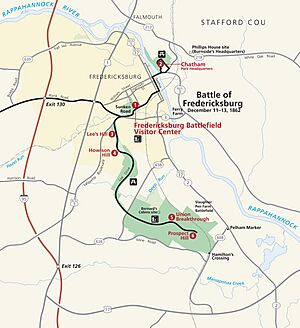
Fredericksburg is near the Rappahannock River, where it crosses the Atlantic Seaboard fall line. This made it an important port during the colonial era. During the Civil War, Fredericksburg was a key location. It was halfway between the capitals of the two sides. The city was the site of the Battle of Fredericksburg and Second Battle of Fredericksburg. Parts of these battles are now preserved at the Fredericksburg and Spotsylvania National Military Park.
Today, tourism is a big part of the city's economy. Around 1.5 million people visit the Fredericksburg area each year. They explore the battlefield park, museums, art shops, and many historical sites. Major employers include the University of Mary Washington, Mary Washington Healthcare, and GEICO. Many people who live in Fredericksburg travel to work in Washington, D.C., Richmond, and nearby counties.
Contents
Naming Fredericksburg
The independent city of Fredericksburg was named in 1728. It was named after Frederick, Prince of Wales, who was the eldest son of King George II. This naming happened when the Virginia General Assembly wanted to create a formal trading center. This center was located where the Rappahannock River became too shallow for large ships.
Before English settlers arrived, Algonquian-speaking tribes lived in the area. These tribes were part of the Powhatan Confederacy. Fredericksburg became a port town for shipping tobacco and receiving goods. It was important for moving farm products. The city was incorporated as a town in 1781. It became an independent city in 1879. This means it has its own government, separate from the surrounding county.
During the American Civil War, Fredericksburg suffered a lot of damage. This was especially true during the Battle of Fredericksburg in 1862.
History of Fredericksburg
When Europeans first arrived, the Siouan-speaking Manahoac tribe lived in the area that became Fredericksburg. English colonists called their village Mahaskahod.
Colonial Times
Fredericksburg grew as colonial Virginia expanded westward. The land for the city was first claimed in 1671. In 1676, the Virginia General Assembly built a fort on the Rappahannock River. In 1714, Lieutenant Governor Alexander Spotswood helped German settlers create a town called Germanna. This town was upstream from Fredericksburg.
As more people became interested in the frontier, Spotsylvania County was formed in 1720. It was named after Governor Spotswood. In 1728, Fredericksburg was made a port for the county. Streets in the town were named after relatives of Frederick, Prince of Wales. The county court moved to Fredericksburg in 1732. This made Fredericksburg the county seat until 1780. Then, the court moved to Spotsylvania Courthouse, Virginia, which was closer to the center of the county.
Fredericksburg then became its own town with its own court, council, and mayor. It officially became an independent city in 1879. In 1911, the city adopted its current government style, with a city manager and council.
The city has strong ties to George Washington. His family moved to Ferry Farm in 1738. This farm was across the Rappahannock River from Fredericksburg. Washington's mother, Mary Ball Washington, later lived in the city. His sister, Betty, lived at Kenmore. Many citizens were active during the American Revolution (1763–1781). For example, locals signed the Leedstown Resolves to protest the Stamp Act. Fielding Lewis, George Washington's brother-in-law, ran an arms factory for the Continental Army. Other important early residents included generals Hugh Mercer and George Weedon, naval hero John Paul Jones, and future U.S. president James Monroe. Thomas Jefferson also wrote the Virginia Statute for Religious Freedom in Fredericksburg.
19th Century Changes
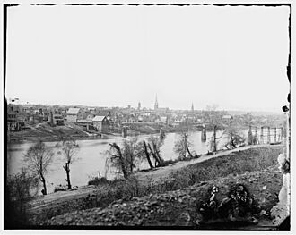
During the 1800s, many mills were built along the Rappahannock River. These mills used water power to grind flour and process cotton. Fredericksburg tried to keep its trade strong. It supported building a canal on the Rappahannock and new roads. By 1837, a railroad connected the town to Richmond. This railroad became the Richmond, Fredericksburg and Potomac Railroad.
During the American Civil War, Fredericksburg was very important. It was located right in the middle of Washington, D.C. (the Union capital) and Richmond (the Confederate capital). From December 11–15, 1862, the Battle of Fredericksburg took place. The town was badly damaged by bombs and looting by Union forces.
During this battle, nearly 10,000 enslaved people from plantations and city homes found freedom. They crossed the Rappahannock River to join the Union lines. This was part of a larger movement of enslaved people seeking freedom during the war.
The Second Battle of Fredericksburg happened on May 3, 1863. It was part of the Battle of Chancellorsville campaign. The battles of the Wilderness and Spotsylvania Court House were also fought nearby in May 1864.
After the war, Fredericksburg slowly recovered. It became a center for local trade again. However, the city and nearby counties did not reach their 1860 population levels until much later in the 20th century. Many freed people moved to larger cities like Richmond and Petersburg after the war.
20th Century to Today
In the early 1900s, many African-Americans moved from the rural South to northern cities. This was part of the Great Migration. Some settled in Washington, D.C., where there were more opportunities.
During World War II, the area's population grew because of defense facilities. In the 1960s, the city saw new growth and development. This was helped by the building of Interstate 95, which made commuting and trade easier. By the 1970s, Fredericksburg became a "bedroom community." This means many residents lived there but worked in Northern Virginia and Washington, D.C. The city also benefited from being close to four military bases.
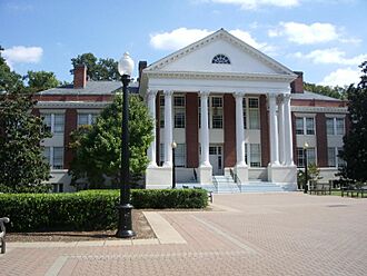
The University of Mary Washington was founded in Fredericksburg in 1908. It started as a school to train white women for teaching. In 1938, it became Mary Washington College. It was linked to the University of Virginia for many years. The college began allowing all students in 1964. It became independent and started accepting men in 1970. In 2004, it changed its name to the University of Mary Washington.
In 1958, musician Link Wray invented the power chord in Fredericksburg. This was during an improvisation of his song "Rumble." The power chord became very important in rock guitar music. Today, Fredericksburg has a lively music scene with many different styles.
A commuter train line, the Virginia Railway Express, started in the 1980s. It provides transportation to Washington, D.C., and other cities north of Fredericksburg.
The city has become a regional healthcare center. Retail and real estate grew quickly in the early 2000s. This growth slowed during the Great Recession that began in 2007. The Hispanic population grew significantly from 2011 to 2020.
Geography and Weather
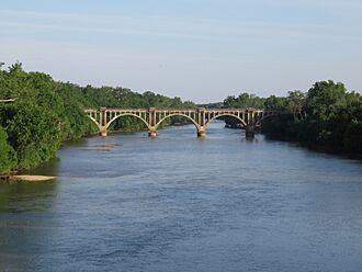
Fredericksburg covers about 10.5 square miles (27.2 square kilometers). Most of this is land, with a small amount of water. The city is located where the Piedmont and Tidewater regions meet. This is known as the Atlantic Seaboard fall line, which you can see on the Rappahannock River.
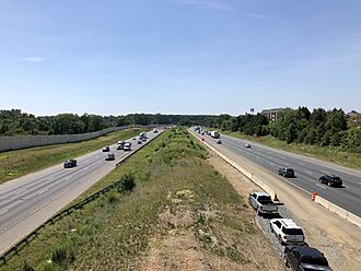
Major roads like US 1, US 17, and I-95 all pass through the city. Fredericksburg is about 53 miles (85 km) south of downtown Washington, D.C.
The city is bordered by the Rappahannock River to the north and east. Across the river is Stafford County. To the south and west, Fredericksburg is bordered by Spotsylvania County.
Fredericksburg has a humid subtropical climate. This means it has cool winters and hot, humid summers. Temperatures are often a bit warmer than in Washington, D.C.
Population Information
| Historical population | |||
|---|---|---|---|
| Census | Pop. | %± | |
| 1830 | 3,308 | — | |
| 1840 | 3,974 | 20.1% | |
| 1850 | 4,061 | 2.2% | |
| 1860 | 5,022 | 23.7% | |
| 1870 | 4,046 | −19.4% | |
| 1880 | 5,010 | 23.8% | |
| 1890 | 4,528 | −9.6% | |
| 1900 | 5,068 | 11.9% | |
| 1910 | 5,874 | 15.9% | |
| 1920 | 5,882 | 0.1% | |
| 1930 | 6,819 | 15.9% | |
| 1940 | 10,066 | 47.6% | |
| 1950 | 12,158 | 20.8% | |
| 1960 | 13,639 | 12.2% | |
| 1970 | 14,450 | 5.9% | |
| 1980 | 15,322 | 6.0% | |
| 1990 | 19,027 | 24.2% | |
| 2000 | 19,279 | 1.3% | |
| 2010 | 24,286 | 26.0% | |
| 2020 | 27,982 | 15.2% | |
| U.S. Decennial Census 1790–1960 1900–1990 1990–2000 2010–2020 |
|||
2020 Census Details
| Race / Ethnicity | Pop 2010 | Pop 2020 | % 2010 | % 2020 |
|---|---|---|---|---|
| White alone (NH) | 14,760 | 15,201 | 60.78% | 54.32% |
| Black or African American alone (NH) | 5,367 | 5,956 | 22.10% | 21.29% |
| Native American or Alaska Native alone (NH) | 58 | 86 | 0.24% | 0.31% |
| Asian alone (NH) | 670 | 1,325 | 2.76% | 4.74% |
| Pacific Islander alone (NH) | 16 | 24 | 0.07% | 0.09% |
| Some Other Race alone (NH) | 64 | 280 | 0.26% | 1.00% |
| Mixed Race/Multi-Racial (NH) | 744 | 1,638 | 3.06% | 5.85% |
| Hispanic or Latino (any race) | 2,607 | 3,472 | 10.73% | 12.41% |
| Total | 24,286 | 27,982 | 100.00% | 100.00% |
Note: the US Census treats Hispanic/Latino as an ethnic category. This table excludes Latinos from the racial categories and assigns them to a separate category. Hispanics/Latinos can be of any race.
In 2020, there were about 29,000 people living in Fredericksburg. There were 8,102 households. The population density was about 1,833 people per square mile.
The racial makeup of the city was about 54% White, 21% Black, and 4.74% Asian. About 12% of the population was Hispanic or Latino.
About 17.8% of the population was under 18 years old. The median age was 30 years. The median household income in the city was $83,445. The median income for a family was $121,781. About 18% of the population lived below the poverty line.
City Government and Politics
Local elections in Fredericksburg are officially non-partisan. This means candidates do not run with a party label like Democrat or Republican. This tradition dates back to the Hatch Act of 1939.
Fredericksburg has a council-manager government. The mayor is Kerry Devine, who was first elected in 2024.
The city council members are:
| Position | Name | Affiliation | District | |
|---|---|---|---|---|
| Mayor | Kerry Devine | Independent | At-Large | |
| Vice Mayor | Charlie Frye Jr. | Independent | Ward 4 | |
| Member | Jason Graham | Independent | Ward 1 | |
| Member | Jon Gerlach | Independent | Ward 2 | |
| Member | Timothy Duffy | Independent | Ward 3 | |
| Member | Jannan Holmes | Independent | At-Large | |
| Member | Will Mackintosh | Independent | At-Large | |
Culture and Fun Activities
Historic Places and Buildings
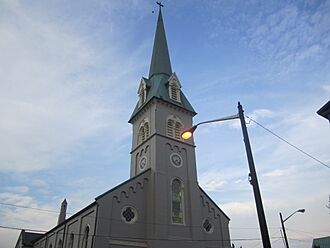
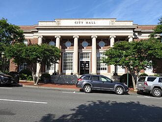
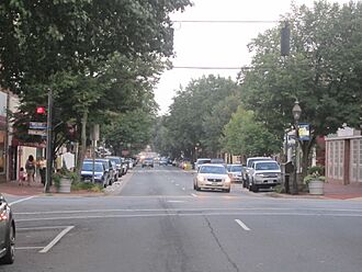
Fredericksburg has many reminders of its past. The Fredericksburg Historic District covers 40 blocks downtown. It has over 350 buildings from the 1700s and 1800s. These include the Fredericksburg Town Hall and Market Square and the Lewis Store.
Within the historic district, four 18th-century sites are managed by the "Washington Heritage Museums." These are the Mary Washington House, where George Washington's mother lived. There is also the Rising Sun Tavern and the Hugh Mercer Apothecary Shop. The St. James House is open to the public during Historic Garden Week.
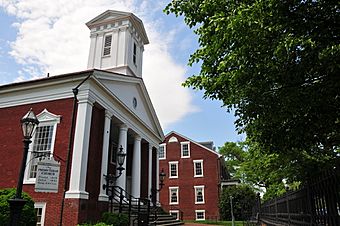
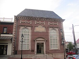
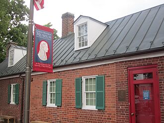
Important public buildings include the 1852 courthouse, designed by James Renwick Jr.. He also designed the Smithsonian Institution's castle building. The 1816 town hall is now the Fredericksburg Area Museum and Cultural Center. Another interesting place is St. George's Church. The James Monroe Museum and Memorial Library is where Monroe practiced law.
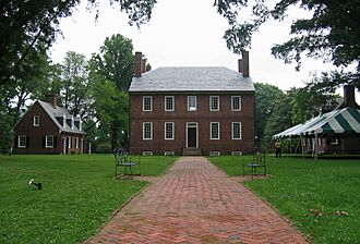
Near the historic district is the Lewis Plantation, also called Kenmore. This was the home of George Washington's sister, Betty, and her husband, Fielding Lewis.
The Fredericksburg and Spotsylvania National Military Park remembers the Civil War battles. This park was created in 1927. It protects parts of the battlefields of Fredericksburg, Chancellorsville, the Wilderness, and Spotsylvania Court House. The Fredericksburg National Cemetery is also part of the park. It has over 15,000 Union soldiers buried there.
After the Civil War, John Washington, a literate enslaved person from Fredericksburg, wrote about his experience gaining freedom. His story was published in books like A Slave No More (2007). In 2010, new historical markers were placed along the Rappahannock River. This "Freedom Trail" marks the path where enslaved people sought freedom.
Modern sites include the University of Mary Washington campus, which started in 1908. Carl's Ice Cream is an old-fashioned ice cream stand.
Nearby places of interest include Ferry Farm, where George Washington spent his childhood. The George Washington Birthplace National Monument is about 38 miles (61 km) east. The historic community of Falmouth is across the Rappahannock. It includes Belmont, the home of artist Gari Melchers.
City Parks
Fredericksburg has several public parks:
- Old Mill Park
- Alum Spring Park
- Hurkamp Park
- Dixon Park
Public Library
The Central Rappahannock Regional Library serves the area.
Education in Fredericksburg
Schools for Kids
The Fredericksburg City Public Schools are separate from the surrounding counties. Public schools include:
- James Monroe High School
- Walker-Grant Middle School
- Hugh Mercer Elementary School
- Lafayette Elementary School
- Gladys West Elementary School (opened in 2025)
Private schools in the area are:
- Fredericksburg Academy
- Fredericksburg Christian School
- Saint Michael the Archangel High School
- Lighthouse Academy
Colleges and Universities
The University of Mary Washington is a four-year public university in the city. It was established in 1908.
Germanna Community College is a public two-year college. It was established in 1970 and has a campus in Fredericksburg.
Media and News
Fredericksburg's daily newspaper is The Free Lance–Star. It started as The Free Lance in 1885. In 1900, it merged with another paper, and in 1926, they became The Free Lance–Star. The paper was owned by the Rowe family until 2014. In 2015, Berkshire Hathaway's BH Media Group bought it. Fredericksburg Today, an online news site, started after the Free Lance–Star bankruptcy in 2014. In 2024, Fredericksburg Today was replaced by The Fredericksburg Free Press. This is a non-profit organization that provides impartial digital news.
Fredericksburg also has several radio stations. These include WFLS (country), WGRQ (classic hits), and WBQB (adult contemporary). AM stations include WFVA (news and talk).
Sports Teams
The Fredericksburg Nationals are a minor league baseball team. They started playing at Virginia Credit Union Stadium in 2021.
High school sports are part of the Virginia High School League. The University of Mary Washington has its own sports teams, the Eagles. Other local sports include Fredericksburg FC soccer and the Rappahannock Rugby Football Club.
Getting Around Fredericksburg
Fredericksburg has several highways and smaller roads. The main highway is Interstate 95. It connects north to Washington, D.C., and south to Richmond. U.S. Route 17 also goes through the area. Route 3 is a major east-west road. It connects downtown Fredericksburg with large shopping centers.
Much of the traffic in Fredericksburg goes north towards the Washington, D.C. area. This happens mostly during busy commuting times. The Route 1 bridge over the Rappahannock River can often get crowded.
Some people use the Virginia Railway Express train service to travel to Washington. Long-distance train service is available through Amtrak.
Fredericksburg Regional Transit (FRED) is a bus service that started in 1996. It serves most communities, shopping centers, and train stations in the area.
Four major airports serve Fredericksburg. These are Reagan National and Dulles International Airport in Virginia. Baltimore/Washington International Airport is in Maryland. Richmond International Airport is south of Fredericksburg.
Famous People from Fredericksburg
People from the 1800s and Earlier
- Lewis Craig, a Baptist preacher who fought for religious freedom.
- Henry Crist, a former Congressman from Kentucky.
- John Paul Jones, a famous American naval commander.
- Fielding Lewis, George Washington's brother-in-law.
- Elizabeth "Betty" Washington, George Washington's sister.
- Hugh Mercer, a soldier and doctor.
- James Monroe, the fifth President of the United States.
- Augustine Washington, George Washington's father.
- George Washington, the first President of the United States.
- Mary Ball Washington, George Washington's mother.
- George Weedon, a general in the Continental Army.
People from the 1900s to Today
- Oliver Ackermann, guitarist for A Place to Bury Strangers.
- Gaye Adegbalola, a blues musician.
- Shakira Austin, a basketball player for the Washington Mystics.
- Daniel Bachman, an American guitarist.
- Julien Binford, an artist.
- Al Bumbry, a baseball player.
- Jermon Bushrod, an NFL player.
- Caressa Cameron, Miss America 2010.
- Eli Carr, a soccer player for Puerto Rico.
- George Coghill, a retired NFL player.
- James Farmer, a civil rights leader.
- Yetur Gross-Matos, an NFL player.
- Derek Hartley, a radio show host.
- Huntley, musician and winner of The Voice (season 24).
- Mark Lenzi, an Olympic diver and gold medalist.
- John Maine, a baseball pitcher.
- Danny McBride, an actor.
- Ryan McBroom, a professional baseball player.
- Erin McKeown, a musician.
- Caelynn Miller-Keyes, a television personality.
- Judge Reinhold, an actor.
- Jack Rose, a musician.
- Jeff Rouse, an Olympic swimmer and gold medalist.
- Dave Smalley, a musician.
- Torrey Smith, an NFL football player.
- Keller Williams, a musician.
- Monty Williams, a basketball player.
Sister Cities
Fredericksburg has sister cities around the world:
See also
 In Spanish: Fredericksburg (Virginia) para niños
 | Stephanie Wilson |
 | Charles Bolden |
 | Ronald McNair |
 | Frederick D. Gregory |


