Stafford County, Virginia facts for kids
Quick facts for kids
Stafford County
|
|
|---|---|
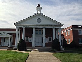
Stafford County Courthouse
|
|
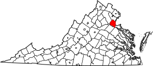
Location within the U.S. state of Virginia
|
|
 Virginia's location within the U.S. |
|
| Country | |
| State | |
| Founded | 1664 |
| Named for | Staffordshire, England |
| Seat | Stafford |
| Largest community | Aquia Harbor |
| Area | |
| • Total | 280 sq mi (700 km2) |
| • Land | 269 sq mi (700 km2) |
| • Water | 11 sq mi (30 km2) 3.9% |
| Population
(2020)
|
|
| • Total | 156,927 |
| • Density | 560/sq mi (216/km2) |
| Time zone | UTC−5 (Eastern) |
| • Summer (DST) | UTC−4 (EDT) |
| ZIP Codes |
22405, 22406, 22134, 22554, 22556
|
| Congressional district | 7th |
Stafford County is a county in Virginia. It is about 40 miles (64 km) south of Washington, D.C. This county is part of the Northern Virginia area and the larger D.C. region. It is known for being one of the fastest-growing counties in America. Many families here have high incomes.
As of the 2020 census, Stafford County had 156,927 people living in it. Its main town, or county seat, is Stafford. The county is located across the Rappahannock River from Fredericksburg and Spotsylvania County. It is part of the larger Washington metropolitan area.
In 2006 and 2009, Forbes magazine said Stafford was the 11th highest-income county in the U.S. A 2019 report from the Census Bureau ranked it as the sixth highest-income county in America.
Contents
History of Stafford County
For thousands of years, different groups of Native Americans lived along the Potomac River and its smaller rivers. When English settlers arrived, there were 32 Algonquian-speaking tribes in the Tidewater Virginia area. These included the Patawomeck tribe and many tribes in the Powhatan Confederacy. The Patawomeck tribe, still in Stafford County, was officially recognized by Virginia in 2010.
Early Encounters and Pocahontas
The first time Native Americans here met Europeans was in 1608. This was with John Smith from the Jamestown Settlement. During a time of fighting between the English colonists and local tribes, the colonists captured Chief Powhatan's daughter, Pocahontas. She was living with her husband, Kocoum, in the Patawomeck town of Passapatanzy. This town was in the eastern part of what is now Stafford County.
The colonists took Pocahontas to an English settlement called Henricus. While she was held there, Alexander Whitaker taught her about Christianity. She became Christian and took the name "Rebecca." Rebecca, or Pocahontas, married an English colonist named John Rolfe on April 5, 1614, in Jamestown. Their children were among the First Families of Virginia.
Forming the County
The English government in Virginia created Stafford County in 1664. It was made from land that was part of Westmoreland County. The county was named after Staffordshire, England.
When it was first created, Stafford County was much larger than it is today. As more people moved in, new counties were formed from its land. These include Arlington, Fairfax, and Prince William counties, and the City of Alexandria. Today, Stafford County is part of the area known as Northern Virginia.
Famous Residents and Landmarks
George Washington spent much of his childhood in the southern part of the county. His family home, Ferry Farm, was along the Rappahannock River across from Fredericksburg. Colonial Forge High School was built on land once owned by Washington's father, Augustine Washington. George Mason, another Founding Father of the U.S., also lived in Stafford when he was young.
Aquia Church, built in 1757, is a special building. It was designed in the shape of a Greek cross, which is unusual for churches in the area. It also has a rare three-level pulpit. This church is so important that it is a National Historic Landmark. The Episcopal church is still used today.
Role in Wars
Stafford County's industries and resources were important for the early U.S. During the Revolutionary War, ironworks in Stafford made weapons for the American soldiers. Aquia Creek sandstone, taken from Government Island, was used to build famous buildings like the White House and the U.S. Capitol.
During the American Civil War, the county was a major battleground. Over 100,000 soldiers occupied it for several years. In 1862, before and after the Battle of Fredericksburg, about 10,000 enslaved people left plantations and homes. They crossed the Rappahannock River to reach Union lines and gain freedom. Historical markers on both sides of the river remember this "Trail of Freedom." The Battle of Aquia Creek also happened in the Aquia Harbour area. Both the Union Army and Confederate Army fought to control the important Potomac Creek Bridge.
Falmouth, a town near Fredericksburg, was home to the artist Gari Melchers. His house, Belmont, is still standing and is on the National Register of Historic Places.
20th Century to Present
Stafford County has grown into a key part of the Washington metropolitan area and Northern Virginia. It is home to government offices and large military bases. Marine Corps Base Quantico is in the northern part of the county. The FBI Academy, FBI National Laboratory, and NCIS HQ are also located on the Stafford side of MCBQ.
Many people who live in Stafford County travel north for work. They work at these defense and federal places, as well as private companies, in Washington, D.C. They use Interstate Highway 95, U.S. Route 1, and the Virginia Railway Express. Stafford County is a suburban area where many people who work for the U.S. government live. It is also home to many military families because it is close to MCBQ.
These reasons help explain why families in Stafford County have high incomes. Many people own their homes and have college degrees. Stafford County has seen a lot of growth recently. More and more workers are moving to the suburbs for their families. This means many new homes and shops are being built in the county.
In the early morning of May 9, 2008, a tornado hit the southern part of the county. It badly damaged about 140 homes. The county was also hit hard by "Snowmageddon" in December 2009 and February 2010. Stafford received a lot of snow, about 25 inches (64 cm) in December and 19 inches (48 cm) in February.
Geography of Stafford County
The U.S. Census Bureau says Stafford County has a total area of 280 square miles (725 km2). About 269 square miles (697 km2) is land, and 11 square miles (28 km2) is water. This means 3.9% of the county is water.
The Potomac River flows along part of the county's eastern border. The Rappahannock River runs along the entire southern border. The city of Fredericksburg grew where the river's "fall line" is, which helped power mills. Aquia Creek flows into the Potomac River at Brent Point in Stafford County.
Stafford County is surrounded by Prince William County to the north, Fauquier County to the west, and the City of Fredericksburg and Spotsylvania County to the south. Because it is so close to Washington, D.C., many federal government workers and commuters live here. This location is a big reason why the county has grown so much.
Major bodies of water
Adjacent counties and independent city
|
|
People of Stafford County
| Historical population | |||
|---|---|---|---|
| Census | Pop. | %± | |
| 1790 | 9,588 | — | |
| 1800 | 9,971 | 4.0% | |
| 1810 | 9,830 | −1.4% | |
| 1820 | 9,517 | −3.2% | |
| 1830 | 9,362 | −1.6% | |
| 1840 | 8,454 | −9.7% | |
| 1850 | 8,044 | −4.8% | |
| 1860 | 8,555 | 6.4% | |
| 1870 | 6,420 | −25.0% | |
| 1880 | 7,211 | 12.3% | |
| 1890 | 7,362 | 2.1% | |
| 1900 | 8,097 | 10.0% | |
| 1910 | 8,070 | −0.3% | |
| 1920 | 8,104 | 0.4% | |
| 1930 | 8,050 | −0.7% | |
| 1940 | 9,548 | 18.6% | |
| 1950 | 11,902 | 24.7% | |
| 1960 | 16,876 | 41.8% | |
| 1970 | 24,587 | 45.7% | |
| 1980 | 40,470 | 64.6% | |
| 1990 | 61,236 | 51.3% | |
| 2000 | 92,446 | 51.0% | |
| 2010 | 128,961 | 39.5% | |
| 2020 | 156,927 | 21.7% | |
| U.S. Decennial Census 1790–1960 1900–1990 1990–2000 2010 2020 |
|||
2020 Census Information
| Race / Ethnicity | Pop 2010 | Pop 2020 | % 2010 | % 2020 |
|---|---|---|---|---|
| White alone (NH) | 87,434 | 85,587 | 67.80% | 54.54% |
| Black or African American alone (NH) | 21,259 | 29,492 | 16.48% | 18.79% |
| Native American or Alaska Native alone (NH) | 454 | 601 | 0.35% | 0.38% |
| Asian alone (NH) | 3,545 | 6,137 | 2.75% | 3.91% |
| Pacific Islander alone (NH) | 149 | 241 | 0.12% | 0.15% |
| Some Other Race alone (NH) | 293 | 1,105 | 0.23% | 0.70% |
| Mixed Race/Multi-Racial (NH) | 3,952 | 10,118 | 3.06% | 6.45% |
| Hispanic or Latino (any race) | 11,875 | 23,646 | 9.21% | 15.07% |
| Total | 128,961 | 156,927 | 100.00% | 100.00% |
Note: The U.S. Census counts Hispanic/Latino people as an ethnic group. This means they can be of any race. The table separates them from the racial categories.
2010 Census Information
In 2010, there were 128,961 people living in Stafford County. There were 38,237 households and 24,481 families. The population density was about 342 people per square mile (132/km2). There were 31,405 housing units.
The racial makeup of the county in 2010 was:
- 72.5% White
- 15.6% African American
- 0.4% Native American
- 2.8% Asian
- 0.10% Pacific Islander
- 3.2% from other races
- 4.0% from two or more races
About 9.2% of the people were Hispanic or Latino (of any race). The county has changed a lot in the last 20 years due to rapid growth. This trend is expected to continue.
In 2000, about 46.90% of households had children under 18. Most households (68.00%) were married couples living together. The average household had 3.01 people, and the average family had 3.32 people.
The median age in the county was 33 years. This means half the people were younger than 33 and half were older. For every 100 females, there were about 101 males.
The median income for a household in 2000 was $75,546. For a family, it was $78,575. By 2007, these numbers had grown to $85,793 for households and $95,433 for families. About 3.50% of the population lived below the poverty line. This included 3.30% of those under 18 and 5.30% of those 65 or older.
Media
Stafford County is part of the D.C. area and Northern Virginia. This means it gets news from D.C. TV stations. These include FOX 5 (WTTG), NBC 4 (WRC-TV), ABC 7 (WJLA-TV), CBS 9 (WUSA), and PBS 26 (WETA-TV). Local newspapers from Northern Virginia and Fredericksburg also cover Stafford County.
Newspapers
- The Free Lance–Star
- InsideNoVa - North Stafford
- The Washington Post
- Potomac Local
Education in Stafford County
Colleges
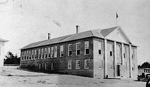
K-12 schoolsStafford County Public Schools teaches most of the students in the county. However, children living on Marine Corps Base Quantico go to schools run by the Department of Defense Education Activity (DoDEA). County high schools include:
Quantico Middle High School serves the DoDEA property.
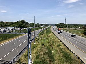
Transportation in Stafford CountyStafford County is about 40 miles (64 km) south of Washington, D.C. The I-95 Express lanes start in the middle of the county and go to Washington, D.C. These lanes are being extended to the southern end of the county. A study by INRIX Roadway Analytics found that Southbound I-95 from D.C. to the southern tip of Stafford County has the worst traffic in the nation. A part of Northbound I-95 was ranked the seventh worst. Because of the fast growth in Stafford County and Northern Virginia, traffic can be very bad. The state of Virginia has invested a lot of money to improve roads in Stafford County. Other major roads like U.S. 1 and U.S. 17 also pass through the county. Major highways
Mass transportation
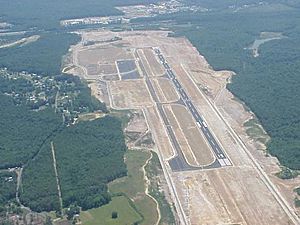
Airport
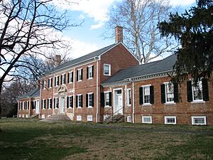
Points of interest
CommunitiesCensus-designated places
Other unincorporated communities
Notable people
See also
|
 | William M. Jackson |
 | Juan E. Gilbert |
 | Neil deGrasse Tyson |


 In Spanish: