Patate facts for kids
Quick facts for kids
Patate
|
|
|---|---|
|
Town
|
|
| Country | Ecuador |
| Province | Tungurahua |
| Canton | Patate Canton |
| Area | |
| • Town | 1.09 km2 (0.42 sq mi) |
| Population | |
| • Town | 2,514 |
| • Density | 2,306/km2 (5,974/sq mi) |
| Time zone | ECT |
| Area code(s) | 593 |
| Climate | Cfb |
| Website | Patate Autonomous Decentralized Government |
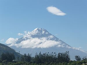
Patate is a charming town in Ecuador, a country in northwestern South America. It is located in the Tungurahua area, nestled between the cities of San Juan de Ambato and Baños. Patate is also very close to the Tungurahua volcano, which is still active.
In 2019, Patate received a special honor. Ecuador's Ministry of Tourism (MINTUR) named it a Pueblo Mágico, which means "magical town." Patate was the very first town in Ecuador to get this amazing title!
Patate's Weather and Climate
Patate has a mild and pleasant climate. This is because it is located at a high elevation. The weather here is often described as an oceanic climate. This means it has cool summers and mild winters, with rainfall spread throughout the year.
| Climate data for Patate, elevation 2,360 m (7,740 ft), (1971–2000) | |||||||||||||
|---|---|---|---|---|---|---|---|---|---|---|---|---|---|
| Month | Jan | Feb | Mar | Apr | May | Jun | Jul | Aug | Sep | Oct | Nov | Dec | Year |
| Mean daily maximum °C (°F) | 22.8 (73.0) |
22.7 (72.9) |
22.6 (72.7) |
22.6 (72.7) |
22.4 (72.3) |
20.7 (69.3) |
20.0 (68.0) |
20.6 (69.1) |
22.0 (71.6) |
22.9 (73.2) |
23.9 (75.0) |
23.4 (74.1) |
22.2 (72.0) |
| Mean daily minimum °C (°F) | 11.4 (52.5) |
11.6 (52.9) |
11.8 (53.2) |
11.9 (53.4) |
11.7 (53.1) |
11.0 (51.8) |
10.5 (50.9) |
10.3 (50.5) |
10.6 (51.1) |
11.2 (52.2) |
11.1 (52.0) |
11.3 (52.3) |
11.2 (52.2) |
| Average precipitation mm (inches) | 22.0 (0.87) |
34.0 (1.34) |
53.0 (2.09) |
50.0 (1.97) |
52.0 (2.05) |
77.0 (3.03) |
58.0 (2.28) |
57.0 (2.24) |
49.0 (1.93) |
47.0 (1.85) |
44.0 (1.73) |
27.0 (1.06) |
570 (22.44) |
| Average relative humidity (%) | 81 | 81 | 81 | 81 | 82 | 84 | 84 | 83 | 83 | 81 | 80 | 80 | 82 |
| Source: FAO | |||||||||||||
See also
 In Spanish: Patate para niños
Black History Month on Kiddle
African-American activists you should know
 | Audre Lorde |
 | John Berry Meachum |
 | Ferdinand Lee Barnett |

All content from Kiddle encyclopedia articles (including the article images and facts) can be freely used under Attribution-ShareAlike license, unless stated otherwise. Cite this article:
Patate Facts for Kids. Kiddle Encyclopedia.


