Pauline, Kansas facts for kids
Quick facts for kids
Pauline, Kansas
|
|
|---|---|

Pauline (2005)
|
|

|
|
| Country | United States |
| State | Kansas |
| County | Shawnee |
| Elevation | 1,027 ft (313 m) |
| Time zone | UTC-6 (CST) |
| • Summer (DST) | UTC-5 (CDT) |
| Area code | 785 |
| FIPS code | 20-54750 |
| GNIS ID | 479073 |
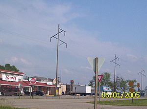
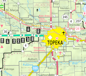
Pauline is a small community in Shawnee County, Kansas, United States. It is not an official city, but rather an unincorporated community. Pauline is located south of Topeka. It sits right next to Forbes Field on southwest Topeka Boulevard. Sometimes, people see Pauline as part of the South City Industry Park for Topeka. This area has many large businesses.
Contents
Pauline: A Look at Its Past
The first post office in Pauline opened its doors in 1872. This was an important step for the growing community.
Train Travel and the Old Depot
Pauline was once a stop on the Atchison, Topeka and Santa Fe Railway. This was a major train line. A train station building, called a depot, was finished there in 1910. This depot was a busy place for travelers and goods. In 1983, the old depot was moved. It now stands at the Old Prairie Town at Historic Ward-Meade Historic Site in Topeka.
Life in Pauline Today
Pauline is a small but active community. It has about 30 houses. There are also around 20 mobile homes in a special park.
Local Businesses and Services
The community has several businesses that serve its residents and visitors. These include:
- three restaurants
- two gas stations
- an auction house
- a bar
- a laundromat
- a grocery store
Pauline also offers places for people to stay. There is a Super 8 Motel. You can also find a modern campground with places for RVs and tents.
 | Jackie Robinson |
 | Jack Johnson |
 | Althea Gibson |
 | Arthur Ashe |
 | Muhammad Ali |


