Pencil Bluff, Arkansas facts for kids
Quick facts for kids
Pencil Bluff, Arkansas
|
|
|---|---|

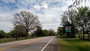
Entering Pencil Bluff from the west
|
|
| Country | United States |
| State | Arkansas |
| County | Montgomery |
| Area | |
| • Total | 0.53 sq mi (1.4 km2) |
| • Land | 0.53 sq mi (1.4 km2) |
| • Water | 0.0 sq mi (0 km2) |
| Elevation | 748 ft (228 m) |
| Population
(2020)
|
|
| • Total | 72 |
| Time zone | UTC-6 (Central (CST)) |
| • Summer (DST) | UTC-5 (CDT) |
| ZIP code |
71965
|
| Area code(s) | 870 |
| GNIS feature ID | 2805676 |
| FIPS code | 05-54410 |
Pencil Bluff is a small community in Montgomery County, Arkansas, in the United States. It's known as an unincorporated community, which means it doesn't have its own local government like a city or town. It's also a census-designated place (CDP), which is an area the U.S. Census Bureau defines for gathering population data.
You can find Pencil Bluff where two roads meet: U.S. Route 270 and Arkansas Highway 88. It's about 7.5 miles (12.1 km) northwest of a place called Mount Ida. In the year 2020, the first time it was counted as a CDP, Pencil Bluff had a population of 72 people. The community also has its own post office with the ZIP code 71965.
People in Pencil Bluff
Pencil Bluff is a very small community. The United States Census helps us understand how many people live in different places and what groups they belong to.
Population Count
According to the 2020 census, there were 72 people living in Pencil Bluff. This number helps us see how the community is growing or changing over time.
Who Lives There?
The census also looks at the different backgrounds of people living in a place. In Pencil Bluff, most of the residents in 2020 were White (not Hispanic or Latino). There were also a few people who identified as Native American or Alaska Native, Asian, or of mixed racial backgrounds. A small number of people identified as Hispanic or Latino.
 | Tommie Smith |
 | Simone Manuel |
 | Shani Davis |
 | Simone Biles |
 | Alice Coachman |


