Pennock Island facts for kids
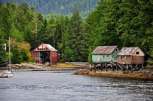
Pennock Island is a small island in Alaska, a state in the United States. It's located very close to the city of Ketchikan. The island is part of a group of islands called the Alexander Archipelago. Most of Pennock Island is public land, managed by the Tongass National Forest. This forest is a huge area of protected land in Alaska.
Where is Pennock Island?
Pennock Island sits between two other islands, Gravina Island and Revillagigedo Island. It's at the eastern end of a waterway called Tongass Narrows. The island is about 3 miles (4.8 km) long from east to west. It's not very wide, ranging from about 0.25 to 0.625 miles (0.4 to 1 km) across.
The island is quite low to the ground and covered in thick trees. Its southern shore is steep. You can find a rock formation called California Rock about 0.5 miles (0.8 km) from the east end of the island. Another small island, East Clump islet, is off the west end. A place called Peninsula Point is west of Pennock and marks the entrance to Ward Cove.
A reef, which is a rocky area under the water, extends about 0.7 miles (1.1 km) into the Tongass Narrows. This reef is about 0.7 miles (1.1 km) southwest of downtown Ketchikan. There's a tiny village on Pennock Island near Whiskey Cove, right across from the Coast Guard Station Ketchikan. Only a few houses are hidden in the dense forest, so not many people live there.
A Look Back: Pennock Island's History
Pennock Island was named around 1895. It got its name from a person called Homer Pennock, who was a prospector (someone who searches for valuable minerals). Captain W.E. George, a local pilot, gave the island its name.
The island is also important to the history of local Native American tribes. It holds ancestral burial grounds for the Taan ta Kwaan (Tongass people) and the Sanyaa Kwáan (Cape Fox people).
The Tongass Narrows, where Pennock Island is located, became famous because of a big discussion about building a bridge. This proposed bridge was called the Gravina Island Bridge. Many people criticized it and even called it the "bridge to nowhere". This was because they thought it would be a very expensive bridge that didn't really lead to a place with many people or much activity.
Ready, Set, Swim! The Pennock Island Challenge
Pennock Island is the location for a yearly swimming competition called the "Pennock Island Challenge." This event started in 2004. Swimmers take part to help raise money for the JDRF, a group that supports research for type 1 diabetes.
The race course is about 8.2 miles (13.2 km) long. Swimmers go in a circle all the way around the rugged island. There are different types of races, including solo swims and relay races where teams take turns swimming. Some swimmers wear wetsuits, and others don't.
It's very important for swimmers to have escort boats and kayaks with them for safety. The water temperature during the race is usually between 55 and 60°F (13 and 16°C). Because of the cold water, the swimmers who participate are often specialists in cold water swimming. For example, the event in 2013 was held on August 4th. Winners of the race receive a certificate that shows their time and place, along with a medal.
 | May Edward Chinn |
 | Rebecca Cole |
 | Alexa Canady |
 | Dorothy Lavinia Brown |


