Pep, Texas facts for kids
Quick facts for kids
Pep, Texas
|
|
|---|---|

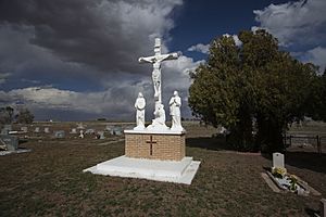
Saint Phillips Cemetery in Pep
|
|
| Country | |
| State | |
| County | Hockley |
| Physiographic region | Llano Estacado |
| Founded | 1936 |
| Elevation | 3,701 ft (1,128 m) |
| Population
(2000)
|
|
| • Total | 35 |
| Time zone | UTC-6 (Central (CST)) |
| • Summer (DST) | UTC-5 (CDT) |
| ZIP code |
79353
|
| Area code | 806 |
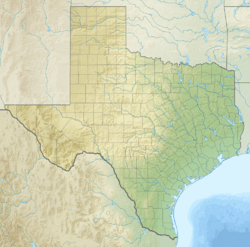
Pep is a small, unincorporated community in Hockley County, Texas. This means it's a place where people live, but it doesn't have its own local government like a city or town. Pep is located in the northwestern part of Texas. It sits on a high, flat area called the Llano Estacado. This community also has its own post office with the ZIP code 79353.
Learning in Pep
Kids in Pep go to public schools run by the Morton Independent School District. Before 1978, Pep had its own school district. But in August 1978, the Pep school district joined with the one in Whiteface. Later, in the 1990s, the Morton Independent School District took over the school. They turned it into a special center for students who learn at a faster pace.
Black History Month on Kiddle
Famous African-American Architects:
 | Georgia Louise Harris Brown |
 | Julian Abele |
 | Norma Merrick Sklarek |
 | William Sidney Pittman |

All content from Kiddle encyclopedia articles (including the article images and facts) can be freely used under Attribution-ShareAlike license, unless stated otherwise. Cite this article:
Pep, Texas Facts for Kids. Kiddle Encyclopedia.


