
Llano Estacado facts for kids
Quick facts for kids
Llano Estacado
"Staked Plains"
|
|
|---|---|
|
Southwestern United States
|
|

Northwest escarpment of the Llano Estacado
|
|

Shaded relief image of the Llano Estacado. The escarpments marking the eastern edge of the Llano are visible, running roughly in a north–south line through the middle of the Panhandle. The western edge is on the New Mexico side of the border, with the Texas–New Mexico border running considerably closer to the western edge of the Llano than to the eastern.
|
|
| Country | |
| State | New Mexico and Texas |
| Area | |
| • Total | 97,000 km2 (37,000 sq mi) |
| Population
(2013)
|
|
| • Total | 1,230,000 |
| • Density | 12.68/km2 (32.84/sq mi) |
The Llano Estacado, also known as the Staked Plains, is a large, flat area in the Southwestern United States. It covers parts of eastern New Mexico and northwestern Texas. It is one of the biggest mesas, or flat-topped landforms, in North America. The land gently slopes from about 3000 feet (914 meters) in the southeast to over 5000 feet (1524 meters) in the northwest.
Contents
What's in a Name?
The Spanish name Llano Estacado is often translated as "Staked Plains." However, a more accurate meaning is "stockaded" or "palisaded plains." This name likely comes from the steep cliffs, called escarpments, that surround the plains on the east, north, and west.
Early explorers like Francisco Vázquez de Coronado described these cliffs as looking like the strong walls or "palisades" of a fort. Another idea is that early travelers used stakes or piles of stones and bones to mark paths across the flat, featureless land. But many experts agree that the name probably refers to the fort-like appearance of the cliffs when seen from below.
Geography and Climate

The Llano Estacado is located at the southern end of the Western High Plains. This area is part of the larger Great Plains of North America. The Canadian River forms the northern edge of the Llano, separating it from the rest of the High Plains.
To the east, a tall cliff called the Caprock Escarpment marks the boundary. This cliff is about 300 feet (91 meters) high. To the west, the Mescalero Escarpment separates the Llano from the Pecos River valley. The Llano Estacado doesn't have a clear southern boundary; it simply blends into the Edwards Plateau near Big Spring, Texas.
This large area stretches about 250 miles (402 km) from north to south and 150 miles (241 km) from east to west. It covers about 37,500 square miles (97,000 km²), which is larger than the state of Indiana. It includes all or parts of 33 counties in Texas and four counties in New Mexico. Sometimes, dust storms from this region can cause warnings in Texas.
The landscape has many small, round dips called playa lakes. These depressions fill with water after it rains, creating temporary ponds. These ponds are important homes for waterfowl (birds that live near water).
The Llano Estacado has a "cold semiarid" climate. This means it has long, hot summers and cold winters. Not much rain falls here, usually less than 23 inches (58 cm) per year. In the western part, it can get as little as 14 inches (36 cm). Because summer temperatures are high (often above 90°F or 32°C), most of the rain evaporates quickly. This makes it hard to grow crops without extra water.
The Llano Estacado includes all or part of these Texas counties:
It also includes all or part of these New Mexico counties:
Several major highways cross the Llano Estacado. Interstate 40 goes across the northern part, from east of Amarillo to Tucumcari, New Mexico. Interstate 27 runs north-south between Amarillo and Lubbock. Interstate 20 passes through the southern part of the Llano Estacado, west of Midland and Odessa.
History of the Llano Estacado
In 1541, the Spanish explorer Francisco Vázquez de Coronado was the first European to travel across this huge, flat area. He described it as "plains so vast, that I did not find their limit anywhere I went." He said it was like being "swallowed up by the sea" because there were no landmarks like stones, hills, or trees to guide them.
In the early 1700s, the Comanche people moved into the Llano Estacado, taking over from the Apaches who lived there before. This region became part of the Comancheria, a strong area for the Comanche. They stayed there until they were finally defeated in the late 1800s. The Comanche had a war trail that went from the Llano Estacado all the way to the Rio Grande.
Many explorers and travelers described the Llano Estacado. General Randolph B. Marcy, after exploring the area in 1852, wrote that it was "as boundless as the ocean." He said there was "not a tree, shrub, or any other object" to break up the view. He called it a "vast-illimitable expanse of desert prairie" and a "treeless, desolate waste."
In the late 1800s, the Llano was a safe place for groups of Kiowas and Comanches who did not want to live on reservations. One of their last big battles against the US Army was the Battle of Palo Duro Canyon in 1874.
Today, most people in the Llano Estacado live in the main cities: Amarillo, Lubbock, Midland, and Odessa, all in Texas. Most of the land is still rural, with large ranches and farms that use irrigation. People sometimes joke that the Llano Estacado is "85 percent sky and 15 percent grassland" because of its wide-open spaces.
Geology of the Plains

The Llano Estacado is made up of layers of sediment, or tiny bits of rock, called the Ogallala Formation. These sediments were carried by rivers from the Rocky Mountains millions of years ago.
Underneath the Llano Estacado is the Ogallala Aquifer, a huge underground layer of water-filled rock. This aquifer is the main source of fresh water for the entire region. It formed from ancient river deposits and later from wind-blown sand and silt. Hard layers of caliche (a type of rock) cap the Ogallala, showing that the area has been dry for a long time.
During the Pleistocene Ice Age, rain would collect on the flat land, creating many round ponds called playa lakes. When it's dry, these lakes are just dusty, flat areas. But after a thunderstorm, they quickly fill with water. This water then soaks into the ground, adding to the groundwater in the Ogallala Aquifer. Early pioneers relied on these ponds for water.
However, people have been using water from the Ogallala Aquifer faster than it can be naturally refilled. This is a big concern for the future water supply in the region. The Pecos River and Canadian River have carved away parts of the Llano Estacado, revealing older, reddish rocks below.
Economy and Resources

The economy of the Llano Estacado is mostly based on agriculture. Farmers grow many different crops, and cattle ranching is also very common.
In the past, too much water was taken from the aquifer. This has led some farmers to go back to growing crops that don't need as much water. This also means less rainwater reaches the playa lakes.
Crops like Cotton, grain sorghum, corn, wheat, peanuts, sunflowers, grapes, and vegetables, along with cattle, are produced here. These products are sold all over the world and bring billions of dollars to the region. Having enough water is very important for this farming economy.

Energy production is another major part of the economy. The region has a lot of oil and natural gas production from the Permian Basin. Also, because the Llano Estacado is dry and windy, it's a great place for solar and wind farms. These renewable energy sources are becoming more and more common.
In Popular Culture
- The Lone Ranch: A Tale of the Staked Plain (1860) by Thomas Mayne Reid
- Empire of the Summer Moon: Quanah Parker and the Rise and Fall of the Comanches, The Most Powerful Indian Tribe in History (2010) by S.C. Gwynne. The Llano Estacado is an important setting in this book.
- "El Llano Estacado", a traditional folk song adapted by Tom Russell
- "Llano Estacado", a song by country music artist Cooder Graw that was used in Dodge commercials.
- Llano Estacado is mentioned in the song "Sweet Amarillo" by Old Crow Medicine Show from their 2014 album Remedy.
- Part of the movie No Country for Old Men was filmed near this region.
- "Winnetou III" (Chapter 2), "The Ghost of the Llano Estacado" and "Old Surehand" by Karl May
- The film Hell or High Water (film) (2016) was filmed in this region.
- Carry Me (2016) by Peter Behrens (writer).
- Featured in James Michener's novel Centennial.
- In Fred Gipson's 1962 children's novel Savage Sam during the search for "Little Arliss".
- The movie Hud (1963), starring Paul Newman, was filmed in and around Claude, Texas, in this region.
Images for kids
-
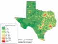
Map of Texas counties with population density
-
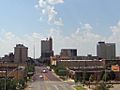
Lubbock, Texas, the largest city on the Llano
-
A shot of downtown Amarillo, Texas
-
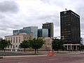
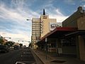
Midland, "The Tall City" of West Texas
-
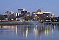
Downtown Odessa


See also
 In Spanish: Llano Estacado para niños
