
Potter County, Texas facts for kids
Quick facts for kids
Potter County
|
||
|---|---|---|

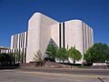
Potter County District Courts Building in downtown Amarillo
|
||
|
||

Location within the U.S. state of Texas
|
||
 Texas's location within the U.S. |
||
| Country | ||
| State | ||
| Founded | 1887 | |
| Named for | Robert Potter | |
| Seat | Amarillo | |
| Largest city | Amarillo | |
| Area | ||
| • Total | 922 sq mi (2,390 km2) | |
| • Land | 908 sq mi (2,350 km2) | |
| • Water | 14 sq mi (40 km2) 1.5% | |
| Population
(2020)
|
||
| • Total | 118,525 |
|
| • Density | 130/sq mi (50/km2) | |
| Time zone | UTC−6 (Central) | |
| • Summer (DST) | UTC−5 (CDT) | |
| Congressional district | 13th | |

Potter County is a county in the state of Texas. In 2020, about 118,525 people lived there. The main city and government center, called the county seat, is Amarillo.
Potter County was created in 1876 and officially started in 1887. It is named after Robert Potter. He was a politician who signed the Texas Declaration of Independence. He also served as the Secretary of the Navy for Texas. Potter County is part of the larger Amarillo metropolitan area, which means it's connected to Amarillo and the towns around it.
Contents
History
LX Ranch: A Big Cattle Farm
The LX Ranch was a very large cattle farm started in Potter County around 1877. It was founded by W.H. "Deacon" Bates and David T. Beals. In 1876, Bates and his cowboys, including Charlie Siringo, set up their first cattle herd. Their main camp was along Ranch Creek, near the Canadian River.
The ranch headquarters grew to include many buildings. There was a bunkhouse for the cowboys, a kitchen, a storeroom, and stables for horses. They also had corrals for the cattle, a blacksmith shop, and sheds for wagons. There was even a post office called Wheeler. The LX Ranch also created the county's first cemetery.
This huge ranch eventually stretched from Dumas all the way to the Palo Duro Canyon. It was about 35 miles wide from east to west. By 1884, the ranch covered 187,000 acres of land. It had 45,000 cattle and 1,000 horses! That year, a company called the American Pastoral Company bought the ranch.
Later, in 1902, the ranch headquarters moved to Bonita Creek. Over the next few years, parts of the ranch were sold off. In 1910, Lee Bivins bought over 30,000 acres. Then, in 1911, R.B. "Ben" Masterson bought almost 90,000 acres. Lee Bivins bought even more land in 1915, including the famous LX brand for the cattle.
Geography
Potter County covers a total area of about 922 square miles. Most of this is land, about 908 square miles. The rest, about 14 square miles, is covered by water.
Main Roads
Many important roads pass through Potter County:
 I-27
I-27 I-40
I-40 Bus. I-40
 US 60
US 60 US 66
US 66 US 87
US 87 US 287
 SH 136
 SH 279
 Loop 335
Neighboring Counties
Potter County shares its borders with several other counties:
- Moore County (to the north)
- Hutchinson County (to the northeast)
- Carson County (to the east)
- Armstrong County (to the southeast)
- Randall County (to the south)
- Deaf Smith County (to the southwest)
- Oldham County (to the west)
- Hartley County (to the northwest)
Protected Natural Areas
Potter County is home to parts of these special natural places:
- Alibates Flint Quarries National Monument
- Lake Meredith National Recreation Area (part of it)
Population Information
| Historical population | |||
|---|---|---|---|
| Census | Pop. | %± | |
| 1880 | 28 | — | |
| 1890 | 849 | 2,932.1% | |
| 1900 | 1,820 | 114.4% | |
| 1910 | 12,424 | 582.6% | |
| 1920 | 16,710 | 34.5% | |
| 1930 | 46,080 | 175.8% | |
| 1940 | 54,265 | 17.8% | |
| 1950 | 73,366 | 35.2% | |
| 1960 | 115,580 | 57.5% | |
| 1970 | 90,511 | −21.7% | |
| 1980 | 98,637 | 9.0% | |
| 1990 | 97,874 | −0.8% | |
| 2000 | 113,546 | 16.0% | |
| 2010 | 121,073 | 6.6% | |
| 2020 | 118,525 | −2.1% | |
| U.S. Decennial Census 1850–2010 2010 2020 |
|||
In 2020, the population of Potter County was 118,525 people. This means there were about 130 people living in each square mile.
Many different groups of people live in Potter County. In 2020, about 42% of the people were White (not Hispanic or Latino). About 10% were Black or African American. About 5% were Asian, and about 38% were Hispanic or Latino. People of Hispanic or Latino background can be of any race.
In 2000, the average age in the county was 32 years old. About 28% of the people were under 18 years old.
Communities
Potter County has several towns and communities.
Cities
- Amarillo (This is the county seat, and part of it is also in Randall County.)
Towns
Unincorporated Communities
These are smaller communities that are not officially organized as cities or towns:
Historical Communities
These are places that used to be communities but are no longer active:
Education
Several school districts serve the students in Potter County:
- Amarillo Independent School District
- Bushland Independent School District
- Highland Park Independent School District
- River Road Independent School District
All areas of the county are also served by Amarillo College, which offers higher education.
Images for kids
-
Potter County District Courts Building in downtown Amarillo
See also
 In Spanish: Condado de Potter (Texas) para niños
