
Castro County, Texas facts for kids
Quick facts for kids
Castro County
|
|
|---|---|

Castro County Courthouse in Dimmitt
|
|

Location within the U.S. state of Texas
|
|
 Texas's location within the U.S. |
|
| Country | |
| State | |
| Founded | 1891 |
| Named for | Henri Castro |
| Seat | Dimmitt |
| Largest city | Dimmitt |
| Area | |
| • Total | 899 sq mi (2,330 km2) |
| • Land | 894 sq mi (2,320 km2) |
| • Water | 4.9 sq mi (13 km2) 0.5% |
| Population
(2020)
|
|
| • Total | 7,371 |
| • Density | 8.199/sq mi (3.1657/km2) |
| Time zone | UTC−6 (Central) |
| • Summer (DST) | UTC−5 (CDT) |
| Congressional district | 19th |
Castro County is a county located in the U.S. state of Texas. It's in the northern part of Texas, an area known as the Panhandle. As of the 2020 census, about 7,371 people live here. The main town and county seat is Dimmitt.
The county is named after Henri Castro. He was an important person who worked for the Republic of Texas in France. He also started a colony in Texas. Castro County was officially created in 1876 and began operating in 1891.
In April 2023, a large fire happened at a dairy farm near Dimmitt. Sadly, many dairy cows were lost in this event.
Contents
Geography of Castro County
Castro County covers a total area of about 899 square miles. Most of this area is land. Only a small part, about 4.9 square miles, is covered by water.
Main Roads in Castro County
These are the most important roads that go through Castro County:
 U.S. Highway 60
 U.S. Highway 385
 State Highway 86
 State Highway 194
Neighboring Counties
Castro County shares borders with these other counties:
- Deaf Smith County (to the north)
- Randall County (to the northeast)
- Swisher County (to the east)
- Hale County (to the southeast)
- Lamb County (to the south)
- Parmer County (to the west)
People of Castro County (Demographics)
The number of people living in Castro County has changed over the years. Here's how the population has grown and shrunk:
| Historical population | |||
|---|---|---|---|
| Census | Pop. | %± | |
| 1890 | 9 | — | |
| 1900 | 400 | 4,344.4% | |
| 1910 | 1,850 | 362.5% | |
| 1920 | 1,948 | 5.3% | |
| 1930 | 4,720 | 142.3% | |
| 1940 | 4,631 | −1.9% | |
| 1950 | 5,417 | 17.0% | |
| 1960 | 8,923 | 64.7% | |
| 1970 | 10,394 | 16.5% | |
| 1980 | 10,556 | 1.6% | |
| 1990 | 9,070 | −14.1% | |
| 2000 | 8,285 | −8.7% | |
| 2010 | 8,062 | −2.7% | |
| 2020 | 7,371 | −8.6% | |
| U.S. Decennial Census 1850–2010 2010 2020 |
|||
In 2000, there were 8,285 people living in the county. About 41% of households had children under 18. Most households, around 65%, were married couples living together. The average household had almost three people.
The median age in the county was 32 years old. This means half the people were younger than 32 and half were older. For every 100 females, there were about 100 males.
The median income for a household in the county was about $30,619 per year. This is the middle income for all households. About 19% of the people in the county lived below the poverty line. This included about 25% of children under 18.
Communities in Castro County

Castro County has several towns and smaller communities.
Cities
Census-Designated Places (CDP)
Unincorporated Communities
These are smaller places that are not officially organized as cities or towns:
- Dodd
- Easter
- Flagg
- Frio
- Hilburn
- Sunnyside
Ghost Towns
These are towns that used to exist but are now abandoned:
- Arney
- Big Square
Education in Castro County
Several school districts serve the students in Castro County:
- Dimmitt Independent School District
- Happy Independent School District
- Hart Independent School District
- Hereford Independent School District
- Lazbuddie Independent School District
- Nazareth Independent School District
- Springlake-Earth Independent School District
Also, all of Castro County is part of the service area for Amarillo College. This college helps students continue their education after high school.
Images for kids
-
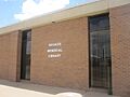
Rhoads Memorial Library serves Castro County.

See also
 In Spanish: Condado de Castro para niños
