Caprock Escarpment facts for kids
Quick facts for kids Caprock Escarpment |
|
|---|---|

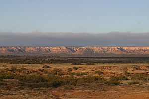
Caprock Escarpment, Garza County, Texas
|
|

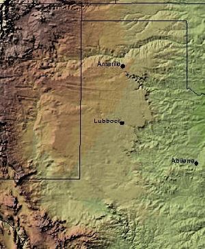
The Caprock Escarpment marking the edge of the Llano Estacado is clearly visible in this shaded relief image. The escarpment can be seen on the eastern edge of the Llano, running roughly in a north–south line through the middle of the Panhandle of Texas.
|
|
| Location | New Mexico and Texas, United States |
| Coordinates | 34°54′35″N 104°04′08″W / 34.90972°N 104.06889°W |
| Elevation | 1,647 feet (502 m) |
| Geology | Caliche |
| Age | Quaternary |
The Caprock Escarpment is a huge natural cliff or steep slope. It marks a big change in the land in West Texas and Eastern New Mexico. This escarpment separates the flat High Plains of the Llano Estacado from the hilly land around it.
In Texas, the Caprock Escarpment stretches for about 200 miles (320 km). It runs from the northeast corner of the Texas Panhandle down towards the south. You can see it clearly in counties like Briscoe, Floyd, and Garza.
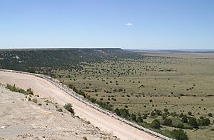
In New Mexico, the escarpment is also very noticeable. It's found along the northern part of the Llano Estacado. This includes areas south of San Jon and Tucumcari. A section on the western side, from Caprock to Maljamar, New Mexico, is known as the Mescalero Ridge.

Contents
What is the Caprock Escarpment Made Of?
The Caprock Escarpment is mostly made of a material called caliche. Caliche is a hard layer of calcium carbonate, which is a mineral. Think of it like a natural cement that helps the land resist being worn away by wind and water.
In some spots, the escarpment rises about 1,000 feet (300 meters) above the flatter plains below. This big change in height is caused by erosion. Erosion happens when rivers and streams slowly wear away the land. This process has created deep valleys and canyons, like the famous Palo Duro Canyon near Amarillo, Texas.
You can really see the change in elevation when you drive across the Caprock Escarpment. For example, on Interstate 40 between Adrian, Texas and San Jon, New Mexico, the land changes by several hundred feet.
How the Caprock Escarpment Affects Weather
The shape of the Caprock Escarpment can actually change the local weather. The way the land slopes upwards can help create more rain and even cause thunderstorms to form. It helps organize these storms as they move across the area.
Parks and Outdoor Fun at the Caprock Escarpment
The Caprock Escarpment is home to some great places for outdoor activities.
Caprock Canyons State Park and Trailway
Caprock Canyons State Park and Trailway is a popular park located near Quitaque. It first opened to visitors in 1982. The park is a fantastic place to explore the unique landscape of the escarpment.
In 1992, a long trail was added to the park, stretching for 65 miles (105 km). This trail is perfect for hiking, biking, and horseback riding. A special spot along the trail is Clarity Tunnel. This tunnel is home to a very large group of Mexican free-tailed bats. It's amazing to see them fly out at dusk!
 | Victor J. Glover |
 | Yvonne Cagle |
 | Jeanette Epps |
 | Bernard A. Harris Jr. |

