Quick facts for kids Perseverance Harbour |
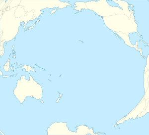
Location in Pacific Ocean
|
| Location |
Campbell Island |
| Coordinates |
52°33′07″S 169°11′42″E / 52.552°S 169.195°E / -52.552; 169.195 |

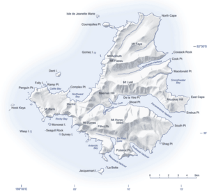
Map of Campbell Island, New Zealand
Perseverance Harbour, also known as South Harbour, is a large bay found on Campbell Island. This island is one of New Zealand's special outlying islands, located far to the south. The harbour is a long, narrow arm of the sea that stretches into the island's southeast.
Perseverance Harbour: A Special Place
This unique harbour is surrounded by tall land. It is overlooked by Mount Honey, which is the highest point on Campbell Island. At the western end of the harbour, you can find the Campbell Island Meteorological Station. This station helps scientists study the weather in this remote part of the world.
A Bit of History
Perseverance Harbour has a sad but important place in history. On November 4, 1810, Captain Frederick Hasselborough lost his life here. He was the person who first discovered Campbell Island. Two other people were with him: Elizabeth Farr, a young woman from Norfolk Island, and George Allwright, a boy about twelve or thirteen years old from Sydney. They all sadly passed away in the harbour.


