Petit lac Métascouac facts for kids
Quick facts for kids Petit lac Métascouac |
|
|---|---|
| Location | Lac-Croche (TNO), La Jacques-Cartier Regional County Municipality, Capitale-Nationale |
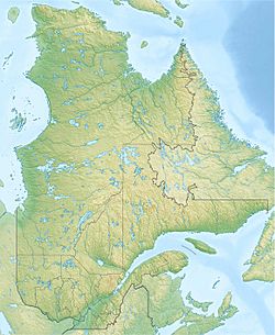
| Coordinates | 47°39′28″N 71°51′06″W / 47.65778°N 71.85167°W |
| Lake type | Natural |
| Primary inflows | (clockwise from the mouth) Discharge of an unidentified lake, Métascouac River. |
| Primary outflows | Métabetchouane River |
| Basin countries | Canada |
| Max. length | 3.6 km (2.2 mi) |
| Max. width | 0.5 km (0.31 mi) |
| Surface elevation | 439 m (1,440 ft) |
The Petit lac Métascouac is a freshwater lake in the province of Quebec, Canada. It is located in the Laurentides Wildlife Reserve, a large protected area. The Métascouac River flows right through this lake.
This lake is found in an area called Lac-Croche, which is part of the La Jacques-Cartier Regional County Municipality. It's also very close to the border of another region called Mauricie.
Forest roads help people get to the lake. These roads are mainly used for logging (cutting down trees) and for fun activities like fishing or camping. Logging is the main business here, with tourism being the second most important.
The lake's surface usually freezes over from early December until the end of March. It's generally safe to walk or play on the ice from mid-December to mid-March.
Contents
Where is Petit lac Métascouac?
Petit lac Métascouac is surrounded by several important rivers and streams. Knowing these helps us understand where the lake's water comes from and where it goes.
- To the north: You'll find the Métascouac River and the Métabetchouane River.
- To the east: There's the Métabetchouane East River and a small stream called Liane.
- To the south: The Métabetchouane River continues, along with the Métabetchouane East River and the rivière à Moïse.
- To the west: More of the Métabetchouane River and Saint-Henri Lake are located here.
Size and Shape of the Lake
Petit lac Métascouac is about 3.6 km (2.2 mi) long and 0.5 km (0.31 mi) wide. It sits at an elevation of 439 m (1,440 ft) above sea level.
The lake gets most of its water from the Métascouac River, which flows in from the north (after passing through Lake Ouelette). Another small stream also feeds into the lake. The lake has a unique shape with five narrow spots. These narrow parts are created by peninsulas (pieces of land sticking out into the water) that almost meet each other. The Métascouac River flows through the entire length of the lake.
Where the Water Goes
The water from Petit lac Métascouac flows out from its southern end. This is where the lake connects to the Métabetchouane River.
From this point, the water travels a long way:
- First, it flows along the Métabetchouane River for about 123.6 km (76.8 mi), generally heading northwest.
- Then, it enters lac Saint-Jean and travels about 22.25 km (13.83 mi) northeast.
- Finally, the water joins the Saguenay River and flows for about 172.3 km (107.1 mi) eastwards. It eventually reaches Tadoussac, where it mixes with the huge Saint Lawrence estuary.
Name of the Lake
The name "Petit lac Métascouac" was officially recognized on December 5, 1968. This was done by the Commission de toponymie du Québec, which is the official body responsible for naming places in Quebec.
 | Toni Morrison |
 | Barack Obama |
 | Martin Luther King Jr. |
 | Ralph Bunche |


