Phillipsburg, Ohio facts for kids
Quick facts for kids
Phillipsburg, Ohio
|
|
|---|---|
|
Village
|
|

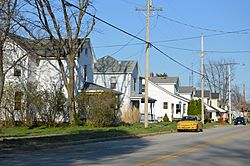
West Main Street
|
|

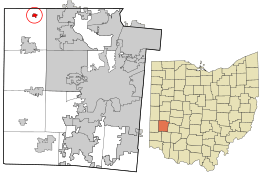
Location in Montgomery County and the state of Ohio.
|
|
| Country | United States |
| State | Ohio |
| County | Montgomery |
| Township | Clay |
| Area | |
| • Total | 0.27 sq mi (0.7 km2) |
| • Land | 0.27 sq mi (0.7 km2) |
| • Water | 0.00 sq mi (0 km2) |
| Elevation | 1,034 ft (315 m) |
| Population
(2020)
|
|
| • Total | 498 |
| • Density | 1,872.18/sq mi (722.85/km2) |
| Time zone | UTC-5 (Eastern (EST)) |
| • Summer (DST) | UTC-4 (EDT) |
| ZIP code |
45354
|
| Area code(s) | 937, 326 |
| FIPS code | 39-62414 |
| GNIS feature ID | 2399662 |
Phillipsburg is a small village located in Montgomery County, Ohio, in the United States. In 2020, about 498 people lived there. It is part of the larger Dayton area, known as the Metropolitan Statistical Area.
Contents
History of Phillipsburg
Phillipsburg was officially planned and laid out in 1836. It was named after Philip Studybaker, who helped start the town.
A post office was first set up in 1848 and was called Centre. Its name changed to Center in 1893. Then, in 1903, it was renamed Phillipsburg. The village officially became an incorporated village in 1899.
Geography and Location
Phillipsburg is a small village, covering an area of about 0.27 square miles (0.70 square kilometers). All of this area is land, with no water.
Population Over the Years
| Historical population | |||
|---|---|---|---|
| Census | Pop. | %± | |
| 1870 | 187 | — | |
| 1880 | 215 | 15.0% | |
| 1890 | 270 | 25.6% | |
| 1910 | 343 | — | |
| 1920 | 348 | 1.5% | |
| 1930 | 436 | 25.3% | |
| 1940 | 504 | 15.6% | |
| 1950 | 609 | 20.8% | |
| 1960 | 715 | 17.4% | |
| 1970 | 831 | 16.2% | |
| 1980 | 705 | −15.2% | |
| 1990 | 644 | −8.7% | |
| 2000 | 628 | −2.5% | |
| 2010 | 557 | −11.3% | |
| 2020 | 498 | −10.6% | |
| U.S. Decennial Census | |||
Phillipsburg in 2010
In 2010, the village had 557 people living in 235 households. About 163 of these were families. The population density was about 2,063 people per square mile.
Most residents, 97.7%, were White. There were also small percentages of African American and Asian residents. About 3.2% of the population identified as Hispanic or Latino.
About 30.2% of households had children under 18. The average age in the village was 40.4 years. About 21.5% of residents were under 18, and 18.5% were 65 or older. The population was almost evenly split between males (51.3%) and females (48.7%).
Education in Phillipsburg
Students in Phillipsburg attend schools in the Northmont City School District. This district serves students in Montgomery County, Ohio.
The schools that serve the area include:
- Northmont High School
- Northmont Middle School
- Englewood Elementary
- Englewood Hills Elementary
- Northmoor Elementary
- Northwood Elementary
- O. R. Edgington Elementary
- Union Elementary
Phillipsburg Elementary School closed in 2009. Its students then started going to Union Elementary School. The old school building was sold to a private owner in November of that year.
Getting Around Phillipsburg
Main Roads
Ohio State Route 49 is a major road that goes through Phillipsburg. It is located about 4 miles north of Interstate 70 in Montgomery County, Ohio.
Local Airport
Phillipsburg Airport is on the northeast side of the village. It opened in 1949 and is still active today. The airport is home to 35 aircraft. It handles about 186 aircraft takeoffs and landings each day.
The airport was first called Myer's Airport, named after its original owner, John L. Myers. Gene and Jayne Miller managed the airport for many years. Since 2013, Danny and Jaime Steel-Potter have owned and operated the airport.
Famous People from Phillipsburg
- Jesse Haines: A famous pitcher who is in the Baseball Hall of Fame. He grew up in Phillipsburg.
See also
 In Spanish: Phillipsburg (Ohio) para niños

