Phillipstown, Illinois facts for kids
Quick facts for kids
Phillipstown
|
|
|---|---|

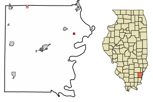
Location of Phillipstown in White County, Illinois.
|
|

Location of Illinois in the United States
|
|
| Country | United States |
| State | Illinois |
| County | White |
| Area | |
| • Total | 0.27 sq mi (0.70 km2) |
| • Land | 0.27 sq mi (0.70 km2) |
| • Water | 0.00 sq mi (0.00 km2) |
| Elevation | 489 ft (149 m) |
| Population
(2020)
|
|
| • Total | 34 |
| • Density | 125.93/sq mi (48.54/km2) |
| Time zone | UTC-6 (CST) |
| • Summer (DST) | UTC-5 (CDT) |
| ZIP Code(s) |
62827
|
| Area code(s) | 618 |
| FIPS code | 17-59520 |
| GNIS ID | 2399664 |
| Wikimedia Commons | Phillipstown, Illinois |
Phillipstown is a small village located in White County, Illinois, in the United States. It's a quiet place with a small population. In 2020, about 34 people lived there.
History of Phillipstown
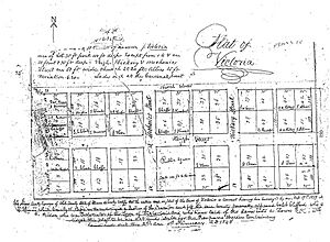
Phillipstown was first planned out on February 19, 1839. The official map, called a plat, was recorded on January 2, 1843. The village was originally named Victoria. However, there was already another post office in Illinois with that name.
Because of this, a new name was needed. On January 29, 1840, the State Legislature decided to rename it Phillipstown. This new name honored Major Alexander Phillips. He was an early settler who had claimed land nearby in 1817. At that time, the area was still part of the Illinois Territory.
The land where Phillipstown was built was first claimed by James Phillips. He was likely Alexander Phillips' father. James later sold his interest in the land. It was then bought by David Phillips and John McClure Graham. David and Rebecca (John's wife) were probably Alexander's siblings.
They received the official land ownership document, called a patent, on November 15, 1830. They sold the property to Major Alexander Phillips on January 6, 1837. He then sold it to Caleb Clifford on February 17, 1837.
Major Alexander Phillips was an important person in the area. He fought in the War of 1812. He was also elected to represent White County in the Illinois House of Representatives several times. This is where laws are made for the state.
Geography of Phillipstown
Phillipstown is located at 38°8′42″N 88°1′13″W / 38.14500°N 88.02028°W. This is its exact spot on a map.
According to information from 2010, Phillipstown covers a total area of about 0.27 square miles (0.70 square kilometers). All of this area is land. There are no large bodies of water within the village limits.
Population and People
| Historical population | |||
|---|---|---|---|
| Census | Pop. | %± | |
| 1900 | 100 | — | |
| 1910 | 105 | 5.0% | |
| 1920 | 70 | −33.3% | |
| 1930 | 47 | −32.9% | |
| 1940 | 53 | 12.8% | |
| 1950 | 102 | 92.5% | |
| 1960 | 69 | −32.4% | |
| 1970 | 55 | −20.3% | |
| 1980 | 37 | −32.7% | |
| 1990 | 48 | 29.7% | |
| 2000 | 28 | −41.7% | |
| 2010 | 44 | 57.1% | |
| 2020 | 34 | −22.7% | |
| U.S. Decennial Census | |||
In the year 2000, there were 28 people living in Phillipstown. These people lived in 13 different homes, and 7 of those were families. The village had about 103 people per square mile. All the residents were White.
Out of the 13 homes, about 15% had children under 18 living there. Most homes (61.5%) were married couples living together. About 30% of homes had just one person living there. Some of these were people aged 65 or older living alone.
The average number of people in each home was 2.15. For families, the average was 2.75 people.
The age of people in the village varied. About 14% were under 18 years old. About 36% were between 25 and 44 years old. And 25% were 65 years or older. The average age in the village was 42 years old.
The average income for a home in the village was $42,917. For families, it was $44,167. The average income per person in the village was $21,188. In 2000, no families or people were living below the poverty line.
Education
Students in Phillipstown attend schools in the Carmi-White County Community Unit School District 5. The main high school for the district is Carmi-White County High School.
See also
 In Spanish: Phillipstown (Illinois) para niños
 | Claudette Colvin |
 | Myrlie Evers-Williams |
 | Alberta Odell Jones |


