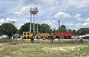
Pink Hill, North Carolina facts for kids
Quick facts for kids
Pink Hill, North Carolina
|
|
|---|---|
|
Mayor: Kyle Nettleton
|
|
 |
|
| Country | United States |
| State | North Carolina |
| County | Lenoir |
| Area | |
| • Total | 0.46 sq mi (1.20 km2) |
| • Land | 0.46 sq mi (1.20 km2) |
| • Water | 0.00 sq mi (0.00 km2) |
| Elevation | 128 ft (39 m) |
| Population
(2020)
|
|
| • Total | 451 |
| • Density | 971.98/sq mi (374.92/km2) |
| Time zone | UTC-5 (Eastern (EST)) |
| • Summer (DST) | UTC-4 (EDT) |
| ZIP code |
28572
|
| Area code(s) | 252 |
| FIPS code | 37-52400 |
| GNIS feature ID | 2407127 |
Pink Hill is a small town in Lenoir County, North Carolina, United States. It is home to a friendly community. In 2020, about 451 people lived there.
Contents
History of Pink Hill
Pink Hill became an official town in 1915. This means it started to have its own local government and rules.
Geography of Pink Hill
Pink Hill covers a total area of about 0.5 square miles (1.2 square kilometers). All of this area is land. There are no large bodies of water within the town limits.
Population and People
| Historical population | |||
|---|---|---|---|
| Census | Pop. | %± | |
| 1910 | 58 | — | |
| 1920 | 166 | 186.2% | |
| 1930 | 188 | 13.3% | |
| 1940 | 307 | 63.3% | |
| 1950 | 386 | 25.7% | |
| 1960 | 457 | 18.4% | |
| 1970 | 522 | 14.2% | |
| 1980 | 644 | 23.4% | |
| 1990 | 547 | −15.1% | |
| 2000 | 521 | −4.8% | |
| 2010 | 552 | 6.0% | |
| 2020 | 451 | −18.3% | |
| U.S. Decennial Census | |||
In 2020, there were 451 people living in Pink Hill. These people made up 247 households and 144 families. The town has a mix of different backgrounds, with people from various ethnic groups living together.
Arts and Culture
Pink Hill has some interesting historical spots.
- The Eagle Nest is a historic place.
- The Hebron Presbyterian Church is also listed on the National Register of Historic Places. This means they are important buildings that are protected.
You can also visit the Wilbur A. Tyndall Tractor Museum. It has a cool collection of old tractors. You might see tractors from brands like John Deere and Massey there.
Education
- Pink Hill Elementary School is the local school for younger students in the town.
See also
 In Spanish: Pink Hill (Carolina del Norte) para niños
 | Janet Taylor Pickett |
 | Synthia Saint James |
 | Howardena Pindell |
 | Faith Ringgold |

