Pinnacle Mountain (Arkansas) facts for kids
Quick facts for kids Pinnacle Mountain |
|
|---|---|

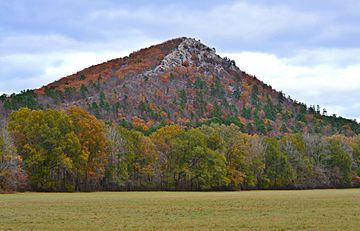
Pinnacle Mountain as seen from Highway 300
|
|
| Highest point | |
| Elevation | 1,013 ft (309 m) NAVD 88 |
| Geography | |
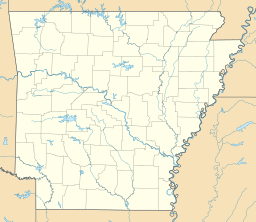
| Location | Pulaski County, Arkansas, U.S. |
| Parent range | Ouachita Mountains, U.S. Interior Highlands |
| Topo map | USGS Pinnacle Mountain |
Pinnacle Mountain is a famous landmark and a big part of Pinnacle Mountain State Park in Arkansas. It's the second tallest natural point in Pulaski County, Arkansas. You can find it near Little Rock, which is the capital city of Arkansas. This mountain is part of the beautiful Ouachita Mountains. The park covers about 2,356 acres, offering lots of space to explore!
Where is Pinnacle Mountain?
Pinnacle Mountain stands tall between two rivers. The Big Maumelle River is to its north, and the Little Maumelle River is to its south. It's also close to the Arkansas River. Its steep southern slopes make it easy to spot from far away.
The mountain is 1,013 feet (about 309 meters) above sea level. For a while, there was a rule that said a landform had to be more than 1,000 feet taller than the land around it to be called a mountain. Pinnacle Mountain is only 763 feet taller than the land around it. Because of this, some people thought it should be called a hill! But this rule was stopped in the 1970s. Today, the U.S. government calls Pinnacle Mountain a "summit." This means it's a high point that rises above the land around it.
What is Pinnacle Mountain Made Of?
Many people wonder if Pinnacle Mountain is a volcano because it looks a bit like one. But it's not! It's actually made of a type of rock called sedimentary rock. This rock formed deep underwater a very long time ago.
The mountain is mostly made of a hard rock called Jackfork Sandstone. This sandstone is very strong and is usually tan in color. It's different from the rocks found in volcanoes, which are formed from hot lava. Scientists believe the Jackfork Sandstone was laid down when the Ouachita Mountains were first forming. Over millions of years, the land changed, and the softer rocks around the sandstone wore away, leaving Pinnacle Mountain standing tall.
Hiking Trails
Pinnacle Mountain is a popular spot for hiking. There are two main trails that go to the top:
- West Summit Trail: This trail is about 1.5 miles long. You can find it by following the yellow markers. It starts from the West Summit parking area off Highway 300. Many people use this trail.
- East Summit Trail: This trail is also about 1.5 miles long. It's marked with red and white blazes. This trail starts from the East Summit parking lot on Pinnacle Valley Road. It can be a bit harder because it involves climbing up some steep, rocky parts.
Both trails can get very busy, especially since the mountain is so close to Little Rock.
There's also a trail that goes all the way around the base of the mountain:
- Base Trail: This trail is 2.5 miles long and has light green markers. It connects the starting points of both the West and East Summit trails.
Part of a much longer trail, the Ouachita Trail, also passes through the park. This trail is marked with blue blazes. About 0.5 miles of the Ouachita Trail overlaps with the Base Trail. It then continues for another 1.5 miles to the park's visitor center.
 | Georgia Louise Harris Brown |
 | Julian Abele |
 | Norma Merrick Sklarek |
 | William Sidney Pittman |


