Pioneer River facts for kids
Quick facts for kids Pioneer |
|
|---|---|

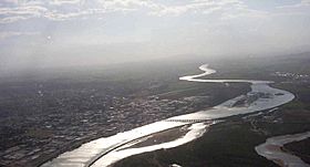
The Pioneer River weaves through Mackay
|
|
|
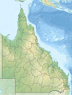
Location of Pioneer River river mouth in Queensland
|
|
| Country | Australia |
| State | Queensland |
| Region | North Queensland |
| Cities | Mackay, Marian |
| Physical characteristics | |
| Main source | Pinnacle Ranges, Pioneer Valley, Eungella Dam below Mount McBryde near Pinevale 75 m (246 ft) 21°18′58″S 148°51′01″E / 21.31611°S 148.85028°E |
| River mouth | Coral Sea East Mackay 0 m (0 ft) 21°09′13″S 149°13′16″E / 21.15361°S 149.22111°E |
| Length | 120 km (75 mi) |
| Basin features | |
| Basin size | 1,550 km2 (600 sq mi) |
| Tributaries |
|
The Pioneer River is an important river located in North Queensland, Australia. It is about 120-kilometre (75 mi) long. The river flows right through the city of Mackay.
Contents
River's Discovery and Name
In 1860, Captain John Mackay and his group were the first European explorers to see this river. Captain Mackay named it Mackay River, after his father, George Mackay.
However, the name was changed a few years later. In October 1862, George Bowen, who was the Governor of Queensland, visited the river. He arrived on a ship called HMS Pioneer. Because of the ship's name, the river was renamed the Pioneer River.
Where the River Flows
The Pioneer River starts in the Pinnacle Ranges. This area is below Mount McBryde, near Pinevale, Queensland. This spot is about 63 kilometres (39 mi) southwest of Mackay.
The river first flows north into the Pioneer Valley. When it reaches Mirani, it turns and flows east. Finally, it reaches its mouth and empties into the Coral Sea at Mackay.
Ten smaller streams, called tributaries, join the Pioneer River. These include Cattle Creek, Queensland (North Burnett Region) and Blacks Creek. The river is not deep enough for large boats. You can even see sandbanks just a few kilometres from the river's mouth. During very high tides, called king tides, the water level in the Pioneer River can change by as much as 6.4 metres (21 ft).
The area that collects water for the river, called its catchment, covers about 1,550 square kilometres (600 sq mi). The upper parts of this area are very steep. Because of this, they are not used for farming. Instead, they are covered by beautiful rainforests and open woodlands.
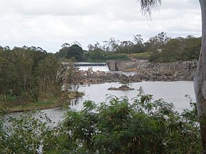
Several places along the river help store water. These include Teemburra Dam, Dumbleton Weir, Mirani Weir, and Marian Weir. The river is also crossed by major roads and railway lines. The Bruce Highway and the North Coast railway line cross it in Mackay. The 485-metre (1,591 ft) Forgan Bridge also crosses the Pioneer River in Mackay.
Pioneer Valley's Importance
The Pioneer Valley is known for growing a lot of sugar cane. It is one of Australia's most productive sugar cane regions. The valley stretches for about 45 km from Netherdale in the west to Marian in the east.
Much of the valley is drained by Cattle Creek. This creek eventually joins the Pioneer River near Benholme. The valley has important sugar mills. It also has railway lines that connect as far west as Pinnacle. These lines help transport the sugar cane.
In September 2022, the Queensland State Government announced a plan for a new energy project. This project would involve building a pumped-storage hydroelectricity scheme. This means some land in the valley might be flooded to create a reservoir for power generation.
River Flooding
The Pioneer River can sometimes flood, especially after very heavy rain. The most recent flood happened in February 2008. The river level reached just over 7 metres (23 ft) in Mackay. This is considered a moderate flood. It happened after an extreme amount of rain fell in Mackay, about 600 millimetres, 24 in in only six hours!
After a very strong storm, the 1918 Mackay cyclone, hit on January 21, 1918, the river stayed flooded for weeks. Since records began in 1884, the Pioneer River has reached major flood levels twenty times. The highest flood ever recorded was in 1958, when the water reached 9.14 metres (30.0 ft).
See also
 In Spanish: Río Pioneer para niños
 | Janet Taylor Pickett |
 | Synthia Saint James |
 | Howardena Pindell |
 | Faith Ringgold |


